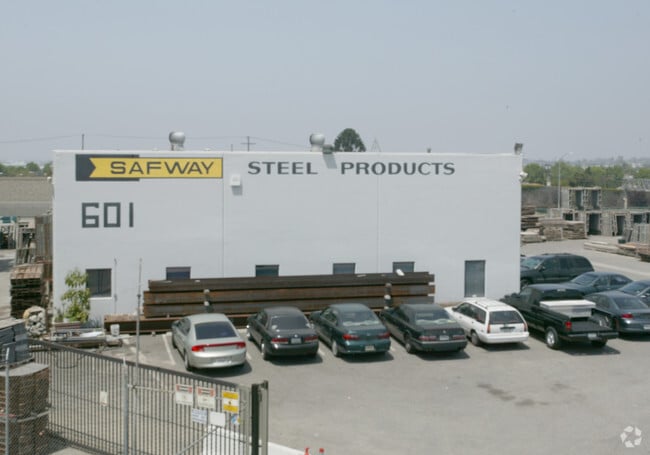
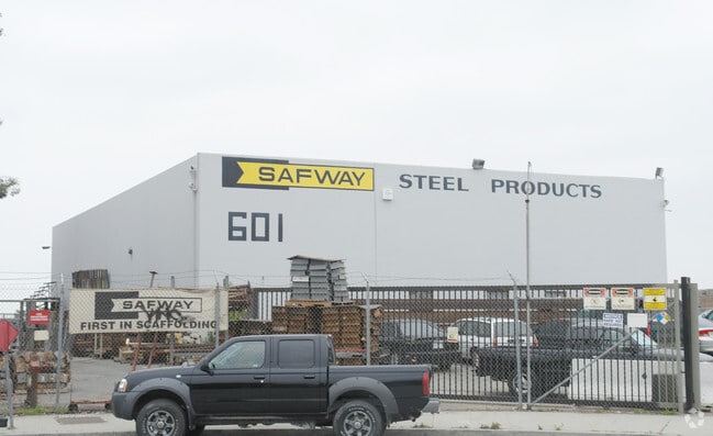
Property Record
601 W 140Th St, Los Angeles, CA 90061

Property Detail
601 W 140Th St
6132-006-018
TRACT NO 22892 LOT 1
Warehouse
LOS ANGELES
LAM2
California
B and X Area of moderate flood hazard, usually the area between the limits of the 100-year and 500-year floods.
1
2025
2.47 AC
2025
West Rancho Dominguez
540901
Los Angeles
5,280 SF
Los Angeles-Long Beach-Glendale, CA
NEARBY LISTINGS FOR SALE OR LEASE
DEMOGRAPHICS near 601 W 140Th St
1 mile
3 mile
5 mile
2025 Total Population
22,248
270,488
808,091
2030 Population
22,230
267,595
796,801
Pop Growth 2025-2030
(0.08%)
(1.07%)
(1.40%)
Average Age
39
39
38
2025 Total Households
6,913
81,535
234,335
HH Growth 2025-2030
(0.25%)
(1.24%)
(1.58%)
Median Household Inc
$77,713
$72,624
$71,760
Avg Household Size
3.10
3.20
3.30
2025 Avg HH Vehicles
2.00
2.00
2.00
Median Home Value
$693,593
$698,371
$712,310
Median Year Built
1962
1959
1958
Nearby Places
Map Layers
Map Styles
 Street
 Aerial
Layers
 Traffic
 Biking
Places
Listings with unknown addresses are not visible on the map
- Restaurants
- Banks
- Shops
- Fitness
- Groceries
PUBLIC TRANSPORTATION
AIRPORT
Los Angeles International
Drive
Walk
Distance
Los Angeles International
15 min
10.8 mi
Long Beach (Daugherty Field)
Drive
Walk
Distance
Long Beach (Daugherty Field)
20 min
13.7 mi
Bob Hope
Drive
Walk
Distance
Bob Hope
35 min
27.7 mi
Freight Ports
Port of Long Beach
Drive
Walk
Distance
Port of Long Beach
23 min
15.6 mi
Nearby Properties
Address
Land Use
TOTAL SIZE
Lot Size
Zoning
Address
Land Use
TOTAL SIZE
Lot Size
Zoning
319,182 SF
13.30 AC
LCM11/2-B1
Address
Land Use
TOTAL SIZE
Lot Size
Zoning
291,731 SF
16.84 AC
CAML*
Address
Land Use
TOTAL SIZE
Lot Size
Zoning
227,596 SF
14.38 AC
HAM1YY
Address
Land Use
TOTAL SIZE
Lot Size
Zoning
214,782 SF
3.66 AC
GAR3
Address
Land Use
TOTAL SIZE
Lot Size
Zoning
59,422 SF
2.89 AC
HAM2YY
Address
Land Use
TOTAL SIZE
Lot Size
Zoning
515,047 SF
4.87 AC
COMH*
Address
Land Use
TOTAL SIZE
Lot Size
Zoning
514,397 SF
24.34 AC
COMH-B*
Address
Land Use
TOTAL SIZE
Lot Size
Zoning
63,922 SF
1.82 AC
LCA16000*
Address
Land Use
TOTAL SIZE
Lot Size
Zoning
472,062 SF
24.39 AC
COMH-B*
Address
Land Use
TOTAL SIZE
Lot Size
Zoning
125,849 SF
6.08 AC
LAM2
Address
Land Use
TOTAL SIZE
Lot Size
Zoning
544,967 SF
10.74 AC
HAM2YY
Address
Land Use
TOTAL SIZE
Lot Size
Zoning
24,060 SF
LAM2
Address
Land Use
TOTAL SIZE
Lot Size
Zoning
230,694 SF
9.02 AC
COMH-B*
Address
Land Use
TOTAL SIZE
Lot Size
Zoning
210,742 SF
11.25 AC
CAML*
Address
Land Use
TOTAL SIZE
Lot Size
Zoning
71,479 SF
3.11 AC
CAML*
Address
Land Use
TOTAL SIZE
Lot Size
Zoning
301,506 SF
CAML*
Address
Land Use
TOTAL SIZE
Lot Size
Zoning
169,426 SF
3.50 AC
LCM11/2-B1
Address
Land Use
TOTAL SIZE
Lot Size
Zoning
121,090 SF
4.18 AC
LCM2*
Address
Land Use
TOTAL SIZE
Lot Size
Zoning
109,179 SF
4.55 AC
LCM2*
Address
Land Use
TOTAL SIZE
Lot Size
Zoning
132,173 SF
11.53 AC
LCM2-B1*
Address
Land Use
TOTAL SIZE
Lot Size
Zoning
147,280 SF
6.58 AC
CAML*
Address
Land Use
TOTAL SIZE
Lot Size
Zoning
483,516 SF
11.10 AC
GAM2
Address
Land Use
TOTAL SIZE
Lot Size
Zoning
118,699 SF
5.21 AC
LCM2-B1*
Address
Land Use
TOTAL SIZE
Lot Size
Zoning
17,280 SF
3.80 AC
CAML&D*
Address
Land Use
TOTAL SIZE
Lot Size
Zoning
289,834 SF
6.67 AC
LCM2*
Address
Land Use
TOTAL SIZE
Lot Size
Zoning
182,521 SF
4.76 AC
CAML&D*
Address
Land Use
TOTAL SIZE
Lot Size
Zoning
111,266 SF
3.42 AC
LAMR1
Address
Land Use
TOTAL SIZE
Lot Size
Zoning
389,029 SF
7.82 AC
CAML&D*
Address
Land Use
TOTAL SIZE
Lot Size
Zoning
133,519 SF
9.31 AC
HAM2
Address
Land Use
TOTAL SIZE
Lot Size
Zoning
138,504 SF
0.59 AC
HAR4*
The World's #1 Commercial Real Estate Marketplace
Connect with us
© 2026 CoStar Group
The information above has been obtained from sources believed reliable. While we do not doubt its accuracy we have not verified it and make no guarantee, warranty or representation about it. It is your responsibility to independently confirm its accuracy and completeness. Any projections, opinions, assumptions, or estimates used are for example only and do not represent the current or future performance of the property. The value of this transaction to you depends on tax and other factors which should be evaluated by your tax, financial, and legal advisors. You and your advisors should conduct a careful, independent investigation of the property to determine to your satisfaction the suitability of the property for your needs.