Property Record
601 W Cr 805 St, Keene, TX 76059
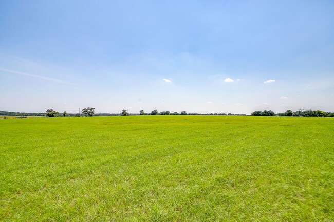
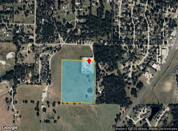
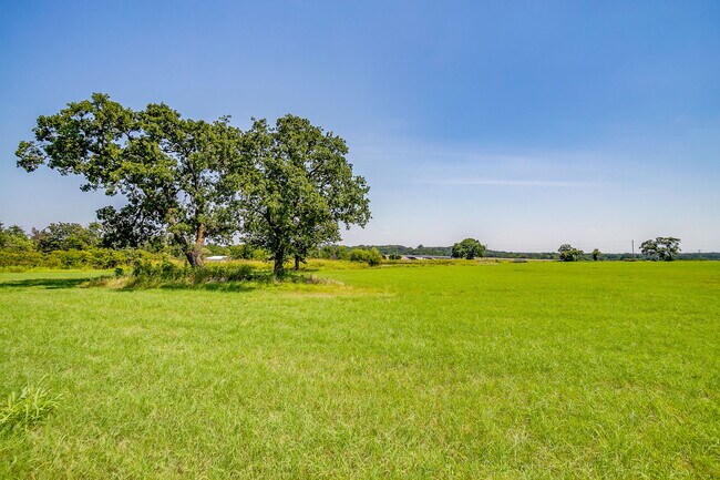
This Property Is For Sale
NEARBY LISTINGS FOR SALE OR LEASE
Property Detail
601 W Cr 805 St
Dallas-Fort Worth-Arlington, TX
J Mackey
126-0589-00109
ABST 589 TR 20A J MACKEY
Farms
Johnson
X
Texas
48251C0190J
18.88 AC
2024
Johnson County
2025
Dallas/Ft Worth
130304
DEMOGRAPHICS near 601 W Cr 805 St
1 Mile
3 Mile
5 Mile
2024 Total Population
4,238
16,962
50,323
2029 Population
5,969
23,891
70,960
Pop Growth 2024-2029
+ 40.84%
+ 40.85%
+ 41.01%
Average Age
38
37
38
2024 Total Households
1,404
5,742
17,523
HH Growth 2024-2029
+ 40.17%
+ 39.92%
+ 40.03%
Median Household Inc
$55,384
$55,932
$62,052
Avg Household Size
2.80
2.80
2.70
2024 Avg HH Vehicles
2.00
2.00
2.00
Median Home Value
$258,545
$255,970
$235,304
Median Year Built
1988
1988
1987
Nearby Places
- Restaurants
- Banks
- Shops
- Fitness
- Groceries
PUBLIC TRANSPORTATION
COMMUTER RAIL
Cleburne Amtrak Station (Texas Eagle - Amtrak)
DRIVE
WALK
Distance
Cleburne Amtrak Station (Texas Eagle - Amtrak)
9 min
5.0 mi
Freight Ports
Port of Shreveport
DRIVE
WALK
Distance
Port of Shreveport
258 min
236.6 mi
Nearby Properties
Address
Land Use
TOTAL SIZE
Lot Size
Zoning
Address
Land Use
TOTAL SIZE
Lot Size
Zoning
24.31 AC
Address
Land Use
TOTAL SIZE
Lot Size
Zoning
127,936 SF
41.41 AC
Address
Land Use
TOTAL SIZE
Lot Size
Zoning
11.04 AC
Address
Land Use
TOTAL SIZE
Lot Size
Zoning
69,592 SF
29.56 AC
Address
Land Use
TOTAL SIZE
Lot Size
Zoning
67,699 SF
43.74 AC
Address
Land Use
TOTAL SIZE
Lot Size
Zoning
45,750 SF
10.49 AC
Address
Land Use
TOTAL SIZE
Lot Size
Zoning
46,839 SF
15.51 AC
Address
Land Use
TOTAL SIZE
Lot Size
Zoning
143,327 SF
20 AC
Address
Land Use
TOTAL SIZE
Lot Size
Zoning
29,553 SF
7.93 AC
Address
Land Use
TOTAL SIZE
Lot Size
Zoning
43,070 SF
7.57 AC
Address
Land Use
TOTAL SIZE
Lot Size
Zoning
34,500 SF
1.44 AC
Address
Land Use
TOTAL SIZE
Lot Size
Zoning
61,336 SF
10.30 AC
Address
Land Use
TOTAL SIZE
Lot Size
Zoning
43,000 SF
23.50 AC
Address
Land Use
TOTAL SIZE
Lot Size
Zoning
44,992 SF
18.14 AC
Address
Land Use
TOTAL SIZE
Lot Size
Zoning
47,300 SF
14.67 AC
Address
Land Use
TOTAL SIZE
Lot Size
Zoning
23,863 SF
13.53 AC
Address
Land Use
TOTAL SIZE
Lot Size
Zoning
22,994 SF
2.92 AC
Address
Land Use
TOTAL SIZE
Lot Size
Zoning
8,000 SF
7.40 AC
Address
Land Use
TOTAL SIZE
Lot Size
Zoning
52,100 SF
15 AC
Address
Land Use
TOTAL SIZE
Lot Size
Zoning
34,342 SF
2.40 AC
Address
Land Use
TOTAL SIZE
Lot Size
Zoning
5,916 SF
5.78 AC
Address
Land Use
TOTAL SIZE
Lot Size
Zoning
181.46 AC
Address
Land Use
TOTAL SIZE
Lot Size
Zoning
4,070 SF
10.12 AC
Address
Land Use
TOTAL SIZE
Lot Size
Zoning
4,724 SF
15.43 AC
Address
Land Use
TOTAL SIZE
Lot Size
Zoning
27,100 SF
3.98 AC
Address
Land Use
TOTAL SIZE
Lot Size
Zoning
5.13 AC
Address
Land Use
TOTAL SIZE
Lot Size
Zoning
110,776 SF
15.16 AC
Address
Land Use
TOTAL SIZE
Lot Size
Zoning
13.49 AC
Address
Land Use
TOTAL SIZE
Lot Size
Zoning
63,704 SF
4.70 AC
Address
Land Use
TOTAL SIZE
Lot Size
Zoning
42,878 SF
2.42 AC
The World's #1 Commercial Real Estate Marketplace
Connect with us
© 2025 CoStar Group
The information above has been obtained from sources believed reliable. While we do not doubt its accuracy we have not verified it and make no guarantee, warranty or representation about it. It is your responsibility to independently confirm its accuracy and completeness. Any projections, opinions, assumptions, or estimates used are for example only and do not represent the current or future performance of the property. The value of this transaction to you depends on tax and other factors which should be evaluated by your tax, financial, and legal advisors. You and your advisors should conduct a careful, independent investigation of the property to determine to your satisfaction the suitability of the property for your needs.