Property Record
601 W Parks Hwy, Wasilla, AK 99654
NEARBY LISTINGS FOR SALE OR LEASE
-
-
View all Wasilla listings for lease on LoopNet.com
Property Detail
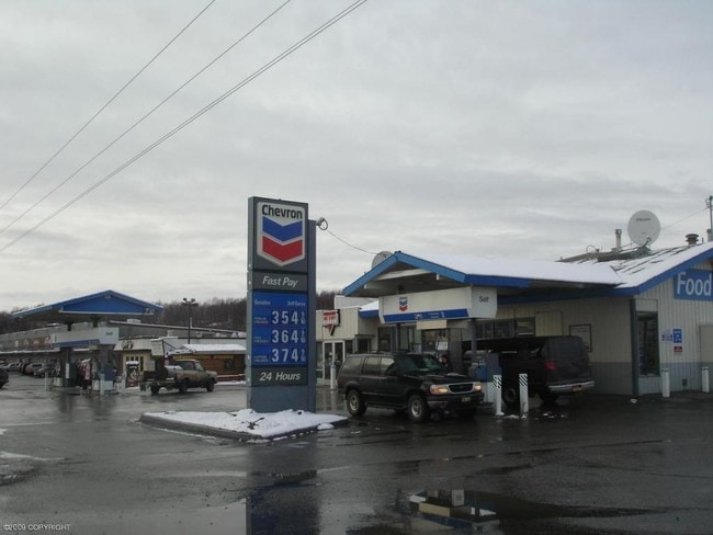
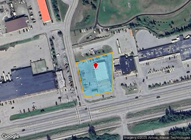
601 W Parks Hwy
Anchorage, AK
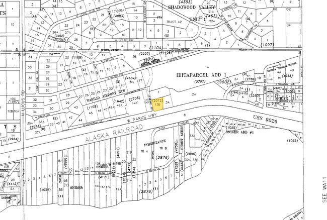
Snider #4 Rsb B/3 L/13
2072000L013B
SNIDER #4 RSB B/3 L/13 LOT 13B
Servicestation
Matanuska-Susitna
X
Alaska
02170C8080F
13b
2024
1.01 AC
2025
Mat-Su Business Region
000800
Anchorage
168 SF
DEMOGRAPHICS near 601 W Parks Hwy
1 Mile
3 Mile
5 Mile
2024 Total Population
3,984
23,812
44,419
2029 Population
4,621
27,360
50,788
Pop Growth 2024-2029
+ 15.99%
+ 14.90%
+ 14.34%
Average Age
38
37
36
2024 Total Households
1,579
8,766
15,877
HH Growth 2024-2029
+ 16.59%
+ 15.51%
+ 14.97%
Median Household Inc
$58,590
$76,437
$81,506
Avg Household Size
2.50
2.70
2.70
2024 Avg HH Vehicles
2.00
2.00
2.00
Median Home Value
$300,541
$296,991
$296,397
Median Year Built
2002
2000
2000
Nearby Places
Map Layers
Map Styles
 Street
 Aerial
- Restaurants
- Banks
- Shops
- Fitness
- Groceries
PUBLIC TRANSPORTATION
AIRPORT
Merrill Field
DRIVE
WALK
Distance
Merrill Field
54 min
42.8 mi
Freight Ports
Port of Anchorage
DRIVE
WALK
Distance
Port of Anchorage
60 min
45.6 mi
SALE & LEASE HISTORY
LISTING DATE
SALE/LEASE

Sep 25, 2016
For Lease
Nearby Properties
Address
Land Use
TOTAL SIZE
Lot Size
Zoning
Address
Land Use
TOTAL SIZE
Lot Size
Zoning
17.15 AC
35
Address
Land Use
TOTAL SIZE
Lot Size
Zoning
68.83 AC
35
Address
Land Use
TOTAL SIZE
Lot Size
Zoning
18.74 AC
35
Address
Land Use
TOTAL SIZE
Lot Size
Zoning
185,670 SF
18.57 AC
35
Address
Land Use
TOTAL SIZE
Lot Size
Zoning
162,711 SF
13.30 AC
35
Address
Land Use
TOTAL SIZE
Lot Size
Zoning
3.88 AC
35
Address
Land Use
TOTAL SIZE
Lot Size
Zoning
20.37 AC
35
Address
Land Use
TOTAL SIZE
Lot Size
Zoning
106,350 SF
59.96 AC
35
Address
Land Use
TOTAL SIZE
Lot Size
Zoning
4.03 AC
35
Address
Land Use
TOTAL SIZE
Lot Size
Zoning
80 AC
41
Address
Land Use
TOTAL SIZE
Lot Size
Zoning
27,216 SF
12.07 AC
35
Address
Land Use
TOTAL SIZE
Lot Size
Zoning
153,815 SF
11.24 AC
35
Address
Land Use
TOTAL SIZE
Lot Size
Zoning
11.66 AC
35
Address
Land Use
TOTAL SIZE
Lot Size
Zoning
5.61 AC
7
Address
Land Use
TOTAL SIZE
Lot Size
Zoning
83,012 SF
6.37 AC
35
Address
Land Use
TOTAL SIZE
Lot Size
Zoning
83.11 AC
8
Address
Land Use
TOTAL SIZE
Lot Size
Zoning
120,550 SF
11.67 AC
35
Address
Land Use
TOTAL SIZE
Lot Size
Zoning
30,349 SF
6.41 AC
35
Address
Land Use
TOTAL SIZE
Lot Size
Zoning
5.21 AC
35
Address
Land Use
TOTAL SIZE
Lot Size
Zoning
24,657 SF
3 AC
35
Address
Land Use
TOTAL SIZE
Lot Size
Zoning
81,172 SF
6.39 AC
35
Address
Land Use
TOTAL SIZE
Lot Size
Zoning
4.86 AC
35
Address
Land Use
TOTAL SIZE
Lot Size
Zoning
2.39 AC
35
Address
Land Use
TOTAL SIZE
Lot Size
Zoning
44,093 SF
1.77 AC
35
Address
Land Use
TOTAL SIZE
Lot Size
Zoning
4.38 AC
35
Address
Land Use
TOTAL SIZE
Lot Size
Zoning
20,202 SF
6.68 AC
8
Address
Land Use
TOTAL SIZE
Lot Size
Zoning
51,537 SF
7.83 AC
35
Address
Land Use
TOTAL SIZE
Lot Size
Zoning
19.92 AC
35
Address
Land Use
TOTAL SIZE
Lot Size
Zoning
29.88 AC
18
Address
Land Use
TOTAL SIZE
Lot Size
Zoning
23,733 SF
4.97 AC
18
The World's #1 Commercial Real Estate Marketplace
Connect with us
© 2025 CoStar Group
The information above has been obtained from sources believed reliable. While we do not doubt its accuracy we have not verified it and make no guarantee, warranty or representation about it. It is your responsibility to independently confirm its accuracy and completeness. Any projections, opinions, assumptions, or estimates used are for example only and do not represent the current or future performance of the property. The value of this transaction to you depends on tax and other factors which should be evaluated by your tax, financial, and legal advisors. You and your advisors should conduct a careful, independent investigation of the property to determine to your satisfaction the suitability of the property for your needs.