Property Record
601 Woodland Square Loop Se, Lacey, WA 98503
NEARBY LISTINGS FOR SALE OR LEASE
Property Detail
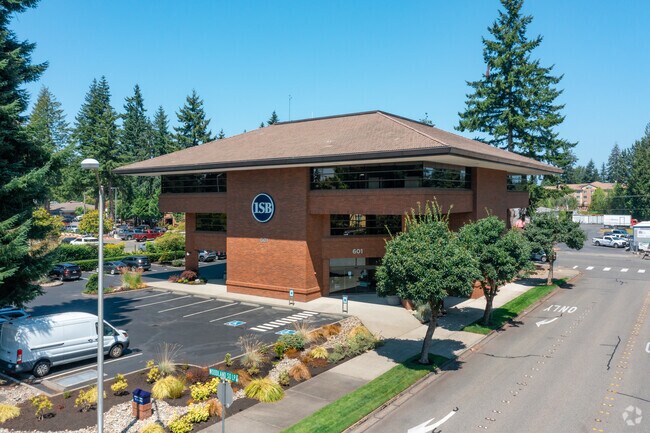
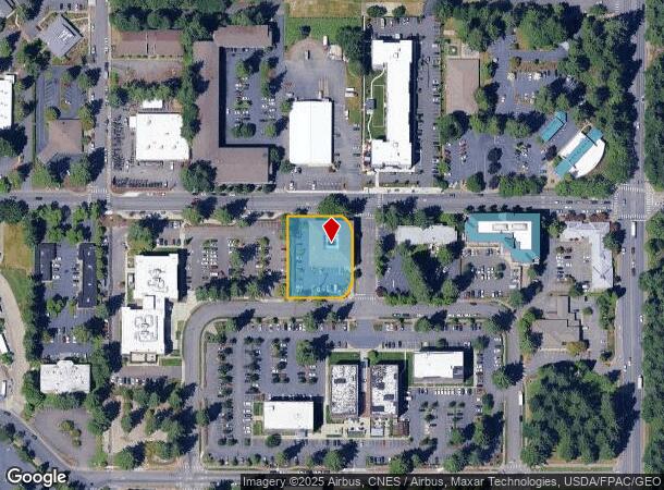
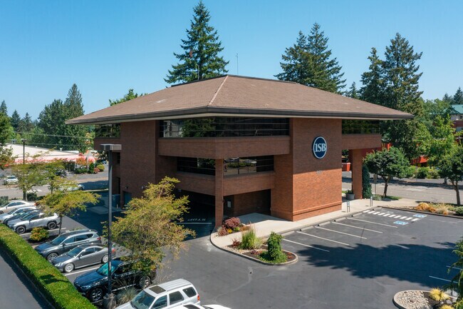
601 Woodland Square Loop Se
Olympia-Tumwater, WA
Woodland Square
84990000100
SECTION 17 TOWNSHIP 18 RANGE 1W QUARTER SE SE PLAT WOODLAND SQUARE BLA-6258 TR B DOCUMENT 014/466
Financialbuilding
Thurston
X
Washington
53067C0187F
1
2024
0.71 AC
2024
Lacey
011200
Olympia
17,576 SF
DEMOGRAPHICS near 601 Woodland Square Loop Se
1 Mile
3 Mile
5 Mile
2024 Total Population
8,926
72,807
166,403
2029 Population
9,445
77,000
175,932
Pop Growth 2024-2029
+ 5.81%
+ 5.76%
+ 5.73%
Average Age
42
41
41
2024 Total Households
3,980
29,012
66,855
HH Growth 2024-2029
+ 5.95%
+ 5.89%
+ 5.85%
Median Household Inc
$49,163
$74,657
$79,285
Avg Household Size
2.10
2.40
2.40
2024 Avg HH Vehicles
1.00
2.00
2.00
Median Home Value
$337,888
$381,322
$404,781
Median Year Built
1981
1984
1989
Nearby Places
Map Layers
Map Styles
 Street
 Aerial
- Restaurants
- Banks
- Shops
- Fitness
- Groceries
PUBLIC TRANSPORTATION
COMMUTER RAIL
DRIVE
WALK
Distance
12 min
4.8 mi
AIRPORT
Seattle-Tacoma International
DRIVE
WALK
Distance
Seattle-Tacoma International
66 min
46.3 mi
Freight Ports
Port of Tacoma
DRIVE
WALK
Distance
Port of Tacoma
39 min
27.9 mi
Nearby Properties
Address
Land Use
TOTAL SIZE
Lot Size
Zoning
Address
Land Use
TOTAL SIZE
Lot Size
Zoning
874,760 SF
28.63 AC
MS
Address
Land Use
TOTAL SIZE
Lot Size
Zoning
497,558 SF
28.57 AC
CBD 7
Address
Land Use
TOTAL SIZE
Lot Size
Zoning
660,544 SF
44.67 AC
MD
Address
Land Use
TOTAL SIZE
Lot Size
Zoning
203,039 SF
38.05 AC
OSI-S
Address
Land Use
TOTAL SIZE
Lot Size
Zoning
224,544 SF
14.36 AC
OSI-S
Address
Land Use
TOTAL SIZE
Lot Size
Zoning
272,388 SF
4.69 AC
HD
Address
Land Use
TOTAL SIZE
Lot Size
Zoning
171,420 SF
63.61 AC
SMU
Address
Land Use
TOTAL SIZE
Lot Size
Zoning
204,136 SF
11.91 AC
RM-24
Address
Land Use
TOTAL SIZE
Lot Size
Zoning
147,156 SF
18.75 AC
MS
Address
Land Use
TOTAL SIZE
Lot Size
Zoning
180,132 SF
6.66 AC
HD
Address
Land Use
TOTAL SIZE
Lot Size
Zoning
173,239 SF
7.66 AC
HD
Address
Land Use
TOTAL SIZE
Lot Size
Zoning
64.18 AC
HPBDBC
Address
Land Use
TOTAL SIZE
Lot Size
Zoning
115,977 SF
35.61 AC
OSI-S
Address
Land Use
TOTAL SIZE
Lot Size
Zoning
62.35 AC
HPBDBC
Address
Land Use
TOTAL SIZE
Lot Size
Zoning
166,022 SF
9.61 AC
MD
Address
Land Use
TOTAL SIZE
Lot Size
Zoning
159,103 SF
8.44 AC
HD
Address
Land Use
TOTAL SIZE
Lot Size
Zoning
185,054 SF
6.29 AC
HD
Address
Land Use
TOTAL SIZE
Lot Size
Zoning
221,642 SF
4.96 AC
CBD 5
Address
Land Use
TOTAL SIZE
Lot Size
Zoning
357,949 SF
28.17 AC
WD
Address
Land Use
TOTAL SIZE
Lot Size
Zoning
185,762 SF
9.43 AC
CO
Address
Land Use
TOTAL SIZE
Lot Size
Zoning
163,167 SF
8.20 AC
CBD 5
Address
Land Use
TOTAL SIZE
Lot Size
Zoning
69,898 SF
19.70 AC
CBD 7
Address
Land Use
TOTAL SIZE
Lot Size
Zoning
273,214 SF
19.54 AC
WD
Address
Land Use
TOTAL SIZE
Lot Size
Zoning
192,392 SF
16.15 AC
MD
Address
Land Use
TOTAL SIZE
Lot Size
Zoning
53.54 AC
HPBD-C
Address
Land Use
TOTAL SIZE
Lot Size
Zoning
213,880 SF
21.75 AC
GC
Address
Land Use
TOTAL SIZE
Lot Size
Zoning
168,325 SF
15.35 AC
HD
Address
Land Use
TOTAL SIZE
Lot Size
Zoning
79,184 SF
13.83 AC
OSI-S
Address
Land Use
TOTAL SIZE
Lot Size
Zoning
125,915 SF
7.45 AC
MS
Address
Land Use
TOTAL SIZE
Lot Size
Zoning
117,925 SF
8.14 AC
MS
The World's #1 Commercial Real Estate Marketplace
Connect with us
© 2025 CoStar Group
The information above has been obtained from sources believed reliable. While we do not doubt its accuracy we have not verified it and make no guarantee, warranty or representation about it. It is your responsibility to independently confirm its accuracy and completeness. Any projections, opinions, assumptions, or estimates used are for example only and do not represent the current or future performance of the property. The value of this transaction to you depends on tax and other factors which should be evaluated by your tax, financial, and legal advisors. You and your advisors should conduct a careful, independent investigation of the property to determine to your satisfaction the suitability of the property for your needs.