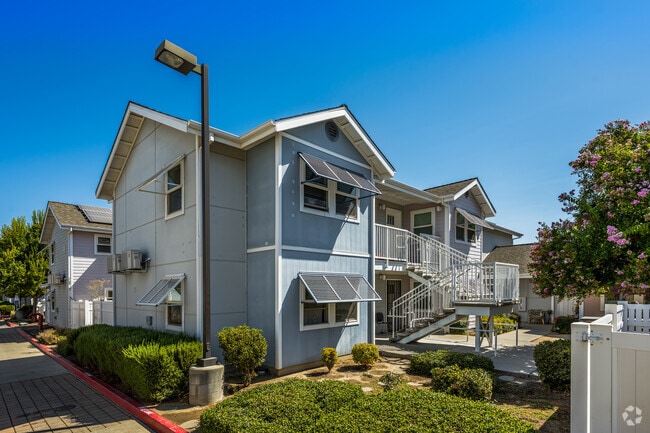
Property Record
6010 34Th St, North Highlands, CA 95660


NEARBY LISTINGS FOR SALE OR LEASE
Property Detail
6010 34Th St
Sacramento--Roseville--Arden-Arcade, CA
Rio Linda 06
215-0072-030
PCL 1 OF PM114-22 EXCL R/W PER 20100527-507
Apartment
Sacramento
X
California
06067C0067H
1
2024
3.50 AC
2025
North Highlands
007403
Sacramento
72,002 SF
DEMOGRAPHICS near 6010 34Th St
1 Mile
3 Mile
5 Mile
2024 Total Population
11,663
114,996
328,027
2029 Population
11,756
115,259
329,348
Pop Growth 2024-2029
+ 0.80%
+ 0.23%
+ 0.40%
Average Age
35
37
38
2024 Total Households
3,481
38,196
114,437
HH Growth 2024-2029
+ 0.75%
+ 0.18%
+ 0.34%
Median Household Inc
$59,471
$63,080
$68,619
Avg Household Size
3.10
2.90
2.80
2024 Avg HH Vehicles
2.00
2.00
2.00
Median Home Value
$291,389
$353,972
$405,363
Median Year Built
1956
1975
1974
Nearby Places
Map Layers
Map Styles
 Street
 Aerial
- Restaurants
- Banks
- Shops
- Fitness
- Groceries
PUBLIC TRANSPORTATION
COMMUTER RAIL
Roseville (California Zephyr - Amtrak, Capitol Corridor - Amtrak)
DRIVE
WALK
Distance
Roseville (California Zephyr - Amtrak, Capitol Corridor - Amtrak)
18 min
9.0 mi
AIRPORT
Sacramento International
DRIVE
WALK
Distance
Sacramento International
26 min
15.0 mi
Freight Ports
Port of Stockton
DRIVE
WALK
Distance
Port of Stockton
71 min
58.0 mi
Nearby Properties
Address
Land Use
TOTAL SIZE
Lot Size
Zoning
Address
Land Use
TOTAL SIZE
Lot Size
Zoning
224,595 SF
42.03 AC
SPA
Address
Land Use
TOTAL SIZE
Lot Size
Zoning
43,200 SF
38.55 AC
SPA
Address
Land Use
TOTAL SIZE
Lot Size
Zoning
430,406 SF
24.45 AC
RD-20
Address
Land Use
TOTAL SIZE
Lot Size
Zoning
173,174 SF
8.89 AC
RD-30
Address
Land Use
TOTAL SIZE
Lot Size
Zoning
180,595 SF
10.74 AC
RD-30
Address
Land Use
TOTAL SIZE
Lot Size
Zoning
183,000 SF
12.49 AC
RD-20
Address
Land Use
TOTAL SIZE
Lot Size
Zoning
14.88 AC
RD-20
Address
Land Use
TOTAL SIZE
Lot Size
Zoning
417,214 SF
23.66 AC
SPA
Address
Land Use
TOTAL SIZE
Lot Size
Zoning
15.83 AC
MRD-SPD
Address
Land Use
TOTAL SIZE
Lot Size
Zoning
170,556 SF
8.41 AC
SPA
Address
Land Use
TOTAL SIZE
Lot Size
Zoning
1,221,441 SF
36.86 AC
SPA
Address
Land Use
TOTAL SIZE
Lot Size
Zoning
217,380 SF
10 AC
SPA
Address
Land Use
TOTAL SIZE
Lot Size
Zoning
136,483 SF
3.77 AC
BP
Address
Land Use
TOTAL SIZE
Lot Size
Zoning
200,104 SF
13.85 AC
RD-20
Address
Land Use
TOTAL SIZE
Lot Size
Zoning
263,792 SF
7.27 AC
SPA
Address
Land Use
TOTAL SIZE
Lot Size
Zoning
130,507 SF
8.97 AC
RD-20
Address
Land Use
TOTAL SIZE
Lot Size
Zoning
146,283 SF
8.73 AC
RD-20
Address
Land Use
TOTAL SIZE
Lot Size
Zoning
160,497 SF
6.85 AC
RD-30
Address
Land Use
TOTAL SIZE
Lot Size
Zoning
123,622 SF
5.93 AC
RD-20
Address
Land Use
TOTAL SIZE
Lot Size
Zoning
0.16 AC
RD-5
Address
Land Use
TOTAL SIZE
Lot Size
Zoning
148,576 SF
4.84 AC
RD-30
Address
Land Use
TOTAL SIZE
Lot Size
Zoning
9.81 AC
SPA
Address
Land Use
TOTAL SIZE
Lot Size
Zoning
280,864 SF
14.94 AC
RD-20
Address
Land Use
TOTAL SIZE
Lot Size
Zoning
43,183 SF
12.35 AC
H F
Address
Land Use
TOTAL SIZE
Lot Size
Zoning
Address
Land Use
TOTAL SIZE
Lot Size
Zoning
288,524 SF
11.64 AC
M-1
Address
Land Use
TOTAL SIZE
Lot Size
Zoning
0.13 AC
RD-7
Address
Land Use
TOTAL SIZE
Lot Size
Zoning
81,124 SF
4.81 AC
RD-20
Address
Land Use
TOTAL SIZE
Lot Size
Zoning
100,529 SF
13.65 AC
RD-10 BP
Address
Land Use
TOTAL SIZE
Lot Size
Zoning
117,288 SF
6.14 AC
M-1S-R
The World's #1 Commercial Real Estate Marketplace
Connect with us
© 2026 CoStar Group
The information above has been obtained from sources believed reliable. While we do not doubt its accuracy we have not verified it and make no guarantee, warranty or representation about it. It is your responsibility to independently confirm its accuracy and completeness. Any projections, opinions, assumptions, or estimates used are for example only and do not represent the current or future performance of the property. The value of this transaction to you depends on tax and other factors which should be evaluated by your tax, financial, and legal advisors. You and your advisors should conduct a careful, independent investigation of the property to determine to your satisfaction the suitability of the property for your needs.