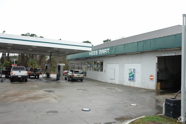
Property Record
6010 E State Highway 100 E, Palm Coast, FL 32137
NEARBY LISTINGS FOR SALE OR LEASE
Property Detail
6010 E State Highway 100 E
Deltona-Daytona Beach-Ormond Beach, FL
.991 ACRES LYING 220 FEET EAST OF ELY R/W OF I-95,180 FEET ON HWY HWY 100, 240 FEET DEEP OR 450 PG 1973 ESMTS-OR450 PG 1977,1989 OR 1995/1828 OR 2432/1500
09-12-31-0000-02040-0000
Flagler
Commercialacreage
Florida
X
1
12035C0231E
5.79 AC
2024
Daytona Area
2025
Other Market Areas
060107
DEMOGRAPHICS near 6010 E State Highway 100 E
1 Mile
3 Mile
5 Mile
2024 Total Population
1,152
16,225
61,710
2029 Population
1,436
19,997
75,614
Pop Growth 2024-2029
+ 24.65%
+ 23.25%
+ 22.53%
Average Age
44
46
47
2024 Total Households
524
6,772
25,327
HH Growth 2024-2029
+ 24.05%
+ 22.59%
+ 21.78%
Median Household Inc
$41,144
$59,268
$63,225
Avg Household Size
2.20
2.40
2.40
2024 Avg HH Vehicles
1.00
2.00
2.00
Median Home Value
$270,454
$279,907
$275,987
Median Year Built
2007
2005
2002
Nearby Places
- Restaurants
- Banks
- Shops
- Fitness
- Groceries
PUBLIC TRANSPORTATION
AIRPORT
Daytona Beach International
DRIVE
WALK
Distance
Daytona Beach International
32 min
24.6 mi
Nearby Properties
Address
Land Use
TOTAL SIZE
Lot Size
Zoning
Address
Land Use
TOTAL SIZE
Lot Size
Zoning
345,915 SF
94.85 AC
COM-2
Address
Land Use
TOTAL SIZE
Lot Size
Zoning
913,614 SF
85.53 AC
PSP
Address
Land Use
TOTAL SIZE
Lot Size
Zoning
142,653 SF
15.71 AC
PUD
Address
Land Use
TOTAL SIZE
Lot Size
Zoning
217,927 SF
1,165.37 AC
I-C
Address
Land Use
TOTAL SIZE
Lot Size
Zoning
280,742 SF
16.06 AC
MPD
Address
Land Use
TOTAL SIZE
Lot Size
Zoning
225,108 SF
41.71 AC
MPD
Address
Land Use
TOTAL SIZE
Lot Size
Zoning
141,171 SF
8.18 AC
MPD
Address
Land Use
TOTAL SIZE
Lot Size
Zoning
904.63 AC
PUD
Address
Land Use
TOTAL SIZE
Lot Size
Zoning
76,544 SF
48.85 AC
R/C
Address
Land Use
TOTAL SIZE
Lot Size
Zoning
459,150 SF
23.52 AC
COM-3
Address
Land Use
TOTAL SIZE
Lot Size
Zoning
124,911 SF
10.18 AC
PUD
Address
Land Use
TOTAL SIZE
Lot Size
Zoning
15.91 AC
PSP
Address
Land Use
TOTAL SIZE
Lot Size
Zoning
220,314 SF
17.41 AC
MPD
Address
Land Use
TOTAL SIZE
Lot Size
Zoning
553.49 AC
PUD
Address
Land Use
TOTAL SIZE
Lot Size
Zoning
82,459 SF
4.09 AC
MPD
Address
Land Use
TOTAL SIZE
Lot Size
Zoning
122,353 SF
17.97 AC
MPD
Address
Land Use
TOTAL SIZE
Lot Size
Zoning
208,450 SF
11.85 AC
MPD
Address
Land Use
TOTAL SIZE
Lot Size
Zoning
45.82 AC
C-2
Address
Land Use
TOTAL SIZE
Lot Size
Zoning
68,684 SF
9.68 AC
MPD
Address
Land Use
TOTAL SIZE
Lot Size
Zoning
220.05 AC
MPD
Address
Land Use
TOTAL SIZE
Lot Size
Zoning
42,025 SF
15.64 AC
MPD
Address
Land Use
TOTAL SIZE
Lot Size
Zoning
112,500 SF
5 AC
HC
Address
Land Use
TOTAL SIZE
Lot Size
Zoning
231,560 SF
39.56 AC
I-C
Address
Land Use
TOTAL SIZE
Lot Size
Zoning
84,899 SF
10.35 AC
COM-2
Address
Land Use
TOTAL SIZE
Lot Size
Zoning
35,243 SF
8.45 AC
COM-3
Address
Land Use
TOTAL SIZE
Lot Size
Zoning
28,591 SF
3.84 AC
PUD
Address
Land Use
TOTAL SIZE
Lot Size
Zoning
59,889 SF
0.75 AC
R-3A
Address
Land Use
TOTAL SIZE
Lot Size
Zoning
54,500 SF
4.95 AC
COM-2
Address
Land Use
TOTAL SIZE
Lot Size
Zoning
47,264 SF
10.20 AC
MPD
The World's #1 Commercial Real Estate Marketplace
Connect with us
© 2025 CoStar Group
The information above has been obtained from sources believed reliable. While we do not doubt its accuracy we have not verified it and make no guarantee, warranty or representation about it. It is your responsibility to independently confirm its accuracy and completeness. Any projections, opinions, assumptions, or estimates used are for example only and do not represent the current or future performance of the property. The value of this transaction to you depends on tax and other factors which should be evaluated by your tax, financial, and legal advisors. You and your advisors should conduct a careful, independent investigation of the property to determine to your satisfaction the suitability of the property for your needs.