Property Record
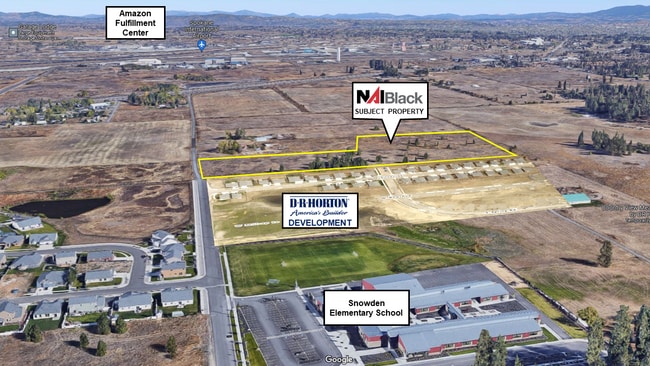
6010 S Holly Rd, Spokane, WA


NEARBY LISTINGS FOR SALE OR LEASE
Property Detail
6010 S Holly Rd
24053.9057
05-24-42 S1/2 OF S1/2 OF NE1/4 OF SW1/4 & S291.09FT OF E754.93FT OF N1/2 OF S1/2 OF NE1/4 OF SW1/4 EXC E20.01FT THERE OF EXC CO RD.
Vacantlandnec
Spokane
X
Washington
53063C0700D
15.74 AC
2025
West Plains
2025
Spokane
013600
Spokane-Spokane Valley, WA
DEMOGRAPHICS near 6010 S Holly Rd
1 Mile
3 Mile
5 Mile
2024 Total Population
1,954
8,393
31,791
2029 Population
2,105
9,060
34,280
Pop Growth 2024-2029
+ 7.73%
+ 7.95%
+ 7.83%
Average Age
40
39
39
2024 Total Households
718
3,093
11,756
HH Growth 2024-2029
+ 7.80%
+ 8.18%
+ 8.15%
Median Household Inc
$89,388
$82,136
$70,653
Avg Household Size
2.70
2.70
2.50
2024 Avg HH Vehicles
2.00
2.00
2.00
Median Home Value
$384,253
$372,624
$374,942
Median Year Built
2001
2002
2002
Nearby Places
Map Layers
Map Styles
 Street
 Aerial
- Restaurants
- Banks
- Shops
- Fitness
- Groceries
PUBLIC TRANSPORTATION
AIRPORT
Spokane International
DRIVE
WALK
Distance
Spokane International
12 min
4.2 mi
Freight Ports
Port of Everett
DRIVE
WALK
Distance
Port of Everett
1 min
219.1 mi
SALE & LEASE HISTORY
LISTING DATE
SALE/LEASE

Oct 19, 2023
For Sale
Mar 05, 2019
For Sale
Aug 08, 2017
For Sale
Nearby Properties
Address
Land Use
TOTAL SIZE
Lot Size
Zoning
Address
Land Use
TOTAL SIZE
Lot Size
Zoning
2,689,133 SF
79.07 AC
LI
Address
Land Use
TOTAL SIZE
Lot Size
Zoning
702,957 SF
277.93 AC
Address
Land Use
TOTAL SIZE
Lot Size
Zoning
808,710 SF
646.44 AC
Address
Land Use
TOTAL SIZE
Lot Size
Zoning
546,897 SF
27.69 AC
Address
Land Use
TOTAL SIZE
Lot Size
Zoning
306,250 SF
16.11 AC
LI
Address
Land Use
TOTAL SIZE
Lot Size
Zoning
562,448 SF
62 AC
LI
Address
Land Use
TOTAL SIZE
Lot Size
Zoning
118,996 SF
8.21 AC
LI
Address
Land Use
TOTAL SIZE
Lot Size
Zoning
218,400 SF
14.69 AC
Address
Land Use
TOTAL SIZE
Lot Size
Zoning
197,933 SF
37.51 AC
UR
Address
Land Use
TOTAL SIZE
Lot Size
Zoning
278,722 SF
44.44 AC
RC
Address
Land Use
TOTAL SIZE
Lot Size
Zoning
303,597 SF
62.39 AC
LDR
Address
Land Use
TOTAL SIZE
Lot Size
Zoning
187,000 SF
12.43 AC
I-2
Address
Land Use
TOTAL SIZE
Lot Size
Zoning
177,707 SF
44.44 AC
LI
Address
Land Use
TOTAL SIZE
Lot Size
Zoning
122,949 SF
11.07 AC
LI
Address
Land Use
TOTAL SIZE
Lot Size
Zoning
159,706 SF
918.26 AC
LI
Address
Land Use
TOTAL SIZE
Lot Size
Zoning
147,774 SF
6.64 AC
RC
Address
Land Use
TOTAL SIZE
Lot Size
Zoning
78,801 SF
14.39 AC
RT
Address
Land Use
TOTAL SIZE
Lot Size
Zoning
59,171 SF
10.12 AC
Address
Land Use
TOTAL SIZE
Lot Size
Zoning
263,013 SF
10.12 AC
LI
Address
Land Use
TOTAL SIZE
Lot Size
Zoning
141,000 SF
14.82 AC
Address
Land Use
TOTAL SIZE
Lot Size
Zoning
508,598 SF
28.78 AC
LI
Address
Land Use
TOTAL SIZE
Lot Size
Zoning
387,963 SF
49.93 AC
LI
Address
Land Use
TOTAL SIZE
Lot Size
Zoning
108,962 SF
14.58 AC
Address
Land Use
TOTAL SIZE
Lot Size
Zoning
91,482 SF
5.13 AC
MDR
Address
Land Use
TOTAL SIZE
Lot Size
Zoning
101,970 SF
7.88 AC
LI
Address
Land Use
TOTAL SIZE
Lot Size
Zoning
155,344 SF
28.64 AC
LI
Address
Land Use
TOTAL SIZE
Lot Size
Zoning
23,494 SF
8.32 AC
LI
Address
Land Use
TOTAL SIZE
Lot Size
Zoning
82,446 SF
3.55 AC
RC
Address
Land Use
TOTAL SIZE
Lot Size
Zoning
55,719 SF
9.94 AC
LI
Address
Land Use
TOTAL SIZE
Lot Size
Zoning
84,183 SF
11.07 AC
LI
The World's #1 Commercial Real Estate Marketplace
Connect with us
© 2025 CoStar Group
The information above has been obtained from sources believed reliable. While we do not doubt its accuracy we have not verified it and make no guarantee, warranty or representation about it. It is your responsibility to independently confirm its accuracy and completeness. Any projections, opinions, assumptions, or estimates used are for example only and do not represent the current or future performance of the property. The value of this transaction to you depends on tax and other factors which should be evaluated by your tax, financial, and legal advisors. You and your advisors should conduct a careful, independent investigation of the property to determine to your satisfaction the suitability of the property for your needs.