Property Record
6010 S Nc 16 Hwy, Maiden, NC 28650


NEARBY LISTINGS FOR SALE OR LEASE
Property Detail
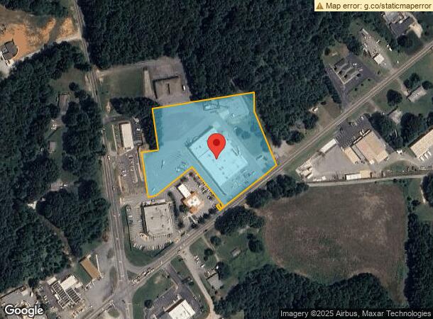
6010 S Nc 16 Hwy
Hickory-Lenoir-Morganton, NC
On The Plat
3686116572460000
LOT 3 PLAT 62-56
Stripcommercialcenter
Catawba
X
North Carolina
3710368600J
3
2024
4.59 AC
2025
Catawba County
011501
Charlotte
33,442 SF
DEMOGRAPHICS near 6010 S Nc 16 Hwy
1 Mile
3 Mile
5 Mile
2024 Total Population
837
9,340
25,412
2029 Population
913
10,421
28,500
Pop Growth 2024-2029
+ 9.08%
+ 11.57%
+ 12.15%
Average Age
41
42
43
2024 Total Households
328
3,713
10,072
HH Growth 2024-2029
+ 9.15%
+ 11.69%
+ 12.15%
Median Household Inc
$62,656
$65,142
$77,690
Avg Household Size
2.50
2.50
2.50
2024 Avg HH Vehicles
2.00
2.00
2.00
Median Home Value
$224,000
$253,898
$302,356
Median Year Built
1997
1995
1997
Nearby Places
Map Layers
Map Styles
 Street
 Aerial
- Restaurants
- Banks
- Shops
- Fitness
- Groceries
PUBLIC TRANSPORTATION
AIRPORT
Charlotte/Douglas International
DRIVE
WALK
Distance
Charlotte/Douglas International
40 min
32.9 mi
SALE & LEASE HISTORY
LISTING DATE
SALE/LEASE

Sep 28, 2016
For Lease
May 17, 2021
For Lease
Nearby Properties
Address
Land Use
TOTAL SIZE
Lot Size
Zoning
Address
Land Use
TOTAL SIZE
Lot Size
Zoning
6,264 SF
24.64 AC
ELDD B-G
Address
Land Use
TOTAL SIZE
Lot Size
Zoning
66,136 SF
18.10 AC
ELDD B-N &
Address
Land Use
TOTAL SIZE
Lot Size
Zoning
251,009 SF
20.46 AC
ELDD I-G
Address
Land Use
TOTAL SIZE
Lot Size
Zoning
71,150 SF
4.70 AC
PD-CD
Address
Land Use
TOTAL SIZE
Lot Size
Zoning
1,912 SF
31.99 AC
HC
Address
Land Use
TOTAL SIZE
Lot Size
Zoning
33,342 SF
9.79 AC
RC
Address
Land Use
TOTAL SIZE
Lot Size
Zoning
1,500 SF
11.02 AC
PD
Address
Land Use
TOTAL SIZE
Lot Size
Zoning
20,923 SF
2.83 AC
R-S CU
Address
Land Use
TOTAL SIZE
Lot Size
Zoning
2,000 SF
33.70 AC
R-30
Address
Land Use
TOTAL SIZE
Lot Size
Zoning
14,736 SF
1.44 AC
HC
Address
Land Use
TOTAL SIZE
Lot Size
Zoning
18,266 SF
9.73 AC
PD-CD
Address
Land Use
TOTAL SIZE
Lot Size
Zoning
10,768 SF
2.20 AC
HC
Address
Land Use
TOTAL SIZE
Lot Size
Zoning
24,548 SF
11.40 AC
ELDD B-G
Address
Land Use
TOTAL SIZE
Lot Size
Zoning
20,000 SF
2.60 AC
ELDD I-G
Address
Land Use
TOTAL SIZE
Lot Size
Zoning
60,000 SF
28.03 AC
ELDD I-G
Address
Land Use
TOTAL SIZE
Lot Size
Zoning
16,000 SF
3.12 AC
ELDD B-G
Address
Land Use
TOTAL SIZE
Lot Size
Zoning
30,048 SF
2 AC
I-G
Address
Land Use
TOTAL SIZE
Lot Size
Zoning
41,606 SF
4.69 AC
PD
Address
Land Use
TOTAL SIZE
Lot Size
Zoning
22.21 AC
R-40
Address
Land Use
TOTAL SIZE
Lot Size
Zoning
8,600 SF
28.44 AC
R-T
Address
Land Use
TOTAL SIZE
Lot Size
Zoning
25,224 SF
10.99 AC
ELDD I-L
Address
Land Use
TOTAL SIZE
Lot Size
Zoning
32.46 AC
PD-CD
Address
Land Use
TOTAL SIZE
Lot Size
Zoning
4,060 SF
13.05 AC
R-40
Address
Land Use
TOTAL SIZE
Lot Size
Zoning
30,000 SF
6.53 AC
I-G
Address
Land Use
TOTAL SIZE
Lot Size
Zoning
10,309 SF
7.47 AC
R-SF
Address
Land Use
TOTAL SIZE
Lot Size
Zoning
22,280 SF
21.29 AC
PD-CD
Address
Land Use
TOTAL SIZE
Lot Size
Zoning
13,257 SF
4.63 AC
I-G & R-SF
Address
Land Use
TOTAL SIZE
Lot Size
Zoning
6,867 SF
3.42 AC
ELDD R-S
Address
Land Use
TOTAL SIZE
Lot Size
Zoning
229.93 AC
R-T
The World's #1 Commercial Real Estate Marketplace
Connect with us
© 2026 CoStar Group
The information above has been obtained from sources believed reliable. While we do not doubt its accuracy we have not verified it and make no guarantee, warranty or representation about it. It is your responsibility to independently confirm its accuracy and completeness. Any projections, opinions, assumptions, or estimates used are for example only and do not represent the current or future performance of the property. The value of this transaction to you depends on tax and other factors which should be evaluated by your tax, financial, and legal advisors. You and your advisors should conduct a careful, independent investigation of the property to determine to your satisfaction the suitability of the property for your needs.