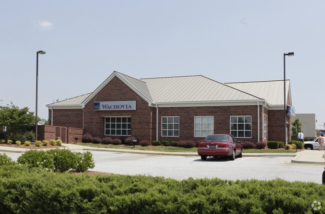
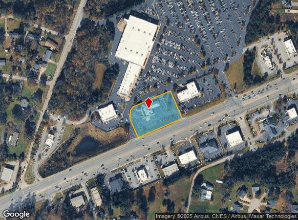
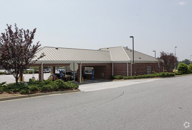
Property Record
6011 Wade Hampton Blvd, Taylors, SC 29687
NEARBY LISTINGS FOR SALE OR LEASE
Property Detail
6011 Wade Hampton Blvd
Greenville-Anderson-Mauldin, SC
MAP T009.04
T009.04-01-025.06
Greenville
Financialbuilding
South Carolina
X
025.06
45045C0342E
1.33 AC
2025
Wade Hampton
2024
Greenville/Spartanburg
002611
DEMOGRAPHICS near 6011 Wade Hampton Blvd
1 Mile
3 Mile
5 Mile
2024 Total Population
4,409
46,524
119,876
2029 Population
4,870
51,147
132,031
Pop Growth 2024-2029
+ 10.46%
+ 9.94%
+ 10.14%
Average Age
39
40
40
2024 Total Households
1,780
18,521
47,452
HH Growth 2024-2029
+ 10.62%
+ 10.03%
+ 10.22%
Median Household Inc
$57,374
$67,886
$70,475
Avg Household Size
2.40
2.50
2.50
2024 Avg HH Vehicles
2.00
2.00
2.00
Median Home Value
$221,296
$229,164
$247,885
Median Year Built
1994
1990
1989
Nearby Places
Map Layers
Map Styles
 Street
 Aerial
- Restaurants
- Banks
- Shops
- Fitness
- Groceries
PUBLIC TRANSPORTATION
COMMUTER RAIL
DRIVE
WALK
Distance
19 min
9.8 mi
AIRPORT
Greenville Spartanburg International
DRIVE
WALK
Distance
Greenville Spartanburg International
11 min
5.5 mi
Asheville Regional
DRIVE
WALK
Distance
Asheville Regional
64 min
46.4 mi
Nearby Properties
Address
Land Use
TOTAL SIZE
Lot Size
Zoning
Address
Land Use
TOTAL SIZE
Lot Size
Zoning
5.07 AC
C2
Address
Land Use
TOTAL SIZE
Lot Size
Zoning
14.20 AC
UNZONED
Address
Land Use
TOTAL SIZE
Lot Size
Zoning
13.25 AC
I1
Address
Land Use
TOTAL SIZE
Lot Size
Zoning
11.80 AC
R10
Address
Land Use
TOTAL SIZE
Lot Size
Zoning
11.30 AC
R10
Address
Land Use
TOTAL SIZE
Lot Size
Zoning
0.42 AC
OD
Address
Land Use
TOTAL SIZE
Lot Size
Zoning
8.22 AC
I1
Address
Land Use
TOTAL SIZE
Lot Size
Zoning
1.90 AC
I1
Address
Land Use
TOTAL SIZE
Lot Size
Zoning
25.70 AC
R20
Address
Land Use
TOTAL SIZE
Lot Size
Zoning
6.81 AC
RM
Address
Land Use
TOTAL SIZE
Lot Size
Zoning
92.74 AC
R15
Address
Land Use
TOTAL SIZE
Lot Size
Zoning
10.20 AC
S1
Address
Land Use
TOTAL SIZE
Lot Size
Zoning
41.90 AC
RMA
Address
Land Use
TOTAL SIZE
Lot Size
Zoning
5.23 AC
I1
Address
Land Use
TOTAL SIZE
Lot Size
Zoning
14.33 AC
I1
Address
Land Use
TOTAL SIZE
Lot Size
Zoning
22.35 AC
R20
Address
Land Use
TOTAL SIZE
Lot Size
Zoning
532 SF
72.61 AC
I1
Address
Land Use
TOTAL SIZE
Lot Size
Zoning
4.07 AC
OD
Address
Land Use
TOTAL SIZE
Lot Size
Zoning
6.90 AC
I1
Address
Land Use
TOTAL SIZE
Lot Size
Zoning
19.02 AC
RRROW
Address
Land Use
TOTAL SIZE
Lot Size
Zoning
11.70 AC
C2
Address
Land Use
TOTAL SIZE
Lot Size
Zoning
7.12 AC
R15
Address
Land Use
TOTAL SIZE
Lot Size
Zoning
44.37 AC
R15
Address
Land Use
TOTAL SIZE
Lot Size
Zoning
5.15 AC
R15
Address
Land Use
TOTAL SIZE
Lot Size
Zoning
3.56 AC
OD
Address
Land Use
TOTAL SIZE
Lot Size
Zoning
5 AC
C3
Address
Land Use
TOTAL SIZE
Lot Size
Zoning
37.96 AC
RS
Address
Land Use
TOTAL SIZE
Lot Size
Zoning
6.62 AC
I1
Address
Land Use
TOTAL SIZE
Lot Size
Zoning
4.85 AC
I1
Address
Land Use
TOTAL SIZE
Lot Size
Zoning
99.01 AC
I1
The World's #1 Commercial Real Estate Marketplace
Connect with us
© 2025 CoStar Group
The information above has been obtained from sources believed reliable. While we do not doubt its accuracy we have not verified it and make no guarantee, warranty or representation about it. It is your responsibility to independently confirm its accuracy and completeness. Any projections, opinions, assumptions, or estimates used are for example only and do not represent the current or future performance of the property. The value of this transaction to you depends on tax and other factors which should be evaluated by your tax, financial, and legal advisors. You and your advisors should conduct a careful, independent investigation of the property to determine to your satisfaction the suitability of the property for your needs.