Property Record
6023 Arndt Rd, Eau Claire, WI 54701
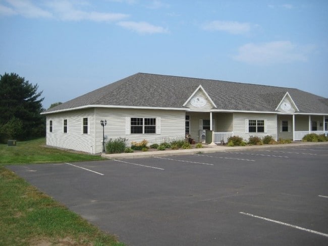

Property Detail
6023 Arndt Rd
Eau Claire, WI
LOT 3 CSM 997 (VOL 5 P 200 #657766) EX HWY R/W CONT 0.20 AC M/L CONVEYED IN 1622/554 SEE TOD DOC 1171396
18024-2-260910-410-9003
EAU CLAIRE
Commercialnec
Wisconsin
C3
3
B and X Area of moderate flood hazard, usually the area between the limits of the 100-year and 500-year floods.
2.15 AC
2025
Eau Claire/Menomonie
2025
Other Market Areas
000302
NEARBY LISTINGS FOR SALE OR LEASE
-
-
View all Eau Claire listings for sale on LoopNet.com
DEMOGRAPHICS near 6023 Arndt Rd
1 mile
3 mile
5 mile
2025 Total Population
932
17,292
53,280
2030 Population
974
17,848
54,888
Pop Growth 2025-2030
+ 4.51%
+ 3.22%
+ 3.02%
Average Age
41
41
38
2025 Total Households
346
7,422
21,569
HH Growth 2025-2030
+ 4.62%
+ 3.27%
+ 3.21%
Median Household Inc
$137,162
$77,995
$75,349
Avg Household Size
2.60
2.30
2.30
2025 Avg HH Vehicles
3.00
2.00
2.00
Median Home Value
$383,333
$329,700
$287,705
Median Year Built
1986
1992
1983
Nearby Places
Map Layers
Map Styles
 Street
 Aerial
Layers
 Traffic
 Biking
Places
Listings with unknown addresses are not visible on the map
- Restaurants
- Banks
- Shops
- Fitness
- Groceries
Nearby Properties
Address
Land Use
TOTAL SIZE
Lot Size
Zoning
Address
Land Use
TOTAL SIZE
Lot Size
Zoning
520,119 SF
42.39 AC
C3
Address
Land Use
TOTAL SIZE
Lot Size
Zoning
207,978 SF
24.47 AC
C3P
Address
Land Use
TOTAL SIZE
Lot Size
Zoning
132,943 SF
11.26 AC
Address
Land Use
TOTAL SIZE
Lot Size
Zoning
66,393 SF
12.95 AC
Address
Land Use
TOTAL SIZE
Lot Size
Zoning
200,880 SF
14.86 AC
C3P
Address
Land Use
TOTAL SIZE
Lot Size
Zoning
173,473 SF
14.38 AC
C3P
Address
Land Use
TOTAL SIZE
Lot Size
Zoning
96,149 SF
5.92 AC
R3P
Address
Land Use
TOTAL SIZE
Lot Size
Zoning
169,740 SF
13.16 AC
C3P
Address
Land Use
TOTAL SIZE
Lot Size
Zoning
92,178 SF
3.81 AC
C3P
Address
Land Use
TOTAL SIZE
Lot Size
Zoning
85,790 SF
5.68 AC
C3
Address
Land Use
TOTAL SIZE
Lot Size
Zoning
50,979 SF
10.40 AC
C3P
Address
Land Use
TOTAL SIZE
Lot Size
Zoning
39,120 SF
5.03 AC
Address
Land Use
TOTAL SIZE
Lot Size
Zoning
Address
Land Use
TOTAL SIZE
Lot Size
Zoning
90,580 SF
5.67 AC
C3P
Address
Land Use
TOTAL SIZE
Lot Size
Zoning
62,964 SF
2.50 AC
R3P
Address
Land Use
TOTAL SIZE
Lot Size
Zoning
117,095 SF
18.74 AC
C3P
Address
Land Use
TOTAL SIZE
Lot Size
Zoning
3.37 AC
Address
Land Use
TOTAL SIZE
Lot Size
Zoning
11,336 SF
3.70 AC
Address
Land Use
TOTAL SIZE
Lot Size
Zoning
8,938 SF
8.06 AC
Address
Land Use
TOTAL SIZE
Lot Size
Zoning
107,347 SF
6.04 AC
C3
Address
Land Use
TOTAL SIZE
Lot Size
Zoning
Address
Land Use
TOTAL SIZE
Lot Size
Zoning
50,001 SF
6.61 AC
C3P
Address
Land Use
TOTAL SIZE
Lot Size
Zoning
44,559 SF
2.07 AC
C3
Address
Land Use
TOTAL SIZE
Lot Size
Zoning
10,948 SF
3.54 AC
Address
Land Use
TOTAL SIZE
Lot Size
Zoning
42,670 SF
4.11 AC
C3P
Address
Land Use
TOTAL SIZE
Lot Size
Zoning
80,286 SF
9.75 AC
C3P
Address
Land Use
TOTAL SIZE
Lot Size
Zoning
98,104 SF
6.79 AC
Address
Land Use
TOTAL SIZE
Lot Size
Zoning
36,916 SF
1.40 AC
C2P
Address
Land Use
TOTAL SIZE
Lot Size
Zoning
29,933 SF
2.84 AC
C3
Address
Land Use
TOTAL SIZE
Lot Size
Zoning
41,970 SF
9.32 AC
C3P
The World's #1 Commercial Real Estate Marketplace
Connect with us
© 2026 CoStar Group
The information above has been obtained from sources believed reliable. While we do not doubt its accuracy we have not verified it and make no guarantee, warranty or representation about it. It is your responsibility to independently confirm its accuracy and completeness. Any projections, opinions, assumptions, or estimates used are for example only and do not represent the current or future performance of the property. The value of this transaction to you depends on tax and other factors which should be evaluated by your tax, financial, and legal advisors. You and your advisors should conduct a careful, independent investigation of the property to determine to your satisfaction the suitability of the property for your needs.