Property Record
6015 E 147Th St, Grandview, MO 64030
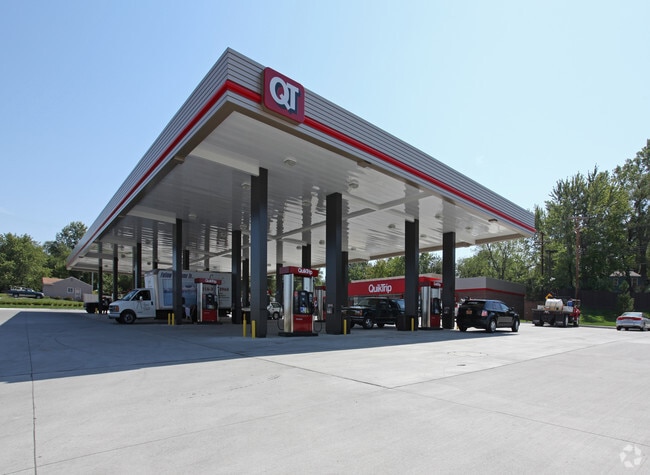


Property Detail
6015 E 147Th St
Kansas City, MO-KS
BELVIDERE HEIGHTS---PT OF TR-A BLK 8 & ALL OF LOTS 215 & 216 RES OF LOTS 1 THRU 14 BLK 8 & BLK 9 & LOTS 1-6 INCL & LOT 1 5 BLK 10 DAF:BEG AT TH NELY COR OF SD LOT 215 TH S 03 DEG 52
67-720-03-30-00-0-00-000
Jackson
Storebuilding
Missouri
B and X Area of moderate flood hazard, usually the area between the limits of the 100-year and 500-year floods.
15
2024
2.57 AC
2025
Southeast Jackson County
013410
Kansas City
4,864 SF
NEARBY LISTINGS FOR SALE OR LEASE
DEMOGRAPHICS near 6015 E 147Th St
1 mile
3 mile
5 mile
2024 Total Population
6,707
37,063
92,904
2029 Population
6,857
37,968
95,476
Pop Growth 2024-2029
+ 2.24%
+ 2.44%
+ 2.77%
Average Age
35
38
39
2024 Total Households
2,931
14,678
36,840
HH Growth 2024-2029
+ 2.46%
+ 2.53%
+ 2.80%
Median Household Inc
$48,184
$58,877
$64,907
Avg Household Size
2.30
2.50
2.50
2024 Avg HH Vehicles
2.00
2.00
2.00
Median Home Value
$172,021
$185,856
$226,571
Median Year Built
1981
1976
1979
Nearby Places
Map Layers
Map Styles
 Street
 Aerial
Transit
 Traffic
 Biking
Places
Listings with unknown addresses are not visible on the map
- Restaurants
- Banks
- Shops
- Fitness
- Groceries
PUBLIC TRANSPORTATION
AIRPORT
Kansas City International
Drive
Walk
Distance
Kansas City International
52 min
38.0 mi
Nearby Properties
Address
Land Use
TOTAL SIZE
Lot Size
Zoning
Address
Land Use
TOTAL SIZE
Lot Size
Zoning
1,314,506 SF
174 AC
Address
Land Use
TOTAL SIZE
Lot Size
Zoning
38.18 AC
Address
Land Use
TOTAL SIZE
Lot Size
Zoning
11.65 AC
Address
Land Use
TOTAL SIZE
Lot Size
Zoning
4,490 SF
27.52 AC
Address
Land Use
TOTAL SIZE
Lot Size
Zoning
456,840 SF
29.46 AC
Address
Land Use
TOTAL SIZE
Lot Size
Zoning
915,528 SF
72.47 AC
Address
Land Use
TOTAL SIZE
Lot Size
Zoning
319,892 SF
Address
Land Use
TOTAL SIZE
Lot Size
Zoning
366,600 SF
9 AC
Address
Land Use
TOTAL SIZE
Lot Size
Zoning
646,513 SF
113.86 AC
Address
Land Use
TOTAL SIZE
Lot Size
Zoning
447,462 SF
37.91 AC
Address
Land Use
TOTAL SIZE
Lot Size
Zoning
631,055 SF
71.76 AC
Address
Land Use
TOTAL SIZE
Lot Size
Zoning
267,428 SF
Address
Land Use
TOTAL SIZE
Lot Size
Zoning
227,676 SF
15.86 AC
Address
Land Use
TOTAL SIZE
Lot Size
Zoning
425,779 SF
23.23 AC
Address
Land Use
TOTAL SIZE
Lot Size
Zoning
372,085 SF
17.16 AC
Address
Land Use
TOTAL SIZE
Lot Size
Zoning
24,132 SF
36.55 AC
Address
Land Use
TOTAL SIZE
Lot Size
Zoning
446,900 SF
19.33 AC
Address
Land Use
TOTAL SIZE
Lot Size
Zoning
90,842 SF
9 AC
Address
Land Use
TOTAL SIZE
Lot Size
Zoning
313,997 SF
20.57 AC
Address
Land Use
TOTAL SIZE
Lot Size
Zoning
504,100 SF
39.25 AC
Address
Land Use
TOTAL SIZE
Lot Size
Zoning
628,134 SF
37.62 AC
Address
Land Use
TOTAL SIZE
Lot Size
Zoning
303,625 SF
Address
Land Use
TOTAL SIZE
Lot Size
Zoning
94,080 SF
5.83 AC
Address
Land Use
TOTAL SIZE
Lot Size
Zoning
17,590 SF
18.30 AC
Address
Land Use
TOTAL SIZE
Lot Size
Zoning
80,976 SF
1.82 AC
Address
Land Use
TOTAL SIZE
Lot Size
Zoning
315,314 SF
37.40 AC
Address
Land Use
TOTAL SIZE
Lot Size
Zoning
46,317 SF
9.63 AC
Address
Land Use
TOTAL SIZE
Lot Size
Zoning
253,575 SF
43.62 AC
Address
Land Use
TOTAL SIZE
Lot Size
Zoning
402,609 SF
15.11 AC
Address
Land Use
TOTAL SIZE
Lot Size
Zoning
94,123 SF
37.36 AC
The World's #1 Commercial Real Estate Marketplace
Connect with us
© 2026 CoStar Group
The information above has been obtained from sources believed reliable. While we do not doubt its accuracy we have not verified it and make no guarantee, warranty or representation about it. It is your responsibility to independently confirm its accuracy and completeness. Any projections, opinions, assumptions, or estimates used are for example only and do not represent the current or future performance of the property. The value of this transaction to you depends on tax and other factors which should be evaluated by your tax, financial, and legal advisors. You and your advisors should conduct a careful, independent investigation of the property to determine to your satisfaction the suitability of the property for your needs.