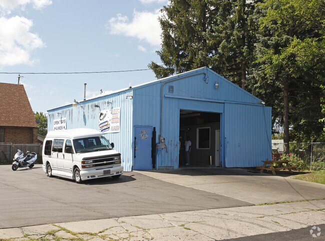
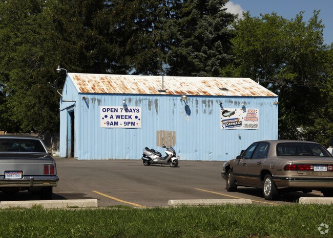
Property Record
6015 N Saginaw St, Flint, MI 48505
NEARBY LISTINGS FOR SALE OR LEASE
-
-
View all Flint listings for sale on LoopNet.com
Property Detail
6015 N Saginaw St
Flint, MI
Suburban Gardens
46-25-429-023
SUBURBAN GARDENS LOTS 147 AND 148
Commercialnec
Genesee
X
Michigan
26049C0179D
147-148
2024
0.23 AC
2025
Flint
000400
Detroit
1,200 SF
DEMOGRAPHICS near 6015 N Saginaw St
1 Mile
3 Mile
5 Mile
2024 Total Population
9,629
63,111
128,779
2029 Population
10,242
65,401
130,782
Pop Growth 2024-2029
+ 6.37%
+ 3.63%
+ 1.56%
Average Age
40
39
39
2024 Total Households
4,171
25,658
53,389
HH Growth 2024-2029
+ 6.35%
+ 3.67%
+ 1.52%
Median Household Inc
$28,380
$31,639
$36,757
Avg Household Size
2.20
2.30
2.30
2024 Avg HH Vehicles
1.00
1.00
1.00
Median Home Value
$52,865
$60,693
$72,934
Median Year Built
1959
1960
1959
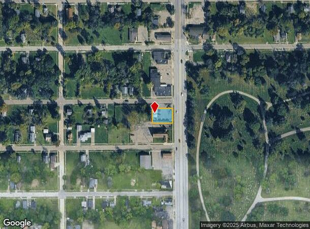
Nearby Places
Map Layers
Map Styles
 Street
 Aerial
- Restaurants
- Banks
- Shops
- Fitness
- Groceries
PUBLIC TRANSPORTATION
COMMUTER RAIL
Flint Amtrak Station (Blue Water - Amtrak)
DRIVE
WALK
Distance
Flint Amtrak Station (Blue Water - Amtrak)
10 min
5.4 mi
AIRPORT
Bishop International
DRIVE
WALK
Distance
Bishop International
26 min
13.5 mi
Freight Ports
Port of Toledo
DRIVE
WALK
Distance
Port of Toledo
142 min
119.3 mi
Nearby Properties
Address
Land Use
TOTAL SIZE
Lot Size
Zoning
Address
Land Use
TOTAL SIZE
Lot Size
Zoning
46,808 SF
32.06 AC
I-2 HVY IN
Address
Land Use
TOTAL SIZE
Lot Size
Zoning
329,849 SF
21.20 AC
CE
Address
Land Use
TOTAL SIZE
Lot Size
Zoning
156,250 SF
Address
Land Use
TOTAL SIZE
Lot Size
Zoning
114,888 SF
11.86 AC
I-2 HVY IN
Address
Land Use
TOTAL SIZE
Lot Size
Zoning
182,408 SF
Address
Land Use
TOTAL SIZE
Lot Size
Zoning
Address
Land Use
TOTAL SIZE
Lot Size
Zoning
Address
Land Use
TOTAL SIZE
Lot Size
Zoning
Address
Land Use
TOTAL SIZE
Lot Size
Zoning
Address
Land Use
TOTAL SIZE
Lot Size
Zoning
224,263 SF
24.98 AC
CC
Address
Land Use
TOTAL SIZE
Lot Size
Zoning
173,312 SF
23.49 AC
CE
Address
Land Use
TOTAL SIZE
Lot Size
Zoning
61,800 SF
1.87 AC
CC
Address
Land Use
TOTAL SIZE
Lot Size
Zoning
101,744 SF
4.90 AC
TN-2
Address
Land Use
TOTAL SIZE
Lot Size
Zoning
33.39 AC
Address
Land Use
TOTAL SIZE
Lot Size
Zoning
726 SF
10.40 AC
R-4 MANUF
Address
Land Use
TOTAL SIZE
Lot Size
Zoning
2.45 AC
Address
Land Use
TOTAL SIZE
Lot Size
Zoning
52,434 SF
4.09 AC
CE
Address
Land Use
TOTAL SIZE
Lot Size
Zoning
9,934 SF
9.70 AC
I-2 HVY IN
Address
Land Use
TOTAL SIZE
Lot Size
Zoning
39,274 SF
20.76 AC
CE
Address
Land Use
TOTAL SIZE
Lot Size
Zoning
110,985 SF
11.25 AC
Address
Land Use
TOTAL SIZE
Lot Size
Zoning
80,999 SF
23.82 AC
CE
Address
Land Use
TOTAL SIZE
Lot Size
Zoning
19.75 AC
Address
Land Use
TOTAL SIZE
Lot Size
Zoning
123,690 SF
9.73 AC
PC
Address
Land Use
TOTAL SIZE
Lot Size
Zoning
3,434 SF
5.63 AC
I-1 LHGT I
Address
Land Use
TOTAL SIZE
Lot Size
Zoning
5.10 AC
MR-2
Address
Land Use
TOTAL SIZE
Lot Size
Zoning
103,279 SF
7.19 AC
GN-1
Address
Land Use
TOTAL SIZE
Lot Size
Zoning
10.15 AC
Address
Land Use
TOTAL SIZE
Lot Size
Zoning
49,798 SF
4.22 AC
CC
Address
Land Use
TOTAL SIZE
Lot Size
Zoning
20.06 AC
Address
Land Use
TOTAL SIZE
Lot Size
Zoning
86,786 SF
9.41 AC
CE
The World's #1 Commercial Real Estate Marketplace
Connect with us
© 2025 CoStar Group
The information above has been obtained from sources believed reliable. While we do not doubt its accuracy we have not verified it and make no guarantee, warranty or representation about it. It is your responsibility to independently confirm its accuracy and completeness. Any projections, opinions, assumptions, or estimates used are for example only and do not represent the current or future performance of the property. The value of this transaction to you depends on tax and other factors which should be evaluated by your tax, financial, and legal advisors. You and your advisors should conduct a careful, independent investigation of the property to determine to your satisfaction the suitability of the property for your needs.