Property Record
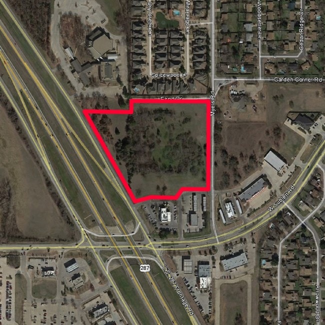
6016 Myers Rd, Arlington, TX 76017

Property Detail
6016 Myers Rd
Dallas-Fort Worth-Arlington, TX
HOUSTON, JOHN C ADDITION LOT 15R
41507290
TARRANT
Residentialacreage
Texas
B and X Area of moderate flood hazard, usually the area between the limits of the 100-year and 500-year floods.
15r
2025
3.35 AC
2025
Arlington/Mansfield
111534
Dallas/Ft Worth
NEARBY LISTINGS FOR SALE OR LEASE
DEMOGRAPHICS near 6016 Myers Rd
1 mile
3 mile
5 mile
2025 Total Population
15,795
80,458
218,102
2030 Population
16,530
84,277
228,741
Pop Growth 2025-2030
+ 4.65%
+ 4.75%
+ 4.88%
Average Age
39
41
39
2025 Total Households
5,770
29,743
77,494
HH Growth 2025-2030
+ 4.75%
+ 4.88%
+ 5.04%
Median Household Inc
$93,044
$105,090
$89,047
Avg Household Size
2.70
2.70
2.80
2025 Avg HH Vehicles
2.00
2.00
2.00
Median Home Value
$326,428
$362,806
$337,729
Median Year Built
1990
1988
1988
Nearby Places
Map Layers
Map Styles
 Street
 Aerial
Layers
 Traffic
 Biking
Places
Listings with unknown addresses are not visible on the map
- Restaurants
- Banks
- Shops
- Fitness
- Groceries
PUBLIC TRANSPORTATION
AIRPORT
Dallas-Fort Worth International
Drive
Walk
Distance
Dallas-Fort Worth International
38 min
27.9 mi
Dallas Love Field
Drive
Walk
Distance
Dallas Love Field
47 min
36.6 mi
Freight Ports
Port of Shreveport
Drive
Walk
Distance
Port of Shreveport
238 min
222.3 mi
SALE & LEASE HISTORY
LISTING DATE
SALE/LEASE

Sep 24, 2016
For Sale
Nearby Properties
Address
Land Use
TOTAL SIZE
Lot Size
Zoning
Address
Land Use
TOTAL SIZE
Lot Size
Zoning
569,312 SF
71.52 AC
Address
Land Use
TOTAL SIZE
Lot Size
Zoning
256,088 SF
10.27 AC
Address
Land Use
TOTAL SIZE
Lot Size
Zoning
214,444 SF
17.45 AC
Address
Land Use
TOTAL SIZE
Lot Size
Zoning
258,465 SF
8.99 AC
Address
Land Use
TOTAL SIZE
Lot Size
Zoning
167,643 SF
8.99 AC
Address
Land Use
TOTAL SIZE
Lot Size
Zoning
186,894 SF
10.85 AC
Address
Land Use
TOTAL SIZE
Lot Size
Zoning
169,347 SF
13.92 AC
Address
Land Use
TOTAL SIZE
Lot Size
Zoning
222,500 SF
13.86 AC
Address
Land Use
TOTAL SIZE
Lot Size
Zoning
182,763 SF
10.54 AC
Address
Land Use
TOTAL SIZE
Lot Size
Zoning
169,837 SF
9.44 AC
Address
Land Use
TOTAL SIZE
Lot Size
Zoning
180,556 SF
11.78 AC
Address
Land Use
TOTAL SIZE
Lot Size
Zoning
147,822 SF
9.45 AC
Address
Land Use
TOTAL SIZE
Lot Size
Zoning
108,838 SF
40.82 AC
Address
Land Use
TOTAL SIZE
Lot Size
Zoning
193,290 SF
10.56 AC
Address
Land Use
TOTAL SIZE
Lot Size
Zoning
217,786 SF
39.04 AC
Address
Land Use
TOTAL SIZE
Lot Size
Zoning
276,267 SF
16.10 AC
Address
Land Use
TOTAL SIZE
Lot Size
Zoning
159,030 SF
10.32 AC
Address
Land Use
TOTAL SIZE
Lot Size
Zoning
268,603 SF
12.45 AC
Address
Land Use
TOTAL SIZE
Lot Size
Zoning
111,764 SF
10.34 AC
Address
Land Use
TOTAL SIZE
Lot Size
Zoning
238,119 SF
7.52 AC
Address
Land Use
TOTAL SIZE
Lot Size
Zoning
142,110 SF
7.40 AC
Address
Land Use
TOTAL SIZE
Lot Size
Zoning
119,741 SF
45 AC
Address
Land Use
TOTAL SIZE
Lot Size
Zoning
86,342 SF
12.15 AC
Address
Land Use
TOTAL SIZE
Lot Size
Zoning
92,815 SF
28.03 AC
Address
Land Use
TOTAL SIZE
Lot Size
Zoning
3,600 SF
43.24 AC
Address
Land Use
TOTAL SIZE
Lot Size
Zoning
77,984 SF
8.16 AC
Address
Land Use
TOTAL SIZE
Lot Size
Zoning
81,540 SF
11.89 AC
Address
Land Use
TOTAL SIZE
Lot Size
Zoning
80,907 SF
29 AC
Address
Land Use
TOTAL SIZE
Lot Size
Zoning
44,669 SF
9.05 AC
Address
Land Use
TOTAL SIZE
Lot Size
Zoning
77,884 SF
30.70 AC
The World's #1 Commercial Real Estate Marketplace
Connect with us
© 2026 CoStar Group
The information above has been obtained from sources believed reliable. While we do not doubt its accuracy we have not verified it and make no guarantee, warranty or representation about it. It is your responsibility to independently confirm its accuracy and completeness. Any projections, opinions, assumptions, or estimates used are for example only and do not represent the current or future performance of the property. The value of this transaction to you depends on tax and other factors which should be evaluated by your tax, financial, and legal advisors. You and your advisors should conduct a careful, independent investigation of the property to determine to your satisfaction the suitability of the property for your needs.