Property Record
Nw Larson Dr, Arcadia, FL 34266
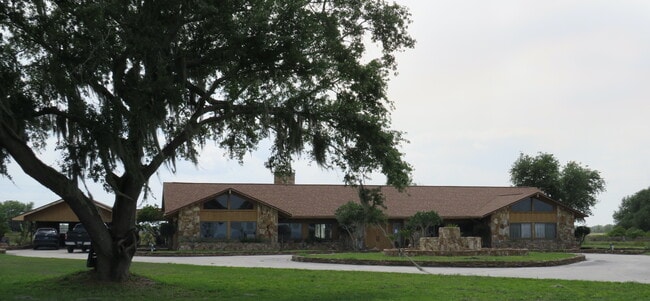

This Property Is For Sale
NEARBY LISTINGS FOR SALE OR LEASE
Property Detail
Nw Larson Dr
10-37-24-0000-0125-0000
PARCEL A MPDAF:S 345 FT OF E1/2 OF NW1/4 OF NW1/4 SUBJ TO 25 FT RD ESMT ON S & W & ALSO S 345 FT W1/2 OF NE1/4 OF NW1/4 SUBJ TO 25 FT ESMT ON S & PARCEL B MPDAF: N 315 FT OF S 660 FT OF E1/2 OF NW1/4 OF NW1/4 SUBJ TO 25 FT ESMT ON W & N 315 FT OF S 6
Farms
DeSoto
X
Florida
12027C0044C
40 AC
2024
Florida Central South Area
2024
Other Market Areas
010302
Arcadia, FL
DEMOGRAPHICS near Nw Larson Dr
1 Mile
3 Mile
5 Mile
2024 Total Population
107
771
6,876
2029 Population
115
826
7,512
Pop Growth 2024-2029
+ 7.48%
+ 7.13%
+ 9.25%
Average Age
41
41
42
2024 Total Households
31
232
2,518
HH Growth 2024-2029
+ 9.68%
+ 7.33%
+ 9.97%
Median Household Inc
$22,857
$23,586
$33,530
Avg Household Size
2.70
2.60
2.60
2024 Avg HH Vehicles
1.00
1.00
2.00
Median Home Value
$158,333
$154,255
$139,217
Median Year Built
1985
1989
1989
Nearby Places
- Restaurants
- Banks
- Shops
- Fitness
- Groceries
PUBLIC TRANSPORTATION
AIRPORT
Punta Gorda
DRIVE
WALK
Distance
Punta Gorda
52 min
31.6 mi
Freight Ports
Port Manatee
DRIVE
WALK
Distance
Port Manatee
83 min
57.8 mi
Nearby Properties
Address
Land Use
TOTAL SIZE
Lot Size
Zoning
Address
Land Use
TOTAL SIZE
Lot Size
Zoning
23,212 SF
6.56 AC
RMF-M
Address
Land Use
TOTAL SIZE
Lot Size
Zoning
12,528 SF
159 AC
A-10
Address
Land Use
TOTAL SIZE
Lot Size
Zoning
9,872 SF
1.95 AC
A-10
Address
Land Use
TOTAL SIZE
Lot Size
Zoning
6,612 SF
10 AC
A-10
Address
Land Use
TOTAL SIZE
Lot Size
Zoning
4,818 SF
17.76 AC
A-10
Address
Land Use
TOTAL SIZE
Lot Size
Zoning
72.89 AC
A-10
Address
Land Use
TOTAL SIZE
Lot Size
Zoning
51.22 AC
A-10
Address
Land Use
TOTAL SIZE
Lot Size
Zoning
3,188 SF
40 AC
A-10
Address
Land Use
TOTAL SIZE
Lot Size
Zoning
351.93 AC
A-10
Address
Land Use
TOTAL SIZE
Lot Size
Zoning
984 SF
133.36 AC
A-10
Address
Land Use
TOTAL SIZE
Lot Size
Zoning
3,284 SF
722 AC
A-10
Address
Land Use
TOTAL SIZE
Lot Size
Zoning
4,736 SF
3.33 AC
RM
Address
Land Use
TOTAL SIZE
Lot Size
Zoning
4,546 SF
42.56 AC
A-10
Address
Land Use
TOTAL SIZE
Lot Size
Zoning
5,860 SF
10.44 AC
A-10
Address
Land Use
TOTAL SIZE
Lot Size
Zoning
4,660 SF
19.22 AC
A-10
Address
Land Use
TOTAL SIZE
Lot Size
Zoning
2,824 SF
190 AC
A-10
Address
Land Use
TOTAL SIZE
Lot Size
Zoning
5,237 SF
45 AC
A-10
Address
Land Use
TOTAL SIZE
Lot Size
Zoning
2,580 SF
10 AC
A-10
Address
Land Use
TOTAL SIZE
Lot Size
Zoning
2,630 SF
15 AC
A-10
Address
Land Use
TOTAL SIZE
Lot Size
Zoning
1,976 SF
10.17 AC
A-10
Address
Land Use
TOTAL SIZE
Lot Size
Zoning
38.98 AC
A-10
Address
Land Use
TOTAL SIZE
Lot Size
Zoning
1,560 SF
10.43 AC
A-10
Address
Land Use
TOTAL SIZE
Lot Size
Zoning
100.18 AC
A-10
Address
Land Use
TOTAL SIZE
Lot Size
Zoning
2,065 SF
640 AC
A-10
Address
Land Use
TOTAL SIZE
Lot Size
Zoning
1,502 SF
640 AC
A-10
Address
Land Use
TOTAL SIZE
Lot Size
Zoning
2,066 SF
23.05 AC
A-10
Address
Land Use
TOTAL SIZE
Lot Size
Zoning
3,728 SF
5.10 AC
A-10
Address
Land Use
TOTAL SIZE
Lot Size
Zoning
10 AC
A-10
Address
Land Use
TOTAL SIZE
Lot Size
Zoning
3,026 SF
20 AC
A-10
Address
Land Use
TOTAL SIZE
Lot Size
Zoning
5,696 SF
10 AC
A-10
The World's #1 Commercial Real Estate Marketplace
Connect with us
© 2025 CoStar Group
The information above has been obtained from sources believed reliable. While we do not doubt its accuracy we have not verified it and make no guarantee, warranty or representation about it. It is your responsibility to independently confirm its accuracy and completeness. Any projections, opinions, assumptions, or estimates used are for example only and do not represent the current or future performance of the property. The value of this transaction to you depends on tax and other factors which should be evaluated by your tax, financial, and legal advisors. You and your advisors should conduct a careful, independent investigation of the property to determine to your satisfaction the suitability of the property for your needs.