Property Record
6019 Riverside Dr, Laredo, TX 78041
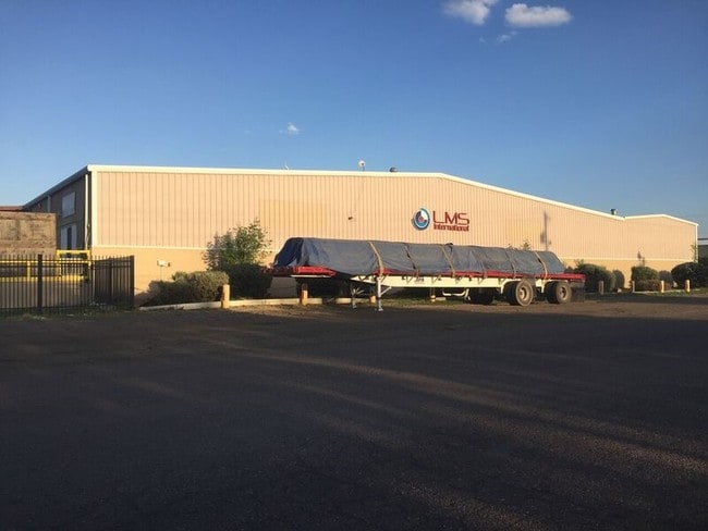
Property Detail
6019 Riverside Dr
206640
ABST 0050 P 25 J M GARCIA 5.00 ACRES 0076754
Commercialnec
Webb
M1
Texas
B and X Area of moderate flood hazard, usually the area between the limits of the 100-year and 500-year floods.
5 AC
2024
Texas South Area
2025
Other Market Areas
001717
Laredo, TX
127,778 SF
NEARBY LISTINGS FOR SALE OR LEASE
DEMOGRAPHICS near 6019 Riverside Dr
1 mile
3 mile
5 mile
2025 Total Population
3,466
85,470
169,763
2030 Population
3,528
86,984
173,382
Pop Growth 2025-2030
+ 1.79%
+ 1.77%
+ 2.13%
Average Age
37
37
36
2025 Total Households
1,247
27,559
53,554
HH Growth 2025-2030
+ 2.00%
+ 1.99%
+ 2.33%
Median Household Inc
$67,283
$60,010
$61,467
Avg Household Size
2.70
3.00
3.10
2025 Avg HH Vehicles
2.00
2.00
2.00
Median Home Value
$272,499
$214,586
$226,632
Median Year Built
1985
1990
1992
Nearby Places
Map Layers
Map Styles
 Street
 Aerial
Layers
 Traffic
 Biking
Places
Listings with unknown addresses are not visible on the map
- Restaurants
- Banks
- Shops
- Fitness
- Groceries
PUBLIC TRANSPORTATION
AIRPORT
Laredo International
Drive
Walk
Distance
Laredo International
17 min
6.5 mi
Nearby Properties
Address
Land Use
TOTAL SIZE
Lot Size
Zoning
Address
Land Use
TOTAL SIZE
Lot Size
Zoning
668,900 SF
38.32 AC
B4
Address
Land Use
TOTAL SIZE
Lot Size
Zoning
489,093 SF
32.23 AC
B4
Address
Land Use
TOTAL SIZE
Lot Size
Zoning
224,926 SF
21.49 AC
R3
Address
Land Use
TOTAL SIZE
Lot Size
Zoning
258,114 SF
30.54 AC
B1
Address
Land Use
TOTAL SIZE
Lot Size
Zoning
227,503 SF
19.84 AC
B4
Address
Land Use
TOTAL SIZE
Lot Size
Zoning
370,800 SF
40.09 AC
Address
Land Use
TOTAL SIZE
Lot Size
Zoning
164,276 SF
43.92 AC
Address
Land Use
TOTAL SIZE
Lot Size
Zoning
192,176 SF
34.94 AC
Address
Land Use
TOTAL SIZE
Lot Size
Zoning
109,695 SF
3.73 AC
M1
Address
Land Use
TOTAL SIZE
Lot Size
Zoning
194,520 SF
11.18 AC
B3
Address
Land Use
TOTAL SIZE
Lot Size
Zoning
355,229 SF
15.41 AC
M1
Address
Land Use
TOTAL SIZE
Lot Size
Zoning
157,376 SF
25.86 AC
B3
Address
Land Use
TOTAL SIZE
Lot Size
Zoning
218,415 SF
13.41 AC
R3
Address
Land Use
TOTAL SIZE
Lot Size
Zoning
203,922 SF
11 AC
R2
Address
Land Use
TOTAL SIZE
Lot Size
Zoning
122,752 SF
17.16 AC
R2
Address
Land Use
TOTAL SIZE
Lot Size
Zoning
257,516 SF
21.94 AC
Address
Land Use
TOTAL SIZE
Lot Size
Zoning
144,522 SF
3.86 AC
B3
Address
Land Use
TOTAL SIZE
Lot Size
Zoning
139,521 SF
18.13 AC
M1
Address
Land Use
TOTAL SIZE
Lot Size
Zoning
101,734 SF
1.63 AC
B3
Address
Land Use
TOTAL SIZE
Lot Size
Zoning
100,598 SF
26.22 AC
Address
Land Use
TOTAL SIZE
Lot Size
Zoning
118,124 SF
11.30 AC
R1A
Address
Land Use
TOTAL SIZE
Lot Size
Zoning
66,567 SF
3.81 AC
M1
Address
Land Use
TOTAL SIZE
Lot Size
Zoning
172,485 SF
9.24 AC
R2
Address
Land Use
TOTAL SIZE
Lot Size
Zoning
96,665 SF
11.12 AC
R1A
Address
Land Use
TOTAL SIZE
Lot Size
Zoning
138,920 SF
13.06 AC
Address
Land Use
TOTAL SIZE
Lot Size
Zoning
93,707 SF
12.29 AC
Address
Land Use
TOTAL SIZE
Lot Size
Zoning
94,056 SF
1.77 AC
Address
Land Use
TOTAL SIZE
Lot Size
Zoning
174,928 SF
10 AC
R2
Address
Land Use
TOTAL SIZE
Lot Size
Zoning
92,559 SF
5.70 AC
R1
Address
Land Use
TOTAL SIZE
Lot Size
Zoning
94,075 SF
20.58 AC
B3
The World's #1 Commercial Real Estate Marketplace
Connect with us
© 2026 CoStar Group
The information above has been obtained from sources believed reliable. While we do not doubt its accuracy we have not verified it and make no guarantee, warranty or representation about it. It is your responsibility to independently confirm its accuracy and completeness. Any projections, opinions, assumptions, or estimates used are for example only and do not represent the current or future performance of the property. The value of this transaction to you depends on tax and other factors which should be evaluated by your tax, financial, and legal advisors. You and your advisors should conduct a careful, independent investigation of the property to determine to your satisfaction the suitability of the property for your needs.