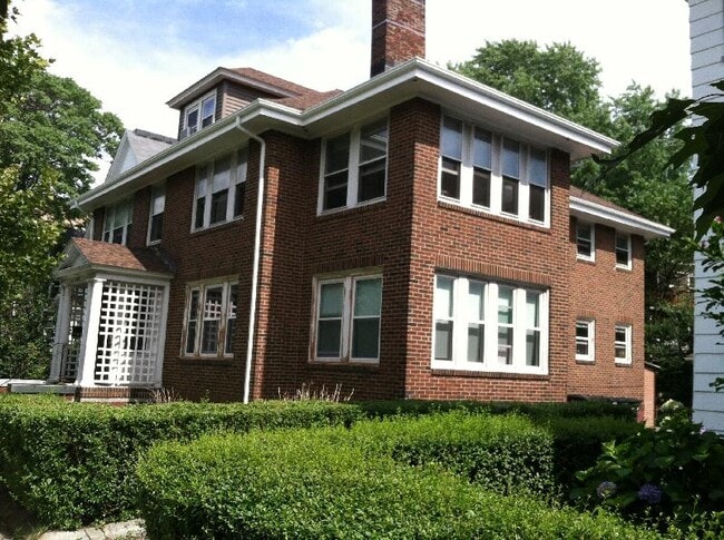
Property Record
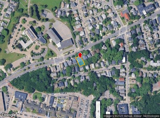
602 Cambridge St, Allston, MA 02134
NEARBY LISTINGS FOR SALE OR LEASE
Property Detail
602 Cambridge St
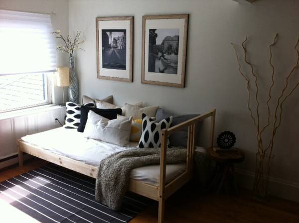
Apartment
Suffolk
X
Massachusetts
25021C0032E
0.14 AC
2025
St Elizabeth's
2025
Boston
000604
Boston-Cambridge-Newton, MA-NH
4,693 SF
ALLS-000000-000021-001216
DEMOGRAPHICS near 602 Cambridge St
1 Mile
3 Mile
5 Mile
2024 Total Population
64,220
374,232
902,001
2029 Population
61,812
364,640
875,895
Pop Growth 2024-2029
(3.75%)
(2.56%)
(2.89%)
Average Age
35
36
38
2024 Total Households
28,840
153,065
378,618
HH Growth 2024-2029
(4.17%)
(2.77%)
(3.12%)
Median Household Inc
$80,683
$97,985
$103,312
Avg Household Size
2.10
2.10
2.10
2024 Avg HH Vehicles
1.00
1.00
1.00
Median Home Value
$765,005
$934,660
$866,264
Median Year Built
1956
1949
1949
Nearby Places
- Restaurants
- Banks
- Shops
- Fitness
- Groceries
PUBLIC TRANSPORTATION
TRANSIT/SUBWAY
Warren Street Station (Green Line - B - Massachusetts Bay Transportation Authority Subway (The T))
DRIVE
WALK
Distance
Warren Street Station (Green Line - B - Massachusetts Bay Transportation Authority Subway (The T))
1 min
7 min
0.4 mi
Allston Street Station (Green Line - B - Massachusetts Bay Transportation Authority Subway (The T))
DRIVE
WALK
Distance
Allston Street Station (Green Line - B - Massachusetts Bay Transportation Authority Subway (The T))
2 min
9 min
0.5 mi
Griggs Street/Long Avenue Station (Green Line - B - Massachusetts Bay Transportation Authority Subway (The T))
DRIVE
WALK
Distance
Griggs Street/Long Avenue Station (Green Line - B - Massachusetts Bay Transportation Authority Subway (The T))
2 min
11 min
0.6 mi
Harvard Avenue Station (Green Line - B - Massachusetts Bay Transportation Authority Subway (The T))
DRIVE
WALK
Distance
Harvard Avenue Station (Green Line - B - Massachusetts Bay Transportation Authority Subway (The T))
1 min
13 min
0.7 mi
Washington Street (Green Line - B - Massachusetts Bay Transportation Authority Subway (The T))
DRIVE
WALK
Distance
Washington Street (Green Line - B - Massachusetts Bay Transportation Authority Subway (The T))
2 min
15 min
0.8 mi
COMMUTER RAIL
Boston Landing (Framingham/Worcester Line - MBTA)
DRIVE
WALK
Distance
Boston Landing (Framingham/Worcester Line - MBTA)
9 min
11 min
0.6 mi
Yawkey (Framingham/Worcester Line - Massachusetts Bay Transportation Authority Commuter Rail (Purple Line))
DRIVE
WALK
Distance
Yawkey (Framingham/Worcester Line - Massachusetts Bay Transportation Authority Commuter Rail (Purple Line))
5 min
2.6 mi
AIRPORT
General Edward Lawrence Logan International
DRIVE
WALK
Distance
General Edward Lawrence Logan International
15 min
8.5 mi
Freight Ports
Port of Boston
DRIVE
WALK
Distance
Port of Boston
13 min
6.8 mi
SALE & LEASE HISTORY
LISTING DATE
SALE/LEASE

Oct 20, 2020
For Sale
Nearby Properties
Address
Land Use
TOTAL SIZE
Lot Size
Zoning
Address
Land Use
TOTAL SIZE
Lot Size
Zoning
610,560 SF
4.01 AC
E
Address
Land Use
TOTAL SIZE
Lot Size
Zoning
439,500 SF
9.21 AC
E
Address
Land Use
TOTAL SIZE
Lot Size
Zoning
125,571 SF
3.25 AC
C-3
Address
Land Use
TOTAL SIZE
Lot Size
Zoning
150,192 SF
10.27 AC
E
Address
Land Use
TOTAL SIZE
Lot Size
Zoning
596,972 SF
7.32 AC
E
Address
Land Use
TOTAL SIZE
Lot Size
Zoning
530,200 SF
62.08 AC
E
Address
Land Use
TOTAL SIZE
Lot Size
Zoning
173,400 SF
1.14 AC
MXD
Address
Land Use
TOTAL SIZE
Lot Size
Zoning
142,458 SF
1.67 AC
C-3
Address
Land Use
TOTAL SIZE
Lot Size
Zoning
230,394 SF
0.60 AC
MXD
Address
Land Use
TOTAL SIZE
Lot Size
Zoning
304,349 SF
1.72 AC
Address
Land Use
TOTAL SIZE
Lot Size
Zoning
3.52 AC
C-3
Address
Land Use
TOTAL SIZE
Lot Size
Zoning
377,634 SF
4.86 AC
E
Address
Land Use
TOTAL SIZE
Lot Size
Zoning
239,377 SF
0.71 AC
MXD
Address
Land Use
TOTAL SIZE
Lot Size
Zoning
419,722 SF
2.03 AC
RC
Address
Land Use
TOTAL SIZE
Lot Size
Zoning
54,500 SF
4.01 AC
O-2A
Address
Land Use
TOTAL SIZE
Lot Size
Zoning
2.81 AC
O-2
Address
Land Use
TOTAL SIZE
Lot Size
Zoning
254,208 SF
3.83 AC
E
Address
Land Use
TOTAL SIZE
Lot Size
Zoning
4,355 SF
13.12 AC
E
Address
Land Use
TOTAL SIZE
Lot Size
Zoning
237,935 SF
1.27 AC
C-3
Address
Land Use
TOTAL SIZE
Lot Size
Zoning
336,518 SF
6.15 AC
I-3
Address
Land Use
TOTAL SIZE
Lot Size
Zoning
2.87 AC
O-2A
Address
Land Use
TOTAL SIZE
Lot Size
Zoning
155,818 SF
5.33 AC
OS
Address
Land Use
TOTAL SIZE
Lot Size
Zoning
220,671 SF
2.52 AC
I-2
Address
Land Use
TOTAL SIZE
Lot Size
Zoning
506,534 SF
2.75 AC
C
Address
Land Use
TOTAL SIZE
Lot Size
Zoning
136,025 SF
6.91 AC
C3
Address
Land Use
TOTAL SIZE
Lot Size
Zoning
2.25 AC
SD-12
Address
Land Use
TOTAL SIZE
Lot Size
Zoning
224,115 SF
2.35 AC
O-2A
Address
Land Use
TOTAL SIZE
Lot Size
Zoning
158,526 SF
0.79 AC
MXD
Address
Land Use
TOTAL SIZE
Lot Size
Zoning
468,308 SF
0.78 AC
E
Address
Land Use
TOTAL SIZE
Lot Size
Zoning
174,764 SF
1.83 AC
C-3
The World's #1 Commercial Real Estate Marketplace
Connect with us
© 2025 CoStar Group
The information above has been obtained from sources believed reliable. While we do not doubt its accuracy we have not verified it and make no guarantee, warranty or representation about it. It is your responsibility to independently confirm its accuracy and completeness. Any projections, opinions, assumptions, or estimates used are for example only and do not represent the current or future performance of the property. The value of this transaction to you depends on tax and other factors which should be evaluated by your tax, financial, and legal advisors. You and your advisors should conduct a careful, independent investigation of the property to determine to your satisfaction the suitability of the property for your needs.