Property Record
602 S Main St, Mount Holly, NC 28120


NEARBY LISTINGS FOR SALE OR LEASE
Property Detail
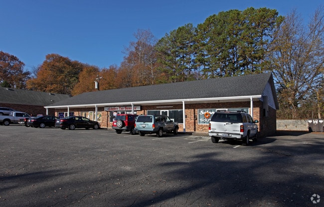
602 S Main St
124079
R F Rankin Property
Commercialofficeresidentialmixeduse
R F RANKIN L 28-33 03 014 086 00 000
X
Gaston
3710359600L
North Carolina
2025
0.55 AC
2025
Gaston County
031102
Charlotte
4,141 SF
Charlotte-Concord-Gastonia, NC-SC
DEMOGRAPHICS near 602 S Main St
1 Mile
3 Mile
5 Mile
2024 Total Population
4,099
33,945
90,864
2029 Population
4,402
36,299
97,244
Pop Growth 2024-2029
+ 7.39%
+ 6.93%
+ 7.02%
Average Age
39
39
39
2024 Total Households
1,820
13,621
35,558
HH Growth 2024-2029
+ 7.53%
+ 7.12%
+ 7.24%
Median Household Inc
$50,144
$60,791
$66,834
Avg Household Size
2.20
2.40
2.50
2024 Avg HH Vehicles
2.00
2.00
2.00
Median Home Value
$187,627
$221,438
$236,700
Median Year Built
1975
1990
1993
Nearby Places
Map Layers
Map Styles
 Street
 Aerial
- Restaurants
- Banks
- Shops
- Fitness
- Groceries
PUBLIC TRANSPORTATION
AIRPORT
Charlotte/Douglas International
DRIVE
WALK
Distance
Charlotte/Douglas International
23 min
10.2 mi
Concord-Padgett Regional
DRIVE
WALK
Distance
Concord-Padgett Regional
30 min
20.8 mi
SALE & LEASE HISTORY
LISTING DATE
SALE/LEASE

Nov 08, 2017
For Lease
Jan 23, 2017
For Lease
Aug 12, 2020
For Lease
Nearby Properties
Address
Land Use
TOTAL SIZE
Lot Size
Zoning
Address
Land Use
TOTAL SIZE
Lot Size
Zoning
15.94 AC
Address
Land Use
TOTAL SIZE
Lot Size
Zoning
37.49 AC
Address
Land Use
TOTAL SIZE
Lot Size
Zoning
568,252 SF
56.05 AC
I-1(CD)
Address
Land Use
TOTAL SIZE
Lot Size
Zoning
41,508 SF
29.70 AC
Address
Land Use
TOTAL SIZE
Lot Size
Zoning
450,580 SF
36.74 AC
I-2(CD)
Address
Land Use
TOTAL SIZE
Lot Size
Zoning
43.38 AC
Address
Land Use
TOTAL SIZE
Lot Size
Zoning
3,428 SF
13.21 AC
R-17MF
Address
Land Use
TOTAL SIZE
Lot Size
Zoning
1,966 SF
36.06 AC
OFF01
Address
Land Use
TOTAL SIZE
Lot Size
Zoning
437,434 SF
150.02 AC
MANU1
Address
Land Use
TOTAL SIZE
Lot Size
Zoning
25.64 AC
Address
Land Use
TOTAL SIZE
Lot Size
Zoning
208,635 SF
50.01 AC
Address
Land Use
TOTAL SIZE
Lot Size
Zoning
171,037 SF
4.37 AC
Address
Land Use
TOTAL SIZE
Lot Size
Zoning
249,645 SF
26.33 AC
I-1(CD)
Address
Land Use
TOTAL SIZE
Lot Size
Zoning
13,090 SF
93.97 AC
INDS2
Address
Land Use
TOTAL SIZE
Lot Size
Zoning
201,608 SF
16.71 AC
I-1(CD)
Address
Land Use
TOTAL SIZE
Lot Size
Zoning
25.14 AC
Address
Land Use
TOTAL SIZE
Lot Size
Zoning
358,450 SF
23.50 AC
STOR2
Address
Land Use
TOTAL SIZE
Lot Size
Zoning
3,536 SF
12.07 AC
APT02
Address
Land Use
TOTAL SIZE
Lot Size
Zoning
190,498 SF
20.10 AC
RET05
Address
Land Use
TOTAL SIZE
Lot Size
Zoning
136,318 SF
4.13 AC
I1
Address
Land Use
TOTAL SIZE
Lot Size
Zoning
46,998 SF
30.47 AC
HCAR1
Address
Land Use
TOTAL SIZE
Lot Size
Zoning
75,208 SF
15.55 AC
R-3
Address
Land Use
TOTAL SIZE
Lot Size
Zoning
184,319 SF
19.61 AC
I1
Address
Land Use
TOTAL SIZE
Lot Size
Zoning
65,513 SF
3.07 AC
Address
Land Use
TOTAL SIZE
Lot Size
Zoning
8,512 SF
102.15 AC
R-3
Address
Land Use
TOTAL SIZE
Lot Size
Zoning
139,155 SF
15.13 AC
RET05
Address
Land Use
TOTAL SIZE
Lot Size
Zoning
99.28 AC
BCD
Address
Land Use
TOTAL SIZE
Lot Size
Zoning
118,896 SF
3.98 AC
Address
Land Use
TOTAL SIZE
Lot Size
Zoning
21.61 AC
Address
Land Use
TOTAL SIZE
Lot Size
Zoning
54,030 SF
5.02 AC
OFF04
The World's #1 Commercial Real Estate Marketplace
Connect with us
© 2026 CoStar Group
The information above has been obtained from sources believed reliable. While we do not doubt its accuracy we have not verified it and make no guarantee, warranty or representation about it. It is your responsibility to independently confirm its accuracy and completeness. Any projections, opinions, assumptions, or estimates used are for example only and do not represent the current or future performance of the property. The value of this transaction to you depends on tax and other factors which should be evaluated by your tax, financial, and legal advisors. You and your advisors should conduct a careful, independent investigation of the property to determine to your satisfaction the suitability of the property for your needs.