Property Record
602 Sloop Ave, Kannapolis, NC 28083


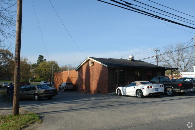
Property Detail
602 Sloop Ave
5624-11-4785-0000
LTS 1-4 JACKSON PARK BLK C
Storebuilding
Cabarrus
GC
North Carolina
B and X Area of moderate flood hazard, usually the area between the limits of the 100-year and 500-year floods.
1-4
0
0.26 AC
2025
Cabarrus County
040701
Charlotte
2,558 SF
Charlotte-Concord-Gastonia, NC-SC
NEARBY LISTINGS FOR SALE OR LEASE
DEMOGRAPHICS near 602 Sloop Ave
1 mile
3 mile
5 mile
2025 Total Population
8,362
47,928
83,584
2030 Population
8,926
51,212
89,042
Pop Growth 2025-2030
+ 6.74%
+ 6.85%
+ 6.53%
Average Age
39
39
39
2025 Total Households
3,320
18,825
33,072
HH Growth 2025-2030
+ 6.87%
+ 7.02%
+ 6.68%
Median Household Inc
$54,458
$58,895
$63,370
Avg Household Size
2.50
2.50
2.50
2025 Avg HH Vehicles
2.00
2.00
2.00
Median Home Value
$199,218
$248,628
$267,859
Median Year Built
1958
1976
1983
Nearby Places
Map Layers
Map Styles
 Street
 Aerial
Transit
 Traffic
 Biking
Places
Listings with unknown addresses are not visible on the map
- Restaurants
- Banks
- Shops
- Fitness
- Groceries
PUBLIC TRANSPORTATION
COMMUTER RAIL
Kannapolis Station (Piedmont - North Carolina by Train (NC Train))
Drive
Walk
Distance
Kannapolis Station (Piedmont - North Carolina by Train (NC Train))
4 min
1.6 mi
AIRPORT
Concord-Padgett Regional
Drive
Walk
Distance
Concord-Padgett Regional
22 min
13.4 mi
Charlotte/Douglas International
Drive
Walk
Distance
Charlotte/Douglas International
48 min
33.7 mi
Nearby Properties
Address
Land Use
TOTAL SIZE
Lot Size
Zoning
Address
Land Use
TOTAL SIZE
Lot Size
Zoning
276,070 SF
CC
Address
Land Use
TOTAL SIZE
Lot Size
Zoning
42,409 SF
16 AC
GC
Address
Land Use
TOTAL SIZE
Lot Size
Zoning
754,000 SF
56.52 AC
I1-CZ
Address
Land Use
TOTAL SIZE
Lot Size
Zoning
128,064 SF
2.68 AC
CC
Address
Land Use
TOTAL SIZE
Lot Size
Zoning
121,156 SF
3.57 AC
CC
Address
Land Use
TOTAL SIZE
Lot Size
Zoning
106,804 SF
1.81 AC
CC
Address
Land Use
TOTAL SIZE
Lot Size
Zoning
44,136 SF
15.42 AC
R18
Address
Land Use
TOTAL SIZE
Lot Size
Zoning
83,152 SF
7.11 AC
CC
Address
Land Use
TOTAL SIZE
Lot Size
Zoning
15,924 SF
16.90 AC
RC
Address
Land Use
TOTAL SIZE
Lot Size
Zoning
176,075 SF
2.35 AC
CC
Address
Land Use
TOTAL SIZE
Lot Size
Zoning
297,600 SF
16.28 AC
Address
Land Use
TOTAL SIZE
Lot Size
Zoning
279,000 SF
23.48 AC
Address
Land Use
TOTAL SIZE
Lot Size
Zoning
114,250 SF
18.50 AC
RM-2
Address
Land Use
TOTAL SIZE
Lot Size
Zoning
5,308 SF
15.16 AC
RC
Address
Land Use
TOTAL SIZE
Lot Size
Zoning
207,899 SF
21.62 AC
C-2
Address
Land Use
TOTAL SIZE
Lot Size
Zoning
85,422 SF
6.30 AC
R8
Address
Land Use
TOTAL SIZE
Lot Size
Zoning
67,862 SF
1.77 AC
CC
Address
Land Use
TOTAL SIZE
Lot Size
Zoning
12,010 SF
0.40 AC
CC
Address
Land Use
TOTAL SIZE
Lot Size
Zoning
66,194 SF
2.94 AC
CC
Address
Land Use
TOTAL SIZE
Lot Size
Zoning
101,014 SF
1.84 AC
CC
Address
Land Use
TOTAL SIZE
Lot Size
Zoning
56,923 SF
2 AC
CC
Address
Land Use
TOTAL SIZE
Lot Size
Zoning
43,682 SF
11.02 AC
O-I
Address
Land Use
TOTAL SIZE
Lot Size
Zoning
33,728 SF
14.29 AC
GC
Address
Land Use
TOTAL SIZE
Lot Size
Zoning
128,280 SF
10.82 AC
Address
Land Use
TOTAL SIZE
Lot Size
Zoning
68,257 SF
8.26 AC
R8
Address
Land Use
TOTAL SIZE
Lot Size
Zoning
64,554 SF
2.67 AC
CC
Address
Land Use
TOTAL SIZE
Lot Size
Zoning
134,363 SF
14.54 AC
C-2
Address
Land Use
TOTAL SIZE
Lot Size
Zoning
22,898 SF
10 AC
R18
Address
Land Use
TOTAL SIZE
Lot Size
Zoning
115,509 SF
4.90 AC
R8
Address
Land Use
TOTAL SIZE
Lot Size
Zoning
193,301 SF
22.50 AC
C-2
The World's #1 Commercial Real Estate Marketplace
Connect with us
© 2026 CoStar Group
The information above has been obtained from sources believed reliable. While we do not doubt its accuracy we have not verified it and make no guarantee, warranty or representation about it. It is your responsibility to independently confirm its accuracy and completeness. Any projections, opinions, assumptions, or estimates used are for example only and do not represent the current or future performance of the property. The value of this transaction to you depends on tax and other factors which should be evaluated by your tax, financial, and legal advisors. You and your advisors should conduct a careful, independent investigation of the property to determine to your satisfaction the suitability of the property for your needs.