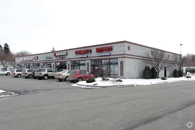
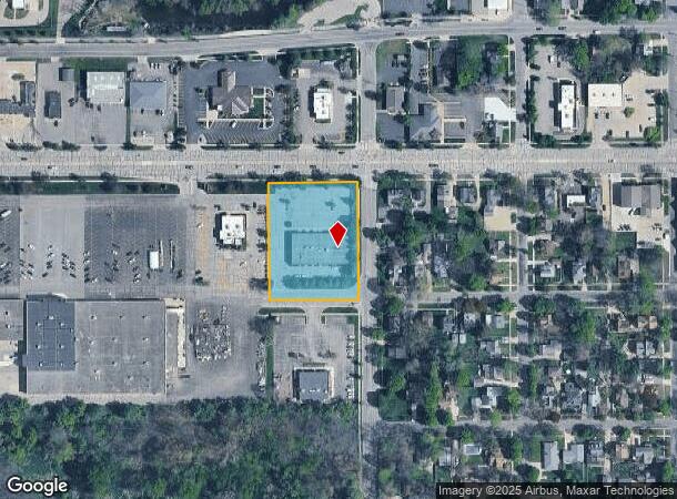
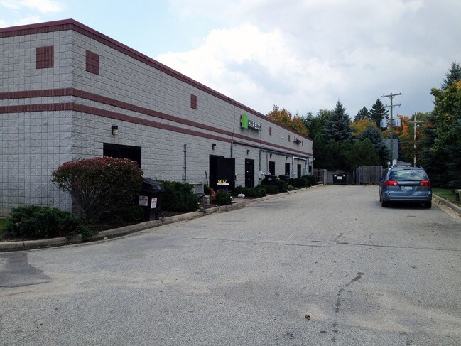
Property Record
602 W State St, Hastings, MI 49058
NEARBY LISTINGS FOR SALE OR LEASE
Property Detail
602 W State St
Grand Rapids-Wyoming, MI
Orig Plan Of The Village Of Th
55-001-211-20
COM NE COR OF MARKET SQUARE, PLAN OF HASTINGS (SD PT BEING A DIST S0*25'40"W 4.5FT & TH N89*41'57"E 1412.46FT FROM NW COR LOT 691 PLAN OF HASTINGS) FOR POB; TH S0*19'15"E 259.31FT ON W ROW LN MARKET ST, TH SW'LY 7.46FT ON A LEFT CURVE RADIUS 50FT CHO
Stripcommercialcenter
Barry
X
Michigan
26015C0193C
691
2024
1.57 AC
2025
Barry County
011402
West Michigan
12,000 SF
DEMOGRAPHICS near 602 W State St
1 Mile
3 Mile
5 Mile
2024 Total Population
5,207
10,753
15,197
2029 Population
5,412
11,187
15,828
Pop Growth 2024-2029
+ 3.94%
+ 4.04%
+ 4.15%
Average Age
40
41
41
2024 Total Households
2,113
4,368
6,071
HH Growth 2024-2029
+ 3.98%
+ 4.03%
+ 4.15%
Median Household Inc
$53,505
$60,050
$63,285
Avg Household Size
2.40
2.40
2.50
2024 Avg HH Vehicles
2.00
2.00
2.00
Median Home Value
$156,445
$166,005
$177,186
Median Year Built
1955
1966
1968
Nearby Places
Map Layers
Map Styles
 Street
 Aerial
- Restaurants
- Banks
- Shops
- Fitness
- Groceries
PUBLIC TRANSPORTATION
AIRPORT
Gerald R Ford International
DRIVE
WALK
Distance
Gerald R Ford International
39 min
23.8 mi
Freight Ports
Port of Toledo
DRIVE
WALK
Distance
Port of Toledo
195 min
148.4 mi
SALE & LEASE HISTORY
LISTING DATE
SALE/LEASE

May 08, 2019
For Lease
May 06, 2022
For Lease
Nearby Properties
Address
Land Use
TOTAL SIZE
Lot Size
Zoning
Address
Land Use
TOTAL SIZE
Lot Size
Zoning
156,011 SF
6.76 AC
A-O
Address
Land Use
TOTAL SIZE
Lot Size
Zoning
100,000 SF
Address
Land Use
TOTAL SIZE
Lot Size
Zoning
231,772 SF
13.51 AC
D-2
Address
Land Use
TOTAL SIZE
Lot Size
Zoning
92,343 SF
1.21 AC
PUD
Address
Land Use
TOTAL SIZE
Lot Size
Zoning
105,705 SF
18.80 AC
Address
Land Use
TOTAL SIZE
Lot Size
Zoning
4,646 SF
1.04 AC
B-2
Address
Land Use
TOTAL SIZE
Lot Size
Zoning
24,938 SF
2.01 AC
B-1
Address
Land Use
TOTAL SIZE
Lot Size
Zoning
58,800 SF
4 AC
PUD
Address
Land Use
TOTAL SIZE
Lot Size
Zoning
39,800 SF
3.10 AC
MU
Address
Land Use
TOTAL SIZE
Lot Size
Zoning
79,428 SF
8.97 AC
B-2
Address
Land Use
TOTAL SIZE
Lot Size
Zoning
81,000 SF
Address
Land Use
TOTAL SIZE
Lot Size
Zoning
95,899 SF
23.29 AC
MU
Address
Land Use
TOTAL SIZE
Lot Size
Zoning
202,882 SF
12.63 AC
D-2
Address
Land Use
TOTAL SIZE
Lot Size
Zoning
42,369 SF
11.77 AC
A-O
Address
Land Use
TOTAL SIZE
Lot Size
Zoning
29,759 SF
2.69 AC
A-1
Address
Land Use
TOTAL SIZE
Lot Size
Zoning
25.23 AC
PUD
Address
Land Use
TOTAL SIZE
Lot Size
Zoning
1,300 SF
31.80 AC
MU
Address
Land Use
TOTAL SIZE
Lot Size
Zoning
81,110 SF
14.12 AC
LI
Address
Land Use
TOTAL SIZE
Lot Size
Zoning
18,804 SF
3.67 AC
B-2
Address
Land Use
TOTAL SIZE
Lot Size
Zoning
91,080 SF
Address
Land Use
TOTAL SIZE
Lot Size
Zoning
Address
Land Use
TOTAL SIZE
Lot Size
Zoning
28,021 SF
3.54 AC
PUD
Address
Land Use
TOTAL SIZE
Lot Size
Zoning
81,563 SF
7.66 AC
Address
Land Use
TOTAL SIZE
Lot Size
Zoning
40,624 SF
3.31 AC
A-O
Address
Land Use
TOTAL SIZE
Lot Size
Zoning
28,392 SF
1.90 AC
PUD
Address
Land Use
TOTAL SIZE
Lot Size
Zoning
58,694 SF
9.29 AC
LI
Address
Land Use
TOTAL SIZE
Lot Size
Zoning
31,578 SF
5.27 AC
Address
Land Use
TOTAL SIZE
Lot Size
Zoning
13,378 SF
5.89 AC
PUD
Address
Land Use
TOTAL SIZE
Lot Size
Zoning
14,144 SF
1.06 AC
B-4
Address
Land Use
TOTAL SIZE
Lot Size
Zoning
18,120 SF
0.44 AC
A-1
The World's #1 Commercial Real Estate Marketplace
Connect with us
© 2026 CoStar Group
The information above has been obtained from sources believed reliable. While we do not doubt its accuracy we have not verified it and make no guarantee, warranty or representation about it. It is your responsibility to independently confirm its accuracy and completeness. Any projections, opinions, assumptions, or estimates used are for example only and do not represent the current or future performance of the property. The value of this transaction to you depends on tax and other factors which should be evaluated by your tax, financial, and legal advisors. You and your advisors should conduct a careful, independent investigation of the property to determine to your satisfaction the suitability of the property for your needs.