Property Record
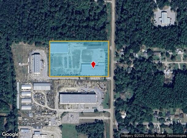
60207 Camp Villere Rd, Slidell, LA 70460

NEARBY LISTINGS FOR SALE OR LEASE
Property Detail
60207 Camp Villere Rd
New Orleans-Metairie, LA
Commercial Camp Villere Rd
109690
5.8455 ACS IN LOT 3 SEC 32 37 8 14 CB 1140 744 CB 1514 497 INST NO 1142862 INST NO 1144868 INST NO 1211072 INST NO 1911572 IN
Commercialnec
St Tammany
ARE
Louisiana
2025
3
2024
5.85 AC
041103
Slidell
48,140 SF
New Orleans/Metairie/Kenner
DEMOGRAPHICS near 60207 Camp Villere Rd
1 Mile
3 Mile
5 Mile
2024 Total Population
1,987
26,257
68,222
2029 Population
2,133
28,202
73,467
Pop Growth 2024-2029
+ 7.35%
+ 7.41%
+ 7.69%
Average Age
39
40
40
2024 Total Households
746
9,997
26,356
HH Growth 2024-2029
+ 7.37%
+ 7.37%
+ 7.74%
Median Household Inc
$60,124
$56,733
$56,222
Avg Household Size
2.60
2.60
2.50
2024 Avg HH Vehicles
2.00
2.00
2.00
Median Home Value
$172,599
$165,100
$175,233
Median Year Built
1988
1984
1986
Nearby Places
Map Layers
Map Styles
 Street
 Aerial
- Restaurants
- Banks
- Shops
- Fitness
- Groceries
PUBLIC TRANSPORTATION
COMMUTER RAIL
Slidell Amtrak Station (Crescent - Amtrak)
DRIVE
WALK
Distance
Slidell Amtrak Station (Crescent - Amtrak)
6 min
3.3 mi
Freight Ports
Port of New Orleans
DRIVE
WALK
Distance
Port of New Orleans
54 min
38.4 mi
Nearby Properties
Address
Land Use
TOTAL SIZE
Lot Size
Zoning
Address
Land Use
TOTAL SIZE
Lot Size
Zoning
205,496 SF
27.47 AC
Address
Land Use
TOTAL SIZE
Lot Size
Zoning
192,685 SF
Address
Land Use
TOTAL SIZE
Lot Size
Zoning
208,769 SF
4.72 AC
Address
Land Use
TOTAL SIZE
Lot Size
Zoning
157,561 SF
10.06 AC
Address
Land Use
TOTAL SIZE
Lot Size
Zoning
144,638 SF
0.88 AC
Address
Land Use
TOTAL SIZE
Lot Size
Zoning
137,402 SF
76.02 AC
Address
Land Use
TOTAL SIZE
Lot Size
Zoning
127,681 SF
3 AC
Address
Land Use
TOTAL SIZE
Lot Size
Zoning
63,135 SF
12.49 AC
Address
Land Use
TOTAL SIZE
Lot Size
Zoning
67,517 SF
0.89 AC
Address
Land Use
TOTAL SIZE
Lot Size
Zoning
1,940 SF
1.77 AC
Address
Land Use
TOTAL SIZE
Lot Size
Zoning
105,300 SF
8.75 AC
Address
Land Use
TOTAL SIZE
Lot Size
Zoning
54,188 SF
1.50 AC
Address
Land Use
TOTAL SIZE
Lot Size
Zoning
131,548 SF
2.99 AC
Address
Land Use
TOTAL SIZE
Lot Size
Zoning
142,482 SF
1.23 AC
Address
Land Use
TOTAL SIZE
Lot Size
Zoning
184,551 SF
20 AC
Address
Land Use
TOTAL SIZE
Lot Size
Zoning
115,666 SF
9.14 AC
Address
Land Use
TOTAL SIZE
Lot Size
Zoning
114,806 SF
10.22 AC
Address
Land Use
TOTAL SIZE
Lot Size
Zoning
108,003 SF
2.59 AC
Address
Land Use
TOTAL SIZE
Lot Size
Zoning
66,634 SF
14 AC
Address
Land Use
TOTAL SIZE
Lot Size
Zoning
1,378 SF
1.19 AC
Address
Land Use
TOTAL SIZE
Lot Size
Zoning
1,729 SF
1.22 AC
Address
Land Use
TOTAL SIZE
Lot Size
Zoning
66,130 SF
3 AC
Address
Land Use
TOTAL SIZE
Lot Size
Zoning
115,776 SF
7.50 AC
Address
Land Use
TOTAL SIZE
Lot Size
Zoning
23,773 SF
2.57 AC
Address
Land Use
TOTAL SIZE
Lot Size
Zoning
48,315 SF
11.95 AC
Address
Land Use
TOTAL SIZE
Lot Size
Zoning
78,962 SF
4.89 AC
Address
Land Use
TOTAL SIZE
Lot Size
Zoning
41,305 SF
2.36 AC
Address
Land Use
TOTAL SIZE
Lot Size
Zoning
68,284 SF
7.20 AC
Address
Land Use
TOTAL SIZE
Lot Size
Zoning
41,069 SF
2.15 AC
Address
Land Use
TOTAL SIZE
Lot Size
Zoning
21.34 AC
The World's #1 Commercial Real Estate Marketplace
Connect with us
© 2025 CoStar Group
The information above has been obtained from sources believed reliable. While we do not doubt its accuracy we have not verified it and make no guarantee, warranty or representation about it. It is your responsibility to independently confirm its accuracy and completeness. Any projections, opinions, assumptions, or estimates used are for example only and do not represent the current or future performance of the property. The value of this transaction to you depends on tax and other factors which should be evaluated by your tax, financial, and legal advisors. You and your advisors should conduct a careful, independent investigation of the property to determine to your satisfaction the suitability of the property for your needs.