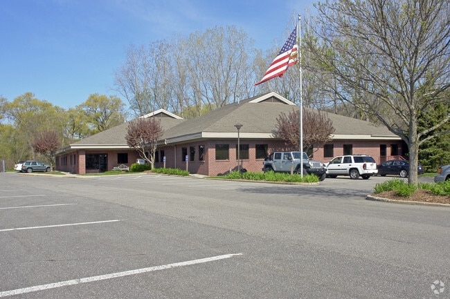
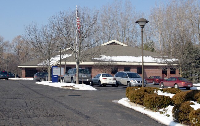
Property Record
6020E Fulton St E, Ada, MI 49301

Property Detail
6020E Fulton St E
41-15-29-420-010
THAT PART OF LOT 1 LYING WLY OF WLY LINE OF RIPPLING DR /66 FT WIDE/ EX THAT PART LYING NLY OF SLY LINE OF HWY M-21 RELOCATED
Commercialnec
Kent
I
Michigan
B and X Area of moderate flood hazard, usually the area between the limits of the 100-year and 500-year floods.
1-3
2024
2.10 AC
2025
Ada/Lowell
011902
West Michigan
13,616 SF
Grand Rapids-Wyoming-Kentwood, MI
NEARBY LISTINGS FOR SALE OR LEASE
DEMOGRAPHICS near 6020E Fulton St E
1 mile
3 mile
5 mile
2025 Total Population
4,013
24,161
76,451
2030 Population
4,172
24,999
78,497
Pop Growth 2025-2030
+ 3.96%
+ 3.47%
+ 2.68%
Average Age
40
41
40
2025 Total Households
1,398
8,291
28,009
HH Growth 2025-2030
+ 4.08%
+ 3.59%
+ 2.71%
Median Household Inc
$164,200
$149,094
$114,779
Avg Household Size
2.90
2.80
2.60
2025 Avg HH Vehicles
2.00
2.00
2.00
Median Home Value
$416,296
$490,062
$454,357
Median Year Built
1992
1993
1983
Nearby Places
Map Layers
Map Styles
 Street
 Aerial
Layers
 Traffic
 Biking
Places
Listings with unknown addresses are not visible on the map
- Restaurants
- Banks
- Shops
- Fitness
- Groceries
PUBLIC TRANSPORTATION
AIRPORT
Gerald R Ford International
Drive
Walk
Distance
Gerald R Ford International
22 min
11.4 mi
Nearby Properties
Address
Land Use
TOTAL SIZE
Lot Size
Zoning
Address
Land Use
TOTAL SIZE
Lot Size
Zoning
277.36 AC
I
Address
Land Use
TOTAL SIZE
Lot Size
Zoning
709,488 SF
106.95 AC
LI
Address
Land Use
TOTAL SIZE
Lot Size
Zoning
126,805 SF
9.36 AC
C4
Address
Land Use
TOTAL SIZE
Lot Size
Zoning
151,708 SF
7.22 AC
C4
Address
Land Use
TOTAL SIZE
Lot Size
Zoning
Address
Land Use
TOTAL SIZE
Lot Size
Zoning
226,877 SF
22.40 AC
R2
Address
Land Use
TOTAL SIZE
Lot Size
Zoning
14,706 SF
11.25 AC
R-1
Address
Land Use
TOTAL SIZE
Lot Size
Zoning
32,366 SF
34.78 AC
R-1
Address
Land Use
TOTAL SIZE
Lot Size
Zoning
154,643 SF
10.96 AC
O-PUD
Address
Land Use
TOTAL SIZE
Lot Size
Zoning
183,583 SF
9.12 AC
R-1
Address
Land Use
TOTAL SIZE
Lot Size
Zoning
8.97 AC
Address
Land Use
TOTAL SIZE
Lot Size
Zoning
105,029 SF
5.65 AC
C
Address
Land Use
TOTAL SIZE
Lot Size
Zoning
Address
Land Use
TOTAL SIZE
Lot Size
Zoning
Address
Land Use
TOTAL SIZE
Lot Size
Zoning
86,082 SF
171.94 AC
R-1
Address
Land Use
TOTAL SIZE
Lot Size
Zoning
33,540 SF
5.67 AC
PO
Address
Land Use
TOTAL SIZE
Lot Size
Zoning
79,374 SF
12.20 AC
C-2
Address
Land Use
TOTAL SIZE
Lot Size
Zoning
14,700 SF
1.44 AC
Address
Land Use
TOTAL SIZE
Lot Size
Zoning
81,494 SF
21.36 AC
R-1
Address
Land Use
TOTAL SIZE
Lot Size
Zoning
59,200 SF
7.62 AC
C-1
Address
Land Use
TOTAL SIZE
Lot Size
Zoning
0.65 AC
Address
Land Use
TOTAL SIZE
Lot Size
Zoning
50,984 SF
2.60 AC
C-1
Address
Land Use
TOTAL SIZE
Lot Size
Zoning
67,789 SF
9.51 AC
O-PUD
Address
Land Use
TOTAL SIZE
Lot Size
Zoning
66,036 SF
4.38 AC
O-PUD
Address
Land Use
TOTAL SIZE
Lot Size
Zoning
37,631 SF
6.49 AC
O-PUD
Address
Land Use
TOTAL SIZE
Lot Size
Zoning
Address
Land Use
TOTAL SIZE
Lot Size
Zoning
64,790 SF
290,921.90 AC
PUD
Address
Land Use
TOTAL SIZE
Lot Size
Zoning
28,564 SF
4.01 AC
C4
Address
Land Use
TOTAL SIZE
Lot Size
Zoning
29,224 SF
5.48 AC
I
Address
Land Use
TOTAL SIZE
Lot Size
Zoning
54,206 SF
8.13 AC
NC-PUD
The World's #1 Commercial Real Estate Marketplace
Connect with us
© 2026 CoStar Group
The information above has been obtained from sources believed reliable. While we do not doubt its accuracy we have not verified it and make no guarantee, warranty or representation about it. It is your responsibility to independently confirm its accuracy and completeness. Any projections, opinions, assumptions, or estimates used are for example only and do not represent the current or future performance of the property. The value of this transaction to you depends on tax and other factors which should be evaluated by your tax, financial, and legal advisors. You and your advisors should conduct a careful, independent investigation of the property to determine to your satisfaction the suitability of the property for your needs.