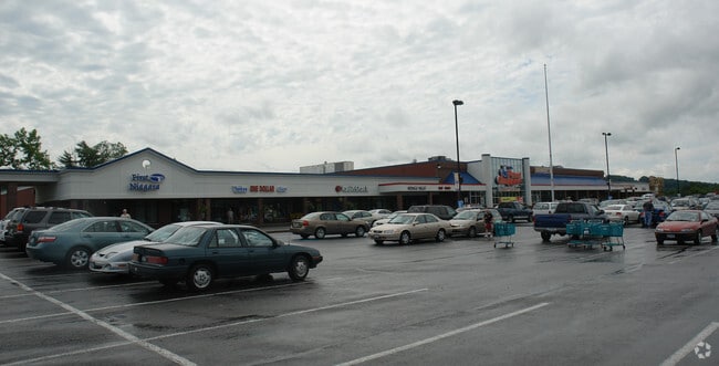
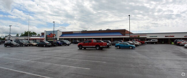
Property Record
6025 State Highway 5, Palatine Bridge, NY 13428

NEARBY LISTINGS FOR SALE OR LEASE
Property Detail
6025 State Highway 5
273403-062-012-0001-016-000-0000
MERGED PO62.-3-30.11/PRCL
Stripcommercialcenter
Montgomery
X
New York
36057C0137E
16.000
2025
9.60 AC
2024
Montgomery County
072300
Albany/Schenectady/Troy
59,148 SF
Amsterdam, NY
DEMOGRAPHICS near 6025 State Highway 5
1 Mile
3 Mile
5 Mile
2024 Total Population
965
7,148
9,133
2029 Population
959
7,209
9,190
Pop Growth 2024-2029
(0.62%)
+ 0.85%
+ 0.62%
Average Age
41
41
41
2024 Total Households
369
2,934
3,659
HH Growth 2024-2029
(0.54%)
+ 0.85%
+ 0.66%
Median Household Inc
$51,818
$50,498
$52,191
Avg Household Size
2.50
2.40
2.40
2024 Avg HH Vehicles
2.00
2.00
2.00
Median Home Value
$93,570
$78,289
$84,438
Median Year Built
1953
1947
1948
Nearby Places
Map Layers
Map Styles
 Street
 Aerial
- Restaurants
- Banks
- Shops
- Fitness
- Groceries
SALE & LEASE HISTORY
LISTING DATE
SALE/LEASE

Sep 25, 2016
For Lease
Oct 09, 2024
For Lease
Aug 22, 2018
For Lease
Apr 03, 2017
For Lease
Nearby Properties
Address
Land Use
TOTAL SIZE
Lot Size
Zoning
Address
Land Use
TOTAL SIZE
Lot Size
Zoning
145,650 SF
21 AC
Address
Land Use
TOTAL SIZE
Lot Size
Zoning
141,063 SF
29 AC
Address
Land Use
TOTAL SIZE
Lot Size
Zoning
106,029 SF
19.90 AC
CONF
Address
Land Use
TOTAL SIZE
Lot Size
Zoning
94,804 SF
8.70 AC
CONF
Address
Land Use
TOTAL SIZE
Lot Size
Zoning
10,894 SF
1.10 AC
Address
Land Use
TOTAL SIZE
Lot Size
Zoning
5.70 AC
Address
Land Use
TOTAL SIZE
Lot Size
Zoning
24,444 SF
0.33 AC
Address
Land Use
TOTAL SIZE
Lot Size
Zoning
4,892 SF
5.40 AC
Address
Land Use
TOTAL SIZE
Lot Size
Zoning
448,075 SF
26.90 AC
Address
Land Use
TOTAL SIZE
Lot Size
Zoning
108,600 SF
10 AC
Address
Land Use
TOTAL SIZE
Lot Size
Zoning
49.29 AC
Address
Land Use
TOTAL SIZE
Lot Size
Zoning
2.80 AC
Address
Land Use
TOTAL SIZE
Lot Size
Zoning
19,865 SF
9.50 AC
Address
Land Use
TOTAL SIZE
Lot Size
Zoning
6,030 SF
3.40 AC
Address
Land Use
TOTAL SIZE
Lot Size
Zoning
42.60 AC
Address
Land Use
TOTAL SIZE
Lot Size
Zoning
63,144 SF
19.60 AC
Address
Land Use
TOTAL SIZE
Lot Size
Zoning
27,403 SF
36.60 AC
Address
Land Use
TOTAL SIZE
Lot Size
Zoning
96,200 SF
17.10 AC
Address
Land Use
TOTAL SIZE
Lot Size
Zoning
12,824 SF
0.44 AC
Address
Land Use
TOTAL SIZE
Lot Size
Zoning
7,500 SF
1.80 AC
Address
Land Use
TOTAL SIZE
Lot Size
Zoning
2.70 AC
Address
Land Use
TOTAL SIZE
Lot Size
Zoning
7,654 SF
0.28 AC
Address
Land Use
TOTAL SIZE
Lot Size
Zoning
7,296 SF
0.35 AC
Address
Land Use
TOTAL SIZE
Lot Size
Zoning
22,592 SF
2.80 AC
Address
Land Use
TOTAL SIZE
Lot Size
Zoning
11,234 SF
2.20 AC
Address
Land Use
TOTAL SIZE
Lot Size
Zoning
29.70 AC
Address
Land Use
TOTAL SIZE
Lot Size
Zoning
7,117 SF
0.42 AC
Address
Land Use
TOTAL SIZE
Lot Size
Zoning
25.06 AC
Address
Land Use
TOTAL SIZE
Lot Size
Zoning
22.60 AC
The World's #1 Commercial Real Estate Marketplace
Connect with us
© 2026 CoStar Group
The information above has been obtained from sources believed reliable. While we do not doubt its accuracy we have not verified it and make no guarantee, warranty or representation about it. It is your responsibility to independently confirm its accuracy and completeness. Any projections, opinions, assumptions, or estimates used are for example only and do not represent the current or future performance of the property. The value of this transaction to you depends on tax and other factors which should be evaluated by your tax, financial, and legal advisors. You and your advisors should conduct a careful, independent investigation of the property to determine to your satisfaction the suitability of the property for your needs.