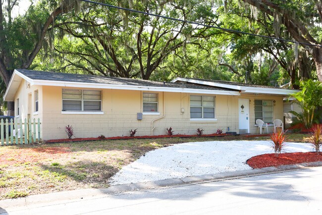
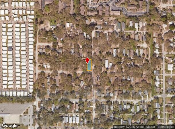
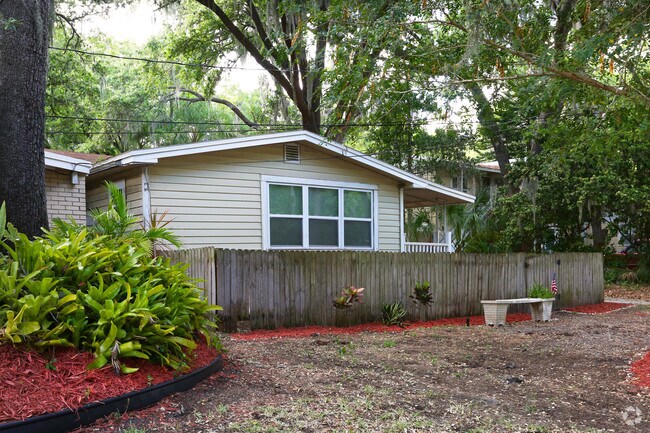
Property Record
603 6Th St Ne, Largo, FL 33770
NEARBY LISTINGS FOR SALE OR LEASE
Property Detail
603 6Th St Ne
Tampa-St. Petersburg-Clearwater, FL
Roosevelt Groves
34-29-15-76536-008-0140
ROOSEVELT GROVES BLK 8, LOT 14
Multifamilydwelling
Pinellas
X
Florida
12103C0116J
14
2024
0.15 AC
2025
Upper Largo
025604
Tampa/St Petersburg
2,286 SF
DEMOGRAPHICS near 603 6Th St Ne
1 Mile
3 Mile
5 Mile
2024 Total Population
14,264
111,416
257,554
2029 Population
14,270
111,721
260,061
Pop Growth 2024-2029
+ 0.04%
+ 0.27%
+ 0.97%
Average Age
48
46
46
2024 Total Households
6,843
51,147
117,398
HH Growth 2024-2029
(0.22%)
+ 0.14%
+ 0.98%
Median Household Inc
$47,794
$53,964
$58,058
Avg Household Size
2.00
2.10
2.10
2024 Avg HH Vehicles
1.00
2.00
2.00
Median Home Value
$182,454
$239,675
$267,449
Median Year Built
1973
1974
1976
Nearby Places
Map Layers
Map Styles
 Street
 Aerial
- Restaurants
- Banks
- Shops
- Fitness
- Groceries
PUBLIC TRANSPORTATION
AIRPORT
St Pete-Clearwater International
DRIVE
WALK
Distance
St Pete-Clearwater International
23 min
9.8 mi
Tampa International
DRIVE
WALK
Distance
Tampa International
35 min
20.4 mi
Freight Ports
Port of Tampa Bay
DRIVE
WALK
Distance
Port of Tampa Bay
45 min
26.7 mi
SALE & LEASE HISTORY
LISTING DATE
SALE/LEASE

Feb 27, 2019
For Sale
Aug 16, 2018
For Sale
Nearby Properties
Address
Land Use
TOTAL SIZE
Lot Size
Zoning
Address
Land Use
TOTAL SIZE
Lot Size
Zoning
839,480 SF
12.93 AC
Address
Land Use
TOTAL SIZE
Lot Size
Zoning
537,958 SF
41.61 AC
C2
Address
Land Use
TOTAL SIZE
Lot Size
Zoning
480,260 SF
5.12 AC
Address
Land Use
TOTAL SIZE
Lot Size
Zoning
529,506 SF
23.06 AC
Address
Land Use
TOTAL SIZE
Lot Size
Zoning
520,871 SF
29 AC
R6
Address
Land Use
TOTAL SIZE
Lot Size
Zoning
367,081 SF
13.80 AC
Address
Land Use
TOTAL SIZE
Lot Size
Zoning
333,425 SF
33.66 AC
Address
Land Use
TOTAL SIZE
Lot Size
Zoning
305,592 SF
9.65 AC
C2
Address
Land Use
TOTAL SIZE
Lot Size
Zoning
588,657 SF
33 AC
Address
Land Use
TOTAL SIZE
Lot Size
Zoning
509,129 SF
18.74 AC
Address
Land Use
TOTAL SIZE
Lot Size
Zoning
290,269 SF
8.49 AC
Address
Land Use
TOTAL SIZE
Lot Size
Zoning
321,140 SF
18.02 AC
Address
Land Use
TOTAL SIZE
Lot Size
Zoning
545,062 SF
8.37 AC
Address
Land Use
TOTAL SIZE
Lot Size
Zoning
235,506 SF
9.95 AC
Address
Land Use
TOTAL SIZE
Lot Size
Zoning
296,919 SF
39.10 AC
Address
Land Use
TOTAL SIZE
Lot Size
Zoning
244,655 SF
16.84 AC
AE
Address
Land Use
TOTAL SIZE
Lot Size
Zoning
241,547 SF
9.27 AC
Address
Land Use
TOTAL SIZE
Lot Size
Zoning
198,688 SF
11.99 AC
Address
Land Use
TOTAL SIZE
Lot Size
Zoning
280,129 SF
Address
Land Use
TOTAL SIZE
Lot Size
Zoning
319,725 SF
9.14 AC
Address
Land Use
TOTAL SIZE
Lot Size
Zoning
84,057 SF
34.26 AC
Address
Land Use
TOTAL SIZE
Lot Size
Zoning
261,486 SF
30.21 AC
RPD20
Address
Land Use
TOTAL SIZE
Lot Size
Zoning
277,450 SF
43.63 AC
Address
Land Use
TOTAL SIZE
Lot Size
Zoning
176,716 SF
14.20 AC
Address
Land Use
TOTAL SIZE
Lot Size
Zoning
169,932 SF
19.83 AC
R3
Address
Land Use
TOTAL SIZE
Lot Size
Zoning
194,610 SF
36.55 AC
R3
Address
Land Use
TOTAL SIZE
Lot Size
Zoning
129,600 SF
7.09 AC
Address
Land Use
TOTAL SIZE
Lot Size
Zoning
157,904 SF
0.57 AC
Address
Land Use
TOTAL SIZE
Lot Size
Zoning
157,475 SF
11.43 AC
Address
Land Use
TOTAL SIZE
Lot Size
Zoning
194,748 SF
12.69 AC
M1
The World's #1 Commercial Real Estate Marketplace
Connect with us
© 2025 CoStar Group
The information above has been obtained from sources believed reliable. While we do not doubt its accuracy we have not verified it and make no guarantee, warranty or representation about it. It is your responsibility to independently confirm its accuracy and completeness. Any projections, opinions, assumptions, or estimates used are for example only and do not represent the current or future performance of the property. The value of this transaction to you depends on tax and other factors which should be evaluated by your tax, financial, and legal advisors. You and your advisors should conduct a careful, independent investigation of the property to determine to your satisfaction the suitability of the property for your needs.