Property Record
747 Ocean Hwy E, Bolivia, NC 28422

Property Detail
747 Ocean Hwy E
1520004411
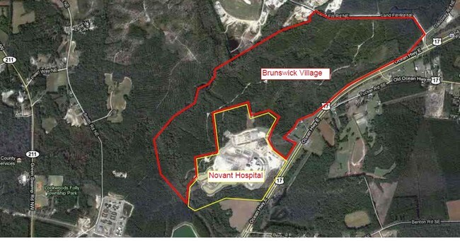
194.81 ACRES PL 48/34 US 17
Vacantlandnec
BRUNSWICK
CLD
North Carolina
AE The base floodplain where base flood elevations are provided. AE Zones are now used on new format FIRMs instead of A1-A30 Zones.
194.81 AC
2024
Leland
2025
Wilmington
020603
Wilmington, NC
NEARBY LISTINGS FOR SALE OR LEASE
DEMOGRAPHICS near 747 Ocean Hwy E
1 mile
3 mile
5 mile
2025 Total Population
83
2,637
9,122
2030 Population
97
3,082
10,762
Pop Growth 2025-2030
+ 16.87%
+ 16.88%
+ 17.98%
Average Age
42
45
47
2025 Total Households
29
1,000
3,643
HH Growth 2025-2030
+ 17.24%
+ 17.00%
+ 17.98%
Median Household Inc
$34,999
$46,267
$59,979
Avg Household Size
2.40
2.40
2.30
2025 Avg HH Vehicles
2.00
2.00
2.00
Median Home Value
$125,000
$262,799
$325,665
Median Year Built
1998
2003
2010
Nearby Places
Map Layers
Map Styles
 Street
 Aerial
Transit
 Traffic
 Biking
Places
Listings with unknown addresses are not visible on the map
- Restaurants
- Banks
- Shops
- Fitness
- Groceries
PUBLIC TRANSPORTATION
AIRPORT
Wilmington International
Drive
Walk
Distance
Wilmington International
48 min
32.3 mi
Freight Ports
Port of Wilmington
Drive
Walk
Distance
Port of Wilmington
38 min
28.0 mi
SALE & LEASE HISTORY
LISTING DATE
SALE/LEASE

Sep 25, 2016
For Lease
Sep 24, 2016
For Sale
Nearby Properties
Address
Land Use
TOTAL SIZE
Lot Size
Zoning
Address
Land Use
TOTAL SIZE
Lot Size
Zoning
265,552 SF
93.50 AC
CLD
Address
Land Use
TOTAL SIZE
Lot Size
Zoning
55,658 SF
170.17 AC
CLD
Address
Land Use
TOTAL SIZE
Lot Size
Zoning
33,033 SF
268.40 AC
RR
Address
Land Use
TOTAL SIZE
Lot Size
Zoning
99,977 SF
39.68 AC
R75
Address
Land Use
TOTAL SIZE
Lot Size
Zoning
62,095 SF
14.30 AC
CLD
Address
Land Use
TOTAL SIZE
Lot Size
Zoning
35,524 SF
2.91 AC
CLD
Address
Land Use
TOTAL SIZE
Lot Size
Zoning
38,870 SF
5 AC
CLD
Address
Land Use
TOTAL SIZE
Lot Size
Zoning
6,140 SF
2.94 AC
CLD
Address
Land Use
TOTAL SIZE
Lot Size
Zoning
20,672 SF
3.10 AC
CLD
Address
Land Use
TOTAL SIZE
Lot Size
Zoning
20,800 SF
11.08 AC
IG
Address
Land Use
TOTAL SIZE
Lot Size
Zoning
14,968 SF
10.59 AC
CLD
Address
Land Use
TOTAL SIZE
Lot Size
Zoning
7,840 SF
136.34 AC
IG
Address
Land Use
TOTAL SIZE
Lot Size
Zoning
72,242 SF
31.16 AC
CLD
Address
Land Use
TOTAL SIZE
Lot Size
Zoning
1,484 SF
2.60 AC
CLD
Address
Land Use
TOTAL SIZE
Lot Size
Zoning
5,160 SF
3.02 AC
CLD
Address
Land Use
TOTAL SIZE
Lot Size
Zoning
9,444 SF
1.09 AC
CLD
Address
Land Use
TOTAL SIZE
Lot Size
Zoning
9,385 SF
3.26 AC
CLD
Address
Land Use
TOTAL SIZE
Lot Size
Zoning
17,718 SF
1.57 AC
CLD
Address
Land Use
TOTAL SIZE
Lot Size
Zoning
14,721 SF
5.75 AC
CLD
Address
Land Use
TOTAL SIZE
Lot Size
Zoning
775.49 AC
R75
Address
Land Use
TOTAL SIZE
Lot Size
Zoning
7,895 SF
2.32 AC
CLD
Address
Land Use
TOTAL SIZE
Lot Size
Zoning
9,173 SF
1.47 AC
CLD
Address
Land Use
TOTAL SIZE
Lot Size
Zoning
18,525 SF
6.01 AC
CLD
Address
Land Use
TOTAL SIZE
Lot Size
Zoning
6,591 SF
2.68 AC
NC
Address
Land Use
TOTAL SIZE
Lot Size
Zoning
7.93 AC
CLD
Address
Land Use
TOTAL SIZE
Lot Size
Zoning
4,496 SF
1.18 AC
CLD
Address
Land Use
TOTAL SIZE
Lot Size
Zoning
878.93 AC
RR
Address
Land Use
TOTAL SIZE
Lot Size
Zoning
4,500 SF
2 AC
CLD
Address
Land Use
TOTAL SIZE
Lot Size
Zoning
3,794 SF
1.75 AC
CLD
The World's #1 Commercial Real Estate Marketplace
Connect with us
© 2026 CoStar Group
The information above has been obtained from sources believed reliable. While we do not doubt its accuracy we have not verified it and make no guarantee, warranty or representation about it. It is your responsibility to independently confirm its accuracy and completeness. Any projections, opinions, assumptions, or estimates used are for example only and do not represent the current or future performance of the property. The value of this transaction to you depends on tax and other factors which should be evaluated by your tax, financial, and legal advisors. You and your advisors should conduct a careful, independent investigation of the property to determine to your satisfaction the suitability of the property for your needs.