Property Record
603 State Route 66, Leechburg, PA 15656


Property Detail
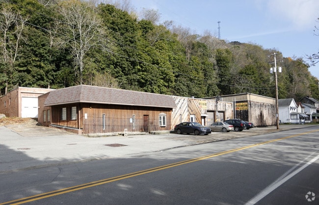
603 State Route 66
18-0-010498
MAP NO:198.19-01-05; 1.119A IMPRS. SERVICE STATION
Autorepair
Westmoreland
RESIDENTIA
Pennsylvania
B and X Area of moderate flood hazard, usually the area between the limits of the 100-year and 500-year floods.
1.12 AC
2026
Armstrong County
2026
Pittsburgh
951300
Pittsburgh, PA
8,932 SF
NEARBY LISTINGS FOR SALE OR LEASE
-
-
View all Leechburg listings for sale on LoopNet.com
DEMOGRAPHICS near 603 State Route 66
1 mile
3 mile
5 mile
2025 Total Population
3,853
16,213
29,037
2030 Population
3,809
16,108
28,618
Pop Growth 2025-2030
(1.14%)
(0.65%)
(1.44%)
Average Age
43
43
45
2025 Total Households
1,703
7,013
12,492
HH Growth 2025-2030
(1.17%)
(0.66%)
(1.48%)
Median Household Inc
$58,683
$58,188
$63,245
Avg Household Size
2.20
2.30
2.30
2025 Avg HH Vehicles
2.00
2.00
2.00
Median Home Value
$125,722
$133,815
$151,705
Median Year Built
1953
1951
1957
Nearby Places
Map Layers
Map Styles
 Street
 Aerial
Layers
 Traffic
 Biking
Places
Listings with unknown addresses are not visible on the map
- Restaurants
- Banks
- Shops
- Fitness
- Groceries
PUBLIC TRANSPORTATION
AIRPORT
Arnold Palmer Regional
Drive
Walk
Distance
Arnold Palmer Regional
63 min
38.1 mi
Freight Ports
Port of Baltimore
Drive
Walk
Distance
Port of Baltimore
300 min
249.2 mi
Nearby Properties
Address
Land Use
TOTAL SIZE
Lot Size
Zoning
Address
Land Use
TOTAL SIZE
Lot Size
Zoning
120,681 SF
2.97 AC
RESIDENTIA
Address
Land Use
TOTAL SIZE
Lot Size
Zoning
81,195 SF
7.65 AC
Address
Land Use
TOTAL SIZE
Lot Size
Zoning
48,148 SF
5.27 AC
Address
Land Use
TOTAL SIZE
Lot Size
Zoning
69,000 SF
7.09 AC
Address
Land Use
TOTAL SIZE
Lot Size
Zoning
36,928 SF
37.75 AC
Address
Land Use
TOTAL SIZE
Lot Size
Zoning
44,550 SF
0.33 AC
BUSINESS
Address
Land Use
TOTAL SIZE
Lot Size
Zoning
6,312 SF
3.46 AC
Address
Land Use
TOTAL SIZE
Lot Size
Zoning
28,600 SF
6.56 AC
Address
Land Use
TOTAL SIZE
Lot Size
Zoning
11,485 SF
2.42 AC
Address
Land Use
TOTAL SIZE
Lot Size
Zoning
17,440 SF
2.57 AC
Address
Land Use
TOTAL SIZE
Lot Size
Zoning
282,040 SF
15.34 AC
Address
Land Use
TOTAL SIZE
Lot Size
Zoning
25,456 SF
2.51 AC
Address
Land Use
TOTAL SIZE
Lot Size
Zoning
41,596 SF
0.32 AC
RESIDENTIA
Address
Land Use
TOTAL SIZE
Lot Size
Zoning
18.60 AC
Address
Land Use
TOTAL SIZE
Lot Size
Zoning
9,133 SF
1 AC
Address
Land Use
TOTAL SIZE
Lot Size
Zoning
41.10 AC
Address
Land Use
TOTAL SIZE
Lot Size
Zoning
164,875 SF
13 AC
Address
Land Use
TOTAL SIZE
Lot Size
Zoning
26,400 SF
2.93 AC
Address
Land Use
TOTAL SIZE
Lot Size
Zoning
27,384 SF
7.70 AC
LIGHT INDU
Address
Land Use
TOTAL SIZE
Lot Size
Zoning
62,099 SF
106.02 AC
AGRICULTUR
Address
Land Use
TOTAL SIZE
Lot Size
Zoning
4,125 SF
104.67 AC
AGRICULTUR
Address
Land Use
TOTAL SIZE
Lot Size
Zoning
9,918 SF
2.42 AC
LIGHT INDU
Address
Land Use
TOTAL SIZE
Lot Size
Zoning
12,350 SF
4.47 AC
Address
Land Use
TOTAL SIZE
Lot Size
Zoning
19,280 SF
0.33 AC
BUSINESS
Address
Land Use
TOTAL SIZE
Lot Size
Zoning
22,801 SF
0.41 AC
RESIDENTIA
Address
Land Use
TOTAL SIZE
Lot Size
Zoning
3,400 SF
3.64 AC
Address
Land Use
TOTAL SIZE
Lot Size
Zoning
24,750 SF
2.37 AC
BUSINESS
Address
Land Use
TOTAL SIZE
Lot Size
Zoning
8,208 SF
10.90 AC
RESIDENTIA
Address
Land Use
TOTAL SIZE
Lot Size
Zoning
10,037 SF
0.58 AC
RESIDENTIA
Address
Land Use
TOTAL SIZE
Lot Size
Zoning
16,242 SF
0.65 AC
RESIDENTIA
The World's #1 Commercial Real Estate Marketplace
Connect with us
© 2026 CoStar Group
The information above has been obtained from sources believed reliable. While we do not doubt its accuracy we have not verified it and make no guarantee, warranty or representation about it. It is your responsibility to independently confirm its accuracy and completeness. Any projections, opinions, assumptions, or estimates used are for example only and do not represent the current or future performance of the property. The value of this transaction to you depends on tax and other factors which should be evaluated by your tax, financial, and legal advisors. You and your advisors should conduct a careful, independent investigation of the property to determine to your satisfaction the suitability of the property for your needs.