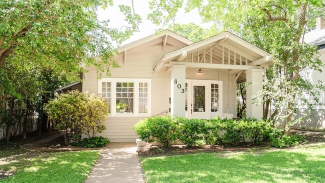
Property Record
603 W 18Th St, Austin, TX 78701


Property Detail
603 W 18Th St
Austin-Round Rock-San Marcos, TX
CEN 50 OF E 138 OF N 128 OLT 25 DIVISION E
199705
Travis
Officebuilding
Texas
B and X Area of moderate flood hazard, usually the area between the limits of the 100-year and 500-year floods.
25
2025
0.15 AC
2025
CBD
000700
Austin
1,648 SF
NEARBY LISTINGS FOR SALE OR LEASE
DEMOGRAPHICS near 603 W 18Th St
1 mile
3 mile
5 mile
2025 Total Population
42,433
181,962
378,355
2030 Population
44,603
192,140
398,850
Pop Growth 2025-2030
+ 5.11%
+ 5.59%
+ 5.42%
Average Age
29
36
36
2025 Total Households
15,574
87,250
175,210
HH Growth 2025-2030
+ 6.91%
+ 6.53%
+ 6.22%
Median Household Inc
$42,585
$102,529
$94,155
Avg Household Size
1.90
1.90
2.00
2025 Avg HH Vehicles
1.00
1.00
2.00
Median Home Value
$908,794
$921,921
$820,779
Median Year Built
2004
2002
1993
Nearby Places
Map Layers
Map Styles
 Street
 Aerial
Transit
 Traffic
 Biking
Places
Listings with unknown addresses are not visible on the map
- Restaurants
- Banks
- Shops
- Fitness
- Groceries
PUBLIC TRANSPORTATION
COMMUTER RAIL
Drive
Walk
Distance
5 min
1.6 mi
AIRPORT
Austin-Bergstrom International
Drive
Walk
Distance
Austin-Bergstrom International
25 min
12.5 mi
SALE & LEASE HISTORY
LISTING DATE
SALE/LEASE

Sep 21, 2020
For Lease
May 02, 2023
For Lease
Apr 17, 2025
For Lease
Nearby Properties
Address
Land Use
TOTAL SIZE
Lot Size
Zoning
Address
Land Use
TOTAL SIZE
Lot Size
Zoning
1,008,789 SF
17.50 AC
Address
Land Use
TOTAL SIZE
Lot Size
Zoning
20,550 SF
14.15 AC
Address
Land Use
TOTAL SIZE
Lot Size
Zoning
262 SF
65.06 AC
Address
Land Use
TOTAL SIZE
Lot Size
Zoning
29,594 SF
155.62 AC
Address
Land Use
TOTAL SIZE
Lot Size
Zoning
28.39 AC
Address
Land Use
TOTAL SIZE
Lot Size
Zoning
Address
Land Use
TOTAL SIZE
Lot Size
Zoning
28.62 AC
Address
Land Use
TOTAL SIZE
Lot Size
Zoning
1,156,135 SF
1.74 AC
Address
Land Use
TOTAL SIZE
Lot Size
Zoning
1,003,475 SF
1.84 AC
Address
Land Use
TOTAL SIZE
Lot Size
Zoning
27.17 AC
Address
Land Use
TOTAL SIZE
Lot Size
Zoning
136,900 SF
19.32 AC
Address
Land Use
TOTAL SIZE
Lot Size
Zoning
786,600 SF
1.27 AC
Address
Land Use
TOTAL SIZE
Lot Size
Zoning
24.50 AC
Address
Land Use
TOTAL SIZE
Lot Size
Zoning
9,034 SF
28.69 AC
Address
Land Use
TOTAL SIZE
Lot Size
Zoning
30.96 AC
Address
Land Use
TOTAL SIZE
Lot Size
Zoning
709,300 SF
0.94 AC
Address
Land Use
TOTAL SIZE
Lot Size
Zoning
498,684 SF
61.86 AC
Address
Land Use
TOTAL SIZE
Lot Size
Zoning
18.52 AC
Address
Land Use
TOTAL SIZE
Lot Size
Zoning
74.69 AC
Address
Land Use
TOTAL SIZE
Lot Size
Zoning
47.20 AC
Address
Land Use
TOTAL SIZE
Lot Size
Zoning
1,400,000 SF
3.07 AC
Address
Land Use
TOTAL SIZE
Lot Size
Zoning
789,220 SF
14.34 AC
Address
Land Use
TOTAL SIZE
Lot Size
Zoning
548,399 SF
23.82 AC
Address
Land Use
TOTAL SIZE
Lot Size
Zoning
35,041 SF
28.65 AC
Address
Land Use
TOTAL SIZE
Lot Size
Zoning
623,000 SF
11.78 AC
Address
Land Use
TOTAL SIZE
Lot Size
Zoning
21 AC
Address
Land Use
TOTAL SIZE
Lot Size
Zoning
999,200 SF
25 AC
Address
Land Use
TOTAL SIZE
Lot Size
Zoning
614,532 SF
66.07 AC
Address
Land Use
TOTAL SIZE
Lot Size
Zoning
513,567 SF
1.78 AC
The World's #1 Commercial Real Estate Marketplace
Connect with us
© 2026 CoStar Group
The information above has been obtained from sources believed reliable. While we do not doubt its accuracy we have not verified it and make no guarantee, warranty or representation about it. It is your responsibility to independently confirm its accuracy and completeness. Any projections, opinions, assumptions, or estimates used are for example only and do not represent the current or future performance of the property. The value of this transaction to you depends on tax and other factors which should be evaluated by your tax, financial, and legal advisors. You and your advisors should conduct a careful, independent investigation of the property to determine to your satisfaction the suitability of the property for your needs.