Property Record
6030 W Thunderbird Rd, Glendale, AZ 85306
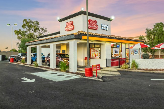


Property Detail
6030 W Thunderbird Rd
200-73-005W
TH PT SE4 SE4 SEC 7 DAF COM SE COR SD SEC TH N 88D 49M W 288.37F TH N 2D 18M E 55.01F TH W 290.06F TO TPOB TH CONT W 85F TO E R/W LI AZ CAN MCR 128-36 TH N 28D 43M W 273.36F TH S 88D 50M E 225.95F TH S 2D 18M W 237.06F TO TPOB
Restaurantdrivein
Maricopa
C-C
Arizona
C and X Area of minimal flood hazard, usually depicted on FIRMs as above the 500-year flood level.
0.84 AC
2025
Glendale
2025
Phoenix
104216
Phoenix-Mesa-Chandler, AZ
1,694 SF
NEARBY LISTINGS FOR SALE OR LEASE
DEMOGRAPHICS near 6030 W Thunderbird Rd
1 mile
3 mile
5 mile
2025 Total Population
14,543
129,770
389,703
2030 Population
15,094
133,432
403,452
Pop Growth 2025-2030
+ 3.79%
+ 2.82%
+ 3.53%
Average Age
41
40
40
2025 Total Households
5,466
46,219
146,220
HH Growth 2025-2030
+ 3.77%
+ 2.83%
+ 3.68%
Median Household Inc
$80,144
$89,336
$74,474
Avg Household Size
2.40
2.70
2.50
2025 Avg HH Vehicles
2.00
2.00
2.00
Median Home Value
$406,186
$404,746
$395,027
Median Year Built
1984
1983
1984
Nearby Places
Map Layers
Map Styles
 Street
 Aerial
Transit
 Traffic
 Biking
Places
Listings with unknown addresses are not visible on the map
- Restaurants
- Banks
- Shops
- Fitness
- Groceries
PUBLIC TRANSPORTATION
AIRPORT
Phoenix Sky Harbor International
Drive
Walk
Distance
Phoenix Sky Harbor International
36 min
22.6 mi
SALE & LEASE HISTORY
LISTING DATE
SALE/LEASE

Nov 11, 2025
For Sale
Jun 24, 2020
For Sale
Nearby Properties
Address
Land Use
TOTAL SIZE
Lot Size
Zoning
Address
Land Use
TOTAL SIZE
Lot Size
Zoning
45,900 SF
11.09 AC
PAD
Address
Land Use
TOTAL SIZE
Lot Size
Zoning
1,019,640 SF
32.10 AC
GO
Address
Land Use
TOTAL SIZE
Lot Size
Zoning
742,601 SF
295.89 AC
R-8
Address
Land Use
TOTAL SIZE
Lot Size
Zoning
708,928 SF
44.86 AC
Address
Land Use
TOTAL SIZE
Lot Size
Zoning
611,971 SF
36.16 AC
A1
Address
Land Use
TOTAL SIZE
Lot Size
Zoning
1.93 AC
C-C
Address
Land Use
TOTAL SIZE
Lot Size
Zoning
360,026 SF
74.94 AC
R-6
Address
Land Use
TOTAL SIZE
Lot Size
Zoning
238,942 SF
36.87 AC
R1-8
Address
Land Use
TOTAL SIZE
Lot Size
Zoning
0.47 AC
Address
Land Use
TOTAL SIZE
Lot Size
Zoning
19.95 AC
AG
Address
Land Use
TOTAL SIZE
Lot Size
Zoning
401,879 SF
67.89 AC
Address
Land Use
TOTAL SIZE
Lot Size
Zoning
348,803 SF
15.91 AC
PAD
Address
Land Use
TOTAL SIZE
Lot Size
Zoning
314,839 SF
39 AC
R-18
Address
Land Use
TOTAL SIZE
Lot Size
Zoning
240,863 SF
35.55 AC
Address
Land Use
TOTAL SIZE
Lot Size
Zoning
241,669 SF
12.78 AC
PAD
Address
Land Use
TOTAL SIZE
Lot Size
Zoning
219,122 SF
33 AC
R-6
Address
Land Use
TOTAL SIZE
Lot Size
Zoning
392,885 SF
17.67 AC
M-H
Address
Land Use
TOTAL SIZE
Lot Size
Zoning
88,059 SF
78.03 AC
AG
Address
Land Use
TOTAL SIZE
Lot Size
Zoning
378,106 SF
19.18 AC
R-3
Address
Land Use
TOTAL SIZE
Lot Size
Zoning
200,658 SF
23.14 AC
C-BP
Address
Land Use
TOTAL SIZE
Lot Size
Zoning
245,400 SF
22.90 AC
PAD
Address
Land Use
TOTAL SIZE
Lot Size
Zoning
115,027 SF
14.46 AC
R-8
Address
Land Use
TOTAL SIZE
Lot Size
Zoning
131,380 SF
25.55 AC
R-6
Address
Land Use
TOTAL SIZE
Lot Size
Zoning
150,002 SF
10.91 AC
C-C
Address
Land Use
TOTAL SIZE
Lot Size
Zoning
90,148 SF
6.13 AC
R-6
Address
Land Use
TOTAL SIZE
Lot Size
Zoning
319,723 SF
10.79 AC
PAD
Address
Land Use
TOTAL SIZE
Lot Size
Zoning
230,076 SF
14.03 AC
PAD
Address
Land Use
TOTAL SIZE
Lot Size
Zoning
153,980 SF
20.11 AC
R-8
Address
Land Use
TOTAL SIZE
Lot Size
Zoning
88,793 SF
13.41 AC
R-8
Address
Land Use
TOTAL SIZE
Lot Size
Zoning
74,958 SF
13.16 AC
R-6
The World's #1 Commercial Real Estate Marketplace
Connect with us
© 2026 CoStar Group
The information above has been obtained from sources believed reliable. While we do not doubt its accuracy we have not verified it and make no guarantee, warranty or representation about it. It is your responsibility to independently confirm its accuracy and completeness. Any projections, opinions, assumptions, or estimates used are for example only and do not represent the current or future performance of the property. The value of this transaction to you depends on tax and other factors which should be evaluated by your tax, financial, and legal advisors. You and your advisors should conduct a careful, independent investigation of the property to determine to your satisfaction the suitability of the property for your needs.