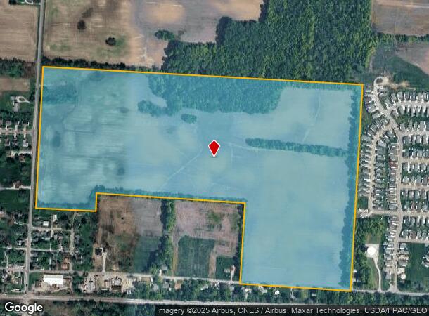
Property Record
6031 Summit Rd Sw, Pataskala, OH 43062
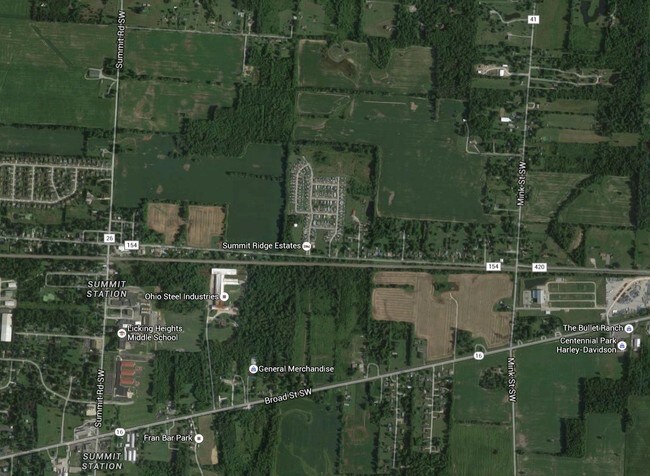
NEARBY LISTINGS FOR SALE OR LEASE
Property Detail
6031 Summit Rd Sw
Columbus, OH
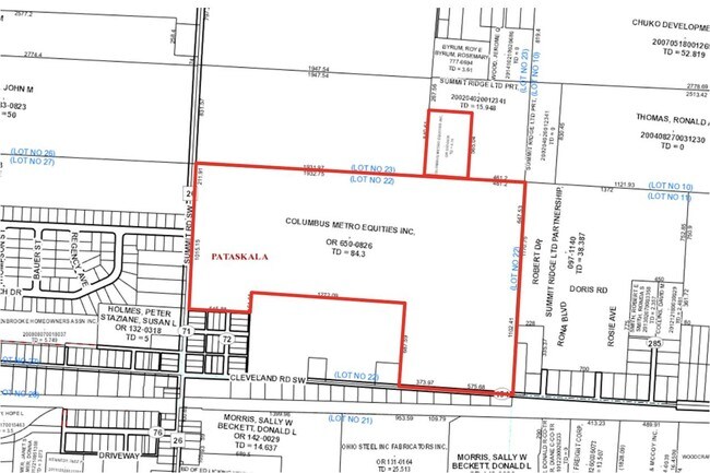
Sw Quarter
063-141474-00.000
84.30 AC LOT 22 R15 T1 Q3
Agriculturalland
Licking
X
Ohio
39089C0269J
22
2024
84.30 AC
2024
Licking County
755901
Columbus
DEMOGRAPHICS near 6031 Summit Rd Sw
1 Mile
3 Mile
5 Mile
2024 Total Population
3,710
38,495
101,189
2029 Population
3,865
39,156
102,982
Pop Growth 2024-2029
+ 4.18%
+ 1.72%
+ 1.77%
Average Age
37
36
38
2024 Total Households
1,235
13,153
37,290
HH Growth 2024-2029
+ 4.29%
+ 1.73%
+ 1.69%
Median Household Inc
$98,199
$94,108
$84,536
Avg Household Size
2.90
2.90
2.70
2024 Avg HH Vehicles
2.00
2.00
2.00
Median Home Value
$236,126
$246,697
$251,398
Median Year Built
1997
2001
1995
Nearby Places
Map Layers
Map Styles
 Street
 Aerial
- Restaurants
- Banks
- Shops
- Fitness
- Groceries
PUBLIC TRANSPORTATION
AIRPORT
John Glenn Columbus International
DRIVE
WALK
Distance
John Glenn Columbus International
20 min
10.9 mi
Rickenbacker International
DRIVE
WALK
Distance
Rickenbacker International
30 min
20.0 mi
Freight Ports
Port of Toledo
DRIVE
WALK
Distance
Port of Toledo
196 min
153.4 mi
SALE & LEASE HISTORY
LISTING DATE
SALE/LEASE

May 02, 2017
For Sale
Jul 21, 2017
For Sale
Nearby Properties
Address
Land Use
TOTAL SIZE
Lot Size
Zoning
Address
Land Use
TOTAL SIZE
Lot Size
Zoning
2,556 SF
93.78 AC
Address
Land Use
TOTAL SIZE
Lot Size
Zoning
1,230,350 SF
78.26 AC
Address
Land Use
TOTAL SIZE
Lot Size
Zoning
1,091,997 SF
49.37 AC
Address
Land Use
TOTAL SIZE
Lot Size
Zoning
1,014,005 SF
101.26 AC
Address
Land Use
TOTAL SIZE
Lot Size
Zoning
699,016 SF
43.57 AC
Address
Land Use
TOTAL SIZE
Lot Size
Zoning
Address
Land Use
TOTAL SIZE
Lot Size
Zoning
154.52 AC
Address
Land Use
TOTAL SIZE
Lot Size
Zoning
1,003,816 SF
75.60 AC
Address
Land Use
TOTAL SIZE
Lot Size
Zoning
978,491 SF
72.31 AC
Address
Land Use
TOTAL SIZE
Lot Size
Zoning
705,707 SF
107.11 AC
Address
Land Use
TOTAL SIZE
Lot Size
Zoning
137,136 SF
69.71 AC
Address
Land Use
TOTAL SIZE
Lot Size
Zoning
201,687 SF
20.97 AC
Address
Land Use
TOTAL SIZE
Lot Size
Zoning
43,829 SF
27.86 AC
Address
Land Use
TOTAL SIZE
Lot Size
Zoning
151,476 SF
83.45 AC
Address
Land Use
TOTAL SIZE
Lot Size
Zoning
47.69 AC
Address
Land Use
TOTAL SIZE
Lot Size
Zoning
303,408 SF
29.74 AC
Address
Land Use
TOTAL SIZE
Lot Size
Zoning
51,968 SF
22.80 AC
Address
Land Use
TOTAL SIZE
Lot Size
Zoning
82,450 SF
28.27 AC
Address
Land Use
TOTAL SIZE
Lot Size
Zoning
2,171 SF
14.44 AC
Address
Land Use
TOTAL SIZE
Lot Size
Zoning
209,585 SF
24.94 AC
Address
Land Use
TOTAL SIZE
Lot Size
Zoning
95,576 SF
16 AC
Address
Land Use
TOTAL SIZE
Lot Size
Zoning
29,720 SF
20.20 AC
Address
Land Use
TOTAL SIZE
Lot Size
Zoning
195,828 SF
25.61 AC
Address
Land Use
TOTAL SIZE
Lot Size
Zoning
83,892 SF
15.80 AC
Address
Land Use
TOTAL SIZE
Lot Size
Zoning
472,029 SF
59.94 AC
Address
Land Use
TOTAL SIZE
Lot Size
Zoning
105,628 SF
17.72 AC
Address
Land Use
TOTAL SIZE
Lot Size
Zoning
7,552 SF
15.41 AC
Address
Land Use
TOTAL SIZE
Lot Size
Zoning
80,769 SF
13.74 AC
Address
Land Use
TOTAL SIZE
Lot Size
Zoning
143,397 SF
16.78 AC
Address
Land Use
TOTAL SIZE
Lot Size
Zoning
56,102 SF
8.14 AC
The World's #1 Commercial Real Estate Marketplace
Connect with us
© 2025 CoStar Group
The information above has been obtained from sources believed reliable. While we do not doubt its accuracy we have not verified it and make no guarantee, warranty or representation about it. It is your responsibility to independently confirm its accuracy and completeness. Any projections, opinions, assumptions, or estimates used are for example only and do not represent the current or future performance of the property. The value of this transaction to you depends on tax and other factors which should be evaluated by your tax, financial, and legal advisors. You and your advisors should conduct a careful, independent investigation of the property to determine to your satisfaction the suitability of the property for your needs.