Property Record
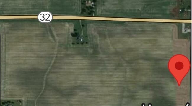
6031 W State Road 32, Lebanon, IN 46052


This Property Is For Sale
NEARBY LISTINGS FOR SALE OR LEASE
Property Detail
6031 W State Road 32
06-09-36-000-020.002-011
PT NE 36-19-2W 76.88A TRUST IN EACH NAME 1/2 INT EACH
Agriculturalland
Boone
X
Indiana
18011C0165E
76.88 AC
2024
Boone County
2025
Indianapolis
810200
Indianapolis-Carmel-Greenwood, IN
DEMOGRAPHICS near 6031 W State Road 32
1 Mile
3 Mile
5 Mile
2024 Total Population
85
1,011
2,755
2029 Population
94
1,114
3,030
Pop Growth 2024-2029
+ 10.59%
+ 10.19%
+ 9.98%
Average Age
41
41
42
2024 Total Households
30
355
1,000
HH Growth 2024-2029
+ 10.00%
+ 10.42%
+ 10.20%
Median Household Inc
$106,250
$99,999
$92,856
Avg Household Size
2.90
2.80
2.70
2024 Avg HH Vehicles
3.00
3.00
3.00
Median Home Value
$295,454
$296,666
$283,060
Median Year Built
1979
1983
1974
Nearby Places
Map Layers
Map Styles
 Street
 Aerial
- Restaurants
- Banks
- Shops
- Fitness
- Groceries
PUBLIC TRANSPORTATION
AIRPORT
Indianapolis International
DRIVE
WALK
Distance
Indianapolis International
56 min
38.4 mi
Freight Ports
Port of Toledo
DRIVE
WALK
Distance
Port of Toledo
293 min
247.0 mi
Nearby Properties
Address
Land Use
TOTAL SIZE
Lot Size
Zoning
Address
Land Use
TOTAL SIZE
Lot Size
Zoning
320 SF
9.47 AC
ZO01
Address
Land Use
TOTAL SIZE
Lot Size
Zoning
291.17 AC
ZO01
Address
Land Use
TOTAL SIZE
Lot Size
Zoning
238 AC
ZO01
Address
Land Use
TOTAL SIZE
Lot Size
Zoning
270 AC
ZO01
Address
Land Use
TOTAL SIZE
Lot Size
Zoning
99.04 AC
ZO01
Address
Land Use
TOTAL SIZE
Lot Size
Zoning
160.66 AC
ZO01
Address
Land Use
TOTAL SIZE
Lot Size
Zoning
2,362 SF
0.44 AC
ZO01
Address
Land Use
TOTAL SIZE
Lot Size
Zoning
172 AC
ZO01
Address
Land Use
TOTAL SIZE
Lot Size
Zoning
156.36 AC
ZO01
Address
Land Use
TOTAL SIZE
Lot Size
Zoning
157 AC
ZO01
Address
Land Use
TOTAL SIZE
Lot Size
Zoning
175.20 AC
ZO01
Address
Land Use
TOTAL SIZE
Lot Size
Zoning
160 AC
ZO01
Address
Land Use
TOTAL SIZE
Lot Size
Zoning
146.04 AC
ZO01
Address
Land Use
TOTAL SIZE
Lot Size
Zoning
152.55 AC
ZO01
Address
Land Use
TOTAL SIZE
Lot Size
Zoning
147.23 AC
ZO01
Address
Land Use
TOTAL SIZE
Lot Size
Zoning
159.11 AC
ZO01
Address
Land Use
TOTAL SIZE
Lot Size
Zoning
144.37 AC
ZO01
Address
Land Use
TOTAL SIZE
Lot Size
Zoning
122.69 AC
ZO01
Address
Land Use
TOTAL SIZE
Lot Size
Zoning
73.37 AC
ZO01
Address
Land Use
TOTAL SIZE
Lot Size
Zoning
143.80 AC
ZO01
Address
Land Use
TOTAL SIZE
Lot Size
Zoning
20.26 AC
ZO01
Address
Land Use
TOTAL SIZE
Lot Size
Zoning
5.90 AC
ZO01
Address
Land Use
TOTAL SIZE
Lot Size
Zoning
120 AC
ZO01
Address
Land Use
TOTAL SIZE
Lot Size
Zoning
1,215 SF
1.08 AC
ZO01
Address
Land Use
TOTAL SIZE
Lot Size
Zoning
126.27 AC
ZO01
Address
Land Use
TOTAL SIZE
Lot Size
Zoning
108 AC
ZO01
Address
Land Use
TOTAL SIZE
Lot Size
Zoning
120 AC
ZO01
Address
Land Use
TOTAL SIZE
Lot Size
Zoning
112.75 AC
ZO01
Address
Land Use
TOTAL SIZE
Lot Size
Zoning
106.45 AC
ZO01
Address
Land Use
TOTAL SIZE
Lot Size
Zoning
114.21 AC
ZO01
The World's #1 Commercial Real Estate Marketplace
Connect with us
© 2026 CoStar Group
The information above has been obtained from sources believed reliable. While we do not doubt its accuracy we have not verified it and make no guarantee, warranty or representation about it. It is your responsibility to independently confirm its accuracy and completeness. Any projections, opinions, assumptions, or estimates used are for example only and do not represent the current or future performance of the property. The value of this transaction to you depends on tax and other factors which should be evaluated by your tax, financial, and legal advisors. You and your advisors should conduct a careful, independent investigation of the property to determine to your satisfaction the suitability of the property for your needs.