Property Record
6032 Hagman Rd, Toledo, OH 43612


Property Detail
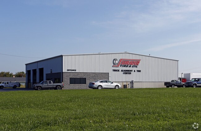
6032 Hagman Rd
22-74698
8 9 5 SW 1/4 NLY 200 FT SLY 1808.02 FTWLY 679.30 FT EXC PT
Vehiclerentalsvehiclesales
Lucas
10-IG
Ohio
B and X Area of moderate flood hazard, usually the area between the limits of the 100-year and 500-year floods.
3.10 AC
0
North Toledo
2025
Toledo
005602
Toledo, OH
11,140 SF
NEARBY LISTINGS FOR SALE OR LEASE
DEMOGRAPHICS near 6032 Hagman Rd
1 mile
3 mile
5 mile
2025 Total Population
2,476
27,580
106,110
2030 Population
2,498
27,222
106,255
Pop Growth 2025-2030
+ 0.89%
(1.30%)
+ 0.14%
Average Age
39
41
39
2025 Total Households
1,013
11,797
44,205
HH Growth 2025-2030
+ 1.09%
(1.33%)
+ 0.07%
Median Household Inc
$68,942
$58,840
$48,634
Avg Household Size
2.40
2.30
2.30
2025 Avg HH Vehicles
2.00
2.00
2.00
Median Home Value
$140,068
$130,739
$117,356
Median Year Built
1973
1961
1955
Nearby Places
Map Layers
Map Styles
 Street
 Aerial
Layers
 Traffic
 Biking
Places
Listings with unknown addresses are not visible on the map
- Restaurants
- Banks
- Shops
- Fitness
- Groceries
PUBLIC TRANSPORTATION
AIRPORT
Eugene F Kranz Toledo Express
Drive
Walk
Distance
Eugene F Kranz Toledo Express
38 min
28.7 mi
Freight Ports
Port of Baltimore
Drive
Walk
Distance
Port of Baltimore
1 min
400.9 mi
Nearby Properties
Address
Land Use
TOTAL SIZE
Lot Size
Zoning
Address
Land Use
TOTAL SIZE
Lot Size
Zoning
169.42 AC
10-IG
Address
Land Use
TOTAL SIZE
Lot Size
Zoning
Address
Land Use
TOTAL SIZE
Lot Size
Zoning
169.42 AC
10-IG
Address
Land Use
TOTAL SIZE
Lot Size
Zoning
163,962 SF
10.13 AC
Address
Land Use
TOTAL SIZE
Lot Size
Zoning
28.51 AC
10-IG
Address
Land Use
TOTAL SIZE
Lot Size
Zoning
450,000 SF
37.30 AC
Address
Land Use
TOTAL SIZE
Lot Size
Zoning
230,400 SF
18 AC
10-CR
Address
Land Use
TOTAL SIZE
Lot Size
Zoning
90,113 SF
8.12 AC
21-PO
Address
Land Use
TOTAL SIZE
Lot Size
Zoning
Address
Land Use
TOTAL SIZE
Lot Size
Zoning
175,978 SF
10.02 AC
10-IL
Address
Land Use
TOTAL SIZE
Lot Size
Zoning
328,898 SF
13.67 AC
10-IG
Address
Land Use
TOTAL SIZE
Lot Size
Zoning
302,338 SF
13.97 AC
Address
Land Use
TOTAL SIZE
Lot Size
Zoning
117,635 SF
5.30 AC
Address
Land Use
TOTAL SIZE
Lot Size
Zoning
90,507 SF
9 AC
10-CRSO
Address
Land Use
TOTAL SIZE
Lot Size
Zoning
106.75 AC
AC = AG
Address
Land Use
TOTAL SIZE
Lot Size
Zoning
92,888 SF
20.24 AC
10-IL
Address
Land Use
TOTAL SIZE
Lot Size
Zoning
159,798 SF
8.32 AC
10-IL
Address
Land Use
TOTAL SIZE
Lot Size
Zoning
123,258 SF
23.59 AC
Address
Land Use
TOTAL SIZE
Lot Size
Zoning
86.45 AC
10-IG
Address
Land Use
TOTAL SIZE
Lot Size
Zoning
125,840 SF
10.50 AC
Address
Land Use
TOTAL SIZE
Lot Size
Zoning
191,297 SF
28.74 AC
10-CRSO
Address
Land Use
TOTAL SIZE
Lot Size
Zoning
48,427 SF
20.29 AC
Address
Land Use
TOTAL SIZE
Lot Size
Zoning
Address
Land Use
TOTAL SIZE
Lot Size
Zoning
389,812 SF
62.25 AC
10-IG
Address
Land Use
TOTAL SIZE
Lot Size
Zoning
53,306 SF
2 AC
10-CO
Address
Land Use
TOTAL SIZE
Lot Size
Zoning
70,404 SF
8.07 AC
10-RS6
Address
Land Use
TOTAL SIZE
Lot Size
Zoning
123,125 SF
18.93 AC
Address
Land Use
TOTAL SIZE
Lot Size
Zoning
80,897 SF
3.36 AC
10-MX
Address
Land Use
TOTAL SIZE
Lot Size
Zoning
22.56 AC
10-IG
Address
Land Use
TOTAL SIZE
Lot Size
Zoning
42,780 SF
1 AC
10-CO
The World's #1 Commercial Real Estate Marketplace
Connect with us
© 2026 CoStar Group
The information above has been obtained from sources believed reliable. While we do not doubt its accuracy we have not verified it and make no guarantee, warranty or representation about it. It is your responsibility to independently confirm its accuracy and completeness. Any projections, opinions, assumptions, or estimates used are for example only and do not represent the current or future performance of the property. The value of this transaction to you depends on tax and other factors which should be evaluated by your tax, financial, and legal advisors. You and your advisors should conduct a careful, independent investigation of the property to determine to your satisfaction the suitability of the property for your needs.