Property Record
6033 Loop 306 S, San Angelo, TX 76905


Property Detail
6033 Loop 306 S
66-08015-1058-200-00
ACRES: 6.722 ABST: A-8015 S-0076 SURVEY: P FLYNN 6.7220 ACRES
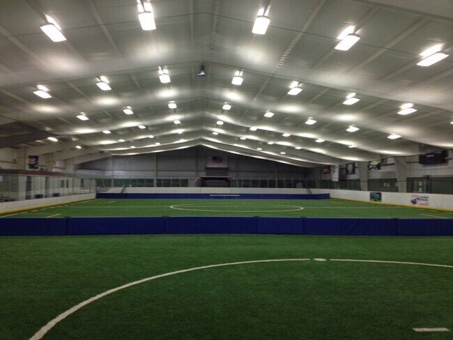
Commercialnec
Tom Green
B and X Area of moderate flood hazard, usually the area between the limits of the 100-year and 500-year floods.
Texas
2025
6.72 AC
2025
Texas West Area
000801
Other Market Areas
192 SF
San Angelo, TX
NEARBY LISTINGS FOR SALE OR LEASE
DEMOGRAPHICS near 6033 Loop 306 S
1 mile
3 mile
5 mile
2025 Total Population
351
1,027
19,254
2030 Population
355
1,037
19,905
Pop Growth 2025-2030
+ 1.14%
+ 0.97%
+ 3.38%
Average Age
41
41
35
2025 Total Households
126
366
6,896
HH Growth 2025-2030
+ 0.79%
+ 0.82%
+ 4.12%
Median Household Inc
$100,446
$100,162
$68,807
Avg Household Size
2.80
2.80
2.50
2025 Avg HH Vehicles
2.00
2.00
2.00
Median Home Value
$287,499
$305,147
$180,247
Median Year Built
1981
1982
1985
Nearby Places
Map Layers
Map Styles
 Street
 Aerial
Layers
 Traffic
 Biking
Places
Listings with unknown addresses are not visible on the map
- Restaurants
- Banks
- Shops
- Fitness
- Groceries
PUBLIC TRANSPORTATION
AIRPORT
San Angelo Regional/Mathis Field
Drive
Walk
Distance
San Angelo Regional/Mathis Field
20 min
12.5 mi
SALE & LEASE HISTORY
LISTING DATE
SALE/LEASE

Sep 25, 2016
For Lease
Nearby Properties
Address
Land Use
TOTAL SIZE
Lot Size
Zoning
Address
Land Use
TOTAL SIZE
Lot Size
Zoning
264,935 SF
20.26 AC
Address
Land Use
TOTAL SIZE
Lot Size
Zoning
1,216 SF
64.91 AC
Address
Land Use
TOTAL SIZE
Lot Size
Zoning
19,238 SF
4 AC
Address
Land Use
TOTAL SIZE
Lot Size
Zoning
330.06 AC
Address
Land Use
TOTAL SIZE
Lot Size
Zoning
6,420 SF
8.50 AC
Address
Land Use
TOTAL SIZE
Lot Size
Zoning
1,596 SF
310.73 AC
Address
Land Use
TOTAL SIZE
Lot Size
Zoning
1,600 SF
6.72 AC
Address
Land Use
TOTAL SIZE
Lot Size
Zoning
Address
Land Use
TOTAL SIZE
Lot Size
Zoning
8,000 SF
5.01 AC
Address
Land Use
TOTAL SIZE
Lot Size
Zoning
165.85 AC
Address
Land Use
TOTAL SIZE
Lot Size
Zoning
158.50 AC
Address
Land Use
TOTAL SIZE
Lot Size
Zoning
154.52 AC
Address
Land Use
TOTAL SIZE
Lot Size
Zoning
169.69 AC
Address
Land Use
TOTAL SIZE
Lot Size
Zoning
600 SF
91.46 AC
Address
Land Use
TOTAL SIZE
Lot Size
Zoning
1,600 SF
3 AC
Address
Land Use
TOTAL SIZE
Lot Size
Zoning
1,825 SF
154.53 AC
Address
Land Use
TOTAL SIZE
Lot Size
Zoning
3,000 SF
8.14 AC
Address
Land Use
TOTAL SIZE
Lot Size
Zoning
7,500 SF
5.40 AC
Address
Land Use
TOTAL SIZE
Lot Size
Zoning
331.10 AC
Address
Land Use
TOTAL SIZE
Lot Size
Zoning
720 SF
331.10 AC
Address
Land Use
TOTAL SIZE
Lot Size
Zoning
2,400 SF
82.43 AC
Address
Land Use
TOTAL SIZE
Lot Size
Zoning
4,212 SF
78.96 AC
Address
Land Use
TOTAL SIZE
Lot Size
Zoning
119.61 AC
Address
Land Use
TOTAL SIZE
Lot Size
Zoning
2.40 AC
Address
Land Use
TOTAL SIZE
Lot Size
Zoning
750 SF
2.31 AC
Address
Land Use
TOTAL SIZE
Lot Size
Zoning
73.53 AC
Address
Land Use
TOTAL SIZE
Lot Size
Zoning
2,777 SF
1.95 AC
The World's #1 Commercial Real Estate Marketplace
Connect with us
© 2026 CoStar Group
The information above has been obtained from sources believed reliable. While we do not doubt its accuracy we have not verified it and make no guarantee, warranty or representation about it. It is your responsibility to independently confirm its accuracy and completeness. Any projections, opinions, assumptions, or estimates used are for example only and do not represent the current or future performance of the property. The value of this transaction to you depends on tax and other factors which should be evaluated by your tax, financial, and legal advisors. You and your advisors should conduct a careful, independent investigation of the property to determine to your satisfaction the suitability of the property for your needs.