Property Record
6033 N Milwaukee Ave, Chicago, IL 60646

NEARBY LISTINGS FOR SALE OR LEASE
Property Detail
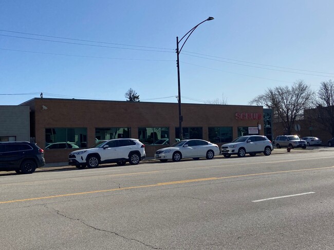
6033 N Milwaukee Ave
Chicago-Naperville-Elgin, IL-IN
Murdock James &Cos Milwaukee
13-05-126-030-0000
(MURDOCK) (JAMES) &COS (MILWAUKEE) AVE ADD A SUB OF L T4 & PT LTS5-6 IN ASSESSORS DIVN OF NE & NW SEC 04-40-13
Commercialbuilding
Cook
X
Illinois
17031C0385J
5,6
2023
0.53 AC
2025
Northwest City
100100
Chicago
DEMOGRAPHICS near 6033 N Milwaukee Ave
1 Mile
3 Mile
5 Mile
2024 Total Population
20,312
202,116
683,540
2029 Population
19,164
193,746
653,222
Pop Growth 2024-2029
(5.65%)
(4.14%)
(4.44%)
Average Age
43
43
41
2024 Total Households
8,025
76,775
249,461
HH Growth 2024-2029
(6.16%)
(4.51%)
(4.76%)
Median Household Inc
$99,988
$90,538
$79,021
Avg Household Size
2.40
2.50
2.60
2024 Avg HH Vehicles
2.00
2.00
2.00
Median Home Value
$386,928
$369,813
$352,549
Median Year Built
1949
1954
1952
Nearby Places
Map Layers
Map Styles
 Street
 Aerial
- Restaurants
- Banks
- Shops
- Fitness
- Groceries
PUBLIC TRANSPORTATION
COMMUTER RAIL
Gladstone Park Station (Union Pacific Northwest Line - Northeast Illinois Regional Commuter Railroad (Metra))
DRIVE
WALK
Distance
Gladstone Park Station (Union Pacific Northwest Line - Northeast Illinois Regional Commuter Railroad (Metra))
2 min
17 min
0.9 mi
Norwood Park Station (Union Pacific Northwest Line - Northeast Illinois Regional Commuter Railroad (Metra))
DRIVE
WALK
Distance
Norwood Park Station (Union Pacific Northwest Line - Northeast Illinois Regional Commuter Railroad (Metra))
5 min
1.3 mi
AIRPORT
Chicago O'Hare International
DRIVE
WALK
Distance
Chicago O'Hare International
37 min
11.8 mi
Chicago Midway International
DRIVE
WALK
Distance
Chicago Midway International
32 min
16.7 mi
SALE & LEASE HISTORY
LISTING DATE
SALE/LEASE

Mar 12, 2021
For Sale
Nearby Properties
Address
Land Use
TOTAL SIZE
Lot Size
Zoning
Address
Land Use
TOTAL SIZE
Lot Size
Zoning
240,942 SF
15.94 AC
PD 72
Address
Land Use
TOTAL SIZE
Lot Size
Zoning
203,090 SF
7.96 AC
Address
Land Use
TOTAL SIZE
Lot Size
Zoning
24.49 AC
Address
Land Use
TOTAL SIZE
Lot Size
Zoning
9.90 AC
Address
Land Use
TOTAL SIZE
Lot Size
Zoning
Address
Land Use
TOTAL SIZE
Lot Size
Zoning
414,878 SF
20.79 AC
Address
Land Use
TOTAL SIZE
Lot Size
Zoning
10.24 AC
Address
Land Use
TOTAL SIZE
Lot Size
Zoning
16.27 AC
Address
Land Use
TOTAL SIZE
Lot Size
Zoning
21.56 AC
RS-2
Address
Land Use
TOTAL SIZE
Lot Size
Zoning
9.38 AC
PD 1179,PO
Address
Land Use
TOTAL SIZE
Lot Size
Zoning
315,373 SF
26.19 AC
Address
Land Use
TOTAL SIZE
Lot Size
Zoning
92,457 SF
4.09 AC
Address
Land Use
TOTAL SIZE
Lot Size
Zoning
43,765 SF
2.79 AC
Address
Land Use
TOTAL SIZE
Lot Size
Zoning
486,884 SF
16.41 AC
Address
Land Use
TOTAL SIZE
Lot Size
Zoning
269,500 SF
11.03 AC
Address
Land Use
TOTAL SIZE
Lot Size
Zoning
100,900 SF
4.85 AC
PD 1415
Address
Land Use
TOTAL SIZE
Lot Size
Zoning
5.60 AC
Address
Land Use
TOTAL SIZE
Lot Size
Zoning
19.42 AC
Address
Land Use
TOTAL SIZE
Lot Size
Zoning
351,666 SF
12.78 AC
Address
Land Use
TOTAL SIZE
Lot Size
Zoning
629,244 SF
11.07 AC
RS-2
Address
Land Use
TOTAL SIZE
Lot Size
Zoning
43,750 SF
1.19 AC
B1-1
Address
Land Use
TOTAL SIZE
Lot Size
Zoning
320,535 SF
12.44 AC
Address
Land Use
TOTAL SIZE
Lot Size
Zoning
167,156 SF
6.23 AC
B3-1
Address
Land Use
TOTAL SIZE
Lot Size
Zoning
95,614 SF
4.20 AC
Address
Land Use
TOTAL SIZE
Lot Size
Zoning
358,324 SF
16.05 AC
Address
Land Use
TOTAL SIZE
Lot Size
Zoning
302,379 SF
10.74 AC
Address
Land Use
TOTAL SIZE
Lot Size
Zoning
337,330 SF
18.94 AC
Address
Land Use
TOTAL SIZE
Lot Size
Zoning
333,078 SF
9.15 AC
Address
Land Use
TOTAL SIZE
Lot Size
Zoning
142,431 SF
3 AC
Address
Land Use
TOTAL SIZE
Lot Size
Zoning
227,894 SF
13.32 AC
The World's #1 Commercial Real Estate Marketplace
Connect with us
© 2026 CoStar Group
The information above has been obtained from sources believed reliable. While we do not doubt its accuracy we have not verified it and make no guarantee, warranty or representation about it. It is your responsibility to independently confirm its accuracy and completeness. Any projections, opinions, assumptions, or estimates used are for example only and do not represent the current or future performance of the property. The value of this transaction to you depends on tax and other factors which should be evaluated by your tax, financial, and legal advisors. You and your advisors should conduct a careful, independent investigation of the property to determine to your satisfaction the suitability of the property for your needs.