Property Record
6036 S 7Th Ave, Phoenix, AZ 85041


Property Detail
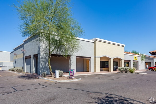
6036 S 7Th Ave
105-83-392
7TH AVENUE AND SOUTHERN MCR 795-15
Regionalshoppingcenterormallwithanchorstore
MARICOPA
C-C
Arizona
C and X Area of minimal flood hazard, usually depicted on FIRMs as above the 500-year flood level.
1
2025
8.71 AC
2025
South Phoenix
116615
Phoenix
76,254 SF
Phoenix-Mesa-Chandler, AZ
NEARBY LISTINGS FOR SALE OR LEASE
DEMOGRAPHICS near 6036 S 7Th Ave
1 mile
3 mile
5 mile
2025 Total Population
23,092
111,326
215,865
2030 Population
24,159
116,417
226,504
Pop Growth 2025-2030
+ 4.62%
+ 4.57%
+ 4.93%
Average Age
34
35
35
2025 Total Households
6,549
33,192
69,418
HH Growth 2025-2030
+ 4.69%
+ 4.60%
+ 5.23%
Median Household Inc
$59,843
$71,336
$68,484
Avg Household Size
3.40
3.20
2.90
2025 Avg HH Vehicles
2.00
2.00
2.00
Median Home Value
$353,684
$378,834
$391,244
Median Year Built
1985
1997
1997
Nearby Places
Map Layers
Map Styles
 Street
 Aerial
Layers
 Traffic
 Biking
Places
Listings with unknown addresses are not visible on the map
- Restaurants
- Banks
- Shops
- Fitness
- Groceries
PUBLIC TRANSPORTATION
AIRPORT
Phoenix Sky Harbor International
Drive
Walk
Distance
Phoenix Sky Harbor International
17 min
8.4 mi
Phoenix-Mesa Gateway
Drive
Walk
Distance
Phoenix-Mesa Gateway
45 min
30.1 mi
Freight Ports
Port of San Diego
Drive
Walk
Distance
Port of San Diego
403 min
359.0 mi
Nearby Properties
Address
Land Use
TOTAL SIZE
Lot Size
Zoning
Address
Land Use
TOTAL SIZE
Lot Size
Zoning
182,984 SF
146.12 AC
I-1
Address
Land Use
TOTAL SIZE
Lot Size
Zoning
10,776 SF
10.14 AC
C-C
Address
Land Use
TOTAL SIZE
Lot Size
Zoning
47,597 SF
22.74 AC
R-43
Address
Land Use
TOTAL SIZE
Lot Size
Zoning
10 SF
644.14 AC
R-35
Address
Land Use
TOTAL SIZE
Lot Size
Zoning
25,289 SF
2.70 AC
I-2
Address
Land Use
TOTAL SIZE
Lot Size
Zoning
369,723 SF
19.41 AC
R3
Address
Land Use
TOTAL SIZE
Lot Size
Zoning
34,520 SF
1.79 AC
C-G
Address
Land Use
TOTAL SIZE
Lot Size
Zoning
558,712 SF
30.72 AC
A2
Address
Land Use
TOTAL SIZE
Lot Size
Zoning
391,630 SF
23 AC
A-1
Address
Land Use
TOTAL SIZE
Lot Size
Zoning
51,000 SF
0.87 AC
C-G
Address
Land Use
TOTAL SIZE
Lot Size
Zoning
398,815 SF
12.72 AC
C2
Address
Land Use
TOTAL SIZE
Lot Size
Zoning
6.55 AC
C-G
Address
Land Use
TOTAL SIZE
Lot Size
Zoning
121,410 SF
10.65 AC
R-6
Address
Land Use
TOTAL SIZE
Lot Size
Zoning
205,550 SF
27.37 AC
R-6
Address
Land Use
TOTAL SIZE
Lot Size
Zoning
66,100 SF
52.74 AC
I-2
Address
Land Use
TOTAL SIZE
Lot Size
Zoning
70,152 SF
180.34 AC
RE35
Address
Land Use
TOTAL SIZE
Lot Size
Zoning
119,393 SF
13.99 AC
C1
Address
Land Use
TOTAL SIZE
Lot Size
Zoning
180,057 SF
40 AC
I-2
Address
Land Use
TOTAL SIZE
Lot Size
Zoning
91,949 SF
19.14 AC
R-43
Address
Land Use
TOTAL SIZE
Lot Size
Zoning
87,690 SF
9.31 AC
R-6
Address
Land Use
TOTAL SIZE
Lot Size
Zoning
93,600 SF
51.60 AC
A2
Address
Land Use
TOTAL SIZE
Lot Size
Zoning
220,649 SF
14.34 AC
I-2
Address
Land Use
TOTAL SIZE
Lot Size
Zoning
91,063 SF
12 AC
R-43AG
Address
Land Use
TOTAL SIZE
Lot Size
Zoning
186,437 SF
17.85 AC
PAD-HD
Address
Land Use
TOTAL SIZE
Lot Size
Zoning
139,410 SF
14.41 AC
C-C
Address
Land Use
TOTAL SIZE
Lot Size
Zoning
118,842 SF
5.10 AC
R3
Address
Land Use
TOTAL SIZE
Lot Size
Zoning
8,880 SF
1.99 AC
I-2
Address
Land Use
TOTAL SIZE
Lot Size
Zoning
254,284 SF
9.47 AC
Address
Land Use
TOTAL SIZE
Lot Size
Zoning
58,603 SF
12.15 AC
R-43AG
Address
Land Use
TOTAL SIZE
Lot Size
Zoning
275,703 SF
18.08 AC
The World's #1 Commercial Real Estate Marketplace
Connect with us
© 2026 CoStar Group
The information above has been obtained from sources believed reliable. While we do not doubt its accuracy we have not verified it and make no guarantee, warranty or representation about it. It is your responsibility to independently confirm its accuracy and completeness. Any projections, opinions, assumptions, or estimates used are for example only and do not represent the current or future performance of the property. The value of this transaction to you depends on tax and other factors which should be evaluated by your tax, financial, and legal advisors. You and your advisors should conduct a careful, independent investigation of the property to determine to your satisfaction the suitability of the property for your needs.