Property Record
604 E Main St, Geronimo, OK 73543
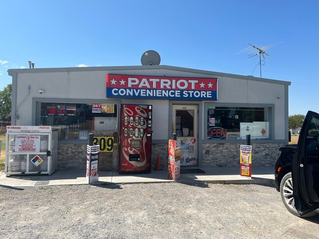
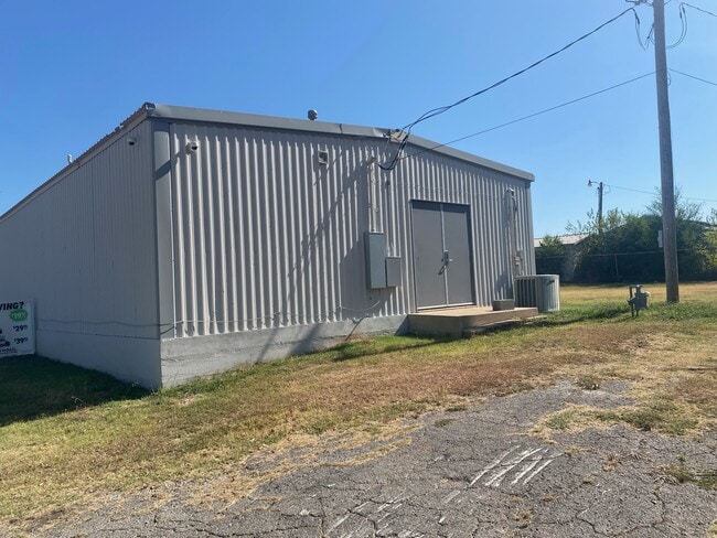
Property Detail
604 E Main St
Lawton, OK
GREATER GERONIMO BLK 13 LOT 13
0032697
COMANCHE
Commercialacreage
Oklahoma
B and X Area of moderate flood hazard, usually the area between the limits of the 100-year and 500-year floods.
13
2025
0.07 AC
2025
Oklahoma West Area
002301
Other Market Areas
NEARBY LISTINGS FOR SALE OR LEASE
DEMOGRAPHICS near 604 E Main St
1 mile
3 mile
5 mile
2024 Total Population
1,197
1,704
2,297
2029 Population
1,219
1,731
2,319
Pop Growth 2024-2029
+ 1.84%
+ 1.58%
+ 0.96%
Average Age
38
39
40
2024 Total Households
443
615
744
HH Growth 2024-2029
+ 1.81%
+ 1.46%
+ 1.08%
Median Household Inc
$78,448
$78,313
$77,696
Avg Household Size
2.70
2.70
2.70
2024 Avg HH Vehicles
3.00
3.00
3.00
Median Home Value
$146,907
$151,071
$159,171
Median Year Built
1990
1989
1989
Nearby Places
Map Layers
Map Styles
 Street
 Aerial
Transit
 Traffic
 Biking
Places
Listings with unknown addresses are not visible on the map
- Restaurants
- Banks
- Shops
- Fitness
- Groceries
PUBLIC TRANSPORTATION
AIRPORT
Lawton-Fort Sill Regional
Drive
Walk
Distance
Lawton-Fort Sill Regional
23 min
8.1 mi
Freight Ports
Tulsa Port Of Catoosa
Drive
Walk
Distance
Tulsa Port Of Catoosa
238 min
219.9 mi
SALE & LEASE HISTORY
LISTING DATE
SALE/LEASE

Mar 30, 2017
For Sale
Jan 08, 2025
For Sale
Aug 16, 2024
For Sale
Nearby Properties
Address
Land Use
TOTAL SIZE
Lot Size
Zoning
Address
Land Use
TOTAL SIZE
Lot Size
Zoning
9,173 SF
2.08 AC
Address
Land Use
TOTAL SIZE
Lot Size
Zoning
3,288 SF
0.16 AC
Address
Land Use
TOTAL SIZE
Lot Size
Zoning
5,000 SF
2.08 AC
Address
Land Use
TOTAL SIZE
Lot Size
Zoning
1,200 SF
2.40 AC
Address
Land Use
TOTAL SIZE
Lot Size
Zoning
7,500 SF
8.87 AC
Address
Land Use
TOTAL SIZE
Lot Size
Zoning
4,400 SF
10.14 AC
Address
Land Use
TOTAL SIZE
Lot Size
Zoning
2,400 SF
5 AC
Address
Land Use
TOTAL SIZE
Lot Size
Zoning
38.95 AC
Address
Land Use
TOTAL SIZE
Lot Size
Zoning
320 SF
10 AC
Address
Land Use
TOTAL SIZE
Lot Size
Zoning
135.37 AC
Address
Land Use
TOTAL SIZE
Lot Size
Zoning
100 SF
0.50 AC
Address
Land Use
TOTAL SIZE
Lot Size
Zoning
Address
Land Use
TOTAL SIZE
Lot Size
Zoning
0.51 AC
Address
Land Use
TOTAL SIZE
Lot Size
Zoning
167.40 AC
Address
Land Use
TOTAL SIZE
Lot Size
Zoning
900 SF
0.10 AC
Address
Land Use
TOTAL SIZE
Lot Size
Zoning
2,400 SF
0.30 AC
Address
Land Use
TOTAL SIZE
Lot Size
Zoning
Address
Land Use
TOTAL SIZE
Lot Size
Zoning
1,800 SF
0.07 AC
Address
Land Use
TOTAL SIZE
Lot Size
Zoning
724 SF
0.16 AC
Address
Land Use
TOTAL SIZE
Lot Size
Zoning
0.21 AC
Address
Land Use
TOTAL SIZE
Lot Size
Zoning
4.97 AC
Address
Land Use
TOTAL SIZE
Lot Size
Zoning
480 SF
0.22 AC
Address
Land Use
TOTAL SIZE
Lot Size
Zoning
Address
Land Use
TOTAL SIZE
Lot Size
Zoning
1,720 SF
150 AC
Address
Land Use
TOTAL SIZE
Lot Size
Zoning
1.06 AC
Address
Land Use
TOTAL SIZE
Lot Size
Zoning
1.06 AC
Address
Land Use
TOTAL SIZE
Lot Size
Zoning
0.92 AC
Address
Land Use
TOTAL SIZE
Lot Size
Zoning
1.06 AC
Address
Land Use
TOTAL SIZE
Lot Size
Zoning
1.02 AC
Address
Land Use
TOTAL SIZE
Lot Size
Zoning
1.06 AC
The World's #1 Commercial Real Estate Marketplace
Connect with us
© 2026 CoStar Group
The information above has been obtained from sources believed reliable. While we do not doubt its accuracy we have not verified it and make no guarantee, warranty or representation about it. It is your responsibility to independently confirm its accuracy and completeness. Any projections, opinions, assumptions, or estimates used are for example only and do not represent the current or future performance of the property. The value of this transaction to you depends on tax and other factors which should be evaluated by your tax, financial, and legal advisors. You and your advisors should conduct a careful, independent investigation of the property to determine to your satisfaction the suitability of the property for your needs.