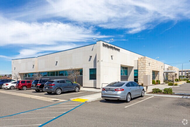
Property Record
604 N Magnolia Ave, Clovis, CA 93611


Current Lease Availabilities
Property Detail
604 N Magnolia Ave
564-050-31
2.66 AC PAR 2 BK 17 PG 57 IN SEC 34 T12R21
Medicalbuilding
Fresno
C2
California
B and X Area of moderate flood hazard, usually the area between the limits of the 100-year and 500-year floods.
2.66 AC
2025
Clovis
2025
Fresno
005907
Fresno, CA
25,431 SF
NEARBY LISTINGS FOR SALE OR LEASE
DEMOGRAPHICS near 604 N Magnolia Ave
1 mile
3 mile
5 mile
2025 Total Population
8,914
83,720
195,431
2030 Population
9,107
85,023
198,985
Pop Growth 2025-2030
+ 2.17%
+ 1.56%
+ 1.82%
Average Age
39
39
38
2025 Total Households
3,092
28,790
67,378
HH Growth 2025-2030
+ 2.33%
+ 1.56%
+ 1.79%
Median Household Inc
$115,013
$110,431
$97,888
Avg Household Size
2.90
2.90
2.80
2025 Avg HH Vehicles
2.00
2.00
2.00
Median Home Value
$461,395
$521,738
$482,165
Median Year Built
1996
1997
1994
Nearby Places
Map Layers
Map Styles
 Street
 Aerial
Layers
 Traffic
 Biking
Places
Listings with unknown addresses are not visible on the map
- Restaurants
- Banks
- Shops
- Fitness
- Groceries
PUBLIC TRANSPORTATION
AIRPORT
Fresno Yosemite International
Drive
Walk
Distance
Fresno Yosemite International
15 min
9.5 mi
Freight Ports
Port of Stockton
Drive
Walk
Distance
Port of Stockton
161 min
131.4 mi
Nearby Properties
Address
Land Use
TOTAL SIZE
Lot Size
Zoning
Address
Land Use
TOTAL SIZE
Lot Size
Zoning
397,556 SF
20.45 AC
CP
Address
Land Use
TOTAL SIZE
Lot Size
Zoning
110,872 SF
2.62 AC
CP
Address
Land Use
TOTAL SIZE
Lot Size
Zoning
165,476 SF
13.90 AC
CP
Address
Land Use
TOTAL SIZE
Lot Size
Zoning
249,818 SF
12.24 AC
PCC
Address
Land Use
TOTAL SIZE
Lot Size
Zoning
96,386 SF
8.47 AC
RT
Address
Land Use
TOTAL SIZE
Lot Size
Zoning
182,606 SF
6.51 AC
RA
Address
Land Use
TOTAL SIZE
Lot Size
Zoning
102,688 SF
10.59 AC
CP
Address
Land Use
TOTAL SIZE
Lot Size
Zoning
191,177 SF
19.19 AC
C2
Address
Land Use
TOTAL SIZE
Lot Size
Zoning
91,715 SF
4.50 AC
R3
Address
Land Use
TOTAL SIZE
Lot Size
Zoning
86,678 SF
4.16 AC
CP
Address
Land Use
TOTAL SIZE
Lot Size
Zoning
32,151 SF
14.84 AC
Address
Land Use
TOTAL SIZE
Lot Size
Zoning
67,465 SF
12.60 AC
C
Address
Land Use
TOTAL SIZE
Lot Size
Zoning
8.11 AC
Address
Land Use
TOTAL SIZE
Lot Size
Zoning
156,738 SF
12.05 AC
R3A
Address
Land Use
TOTAL SIZE
Lot Size
Zoning
86,136 SF
5.50 AC
M2
Address
Land Use
TOTAL SIZE
Lot Size
Zoning
124,728 SF
10.96 AC
R2
Address
Land Use
TOTAL SIZE
Lot Size
Zoning
30,149 SF
16.79 AC
CP
Address
Land Use
TOTAL SIZE
Lot Size
Zoning
114,460 SF
7.79 AC
R2
Address
Land Use
TOTAL SIZE
Lot Size
Zoning
57,695 SF
4.99 AC
R2A
Address
Land Use
TOTAL SIZE
Lot Size
Zoning
401,192 SF
0.01 AC
PCC
Address
Land Use
TOTAL SIZE
Lot Size
Zoning
123,120 SF
8.82 AC
RA
Address
Land Use
TOTAL SIZE
Lot Size
Zoning
110,784 SF
6.63 AC
Address
Land Use
TOTAL SIZE
Lot Size
Zoning
109,347 SF
9.12 AC
R3
Address
Land Use
TOTAL SIZE
Lot Size
Zoning
83,543 SF
6.79 AC
C2
Address
Land Use
TOTAL SIZE
Lot Size
Zoning
32,230 SF
7.76 AC
R2
Address
Land Use
TOTAL SIZE
Lot Size
Zoning
34,949 SF
2.69 AC
C2
Address
Land Use
TOTAL SIZE
Lot Size
Zoning
112,554 SF
7.76 AC
R3
Address
Land Use
TOTAL SIZE
Lot Size
Zoning
153,412 SF
9.11 AC
R3
The World's #1 Commercial Real Estate Marketplace
Connect with us
© 2026 CoStar Group
The information above has been obtained from sources believed reliable. While we do not doubt its accuracy we have not verified it and make no guarantee, warranty or representation about it. It is your responsibility to independently confirm its accuracy and completeness. Any projections, opinions, assumptions, or estimates used are for example only and do not represent the current or future performance of the property. The value of this transaction to you depends on tax and other factors which should be evaluated by your tax, financial, and legal advisors. You and your advisors should conduct a careful, independent investigation of the property to determine to your satisfaction the suitability of the property for your needs.