Property Record
604 Nautilus St, Panama City Beach, FL 32413


Save to a Folder
{{folder.Name}}
{{folder.ListingIds.length}} Properties
{{folder.ListingIds.length}} Property
Create a New Folder
Property Detail
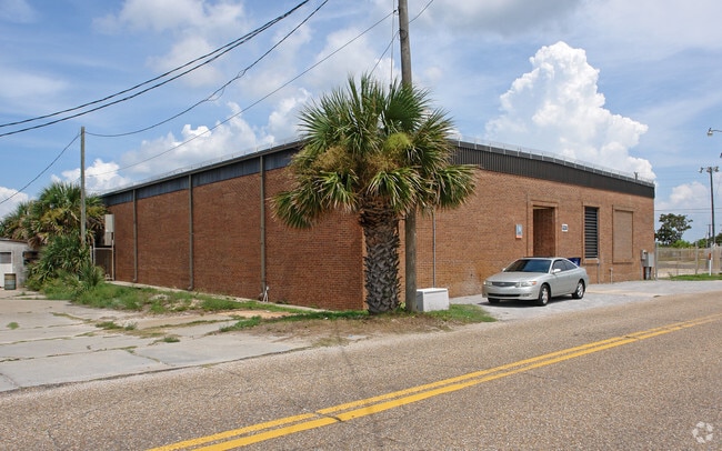
604 Nautilus St
34497-000-000
28 3S 16W -14-38B2 BEG NW COR BLK G BID-A-WEE SUB THWLY 40 ALONG S LINE MILCOE AVE FOR POB TH 90 DEG L 150 90 DEG R127 90 DEG R 150 90 DEG R 1 27 TO BEG PER DB 120 P 26 & PORTION OF ABANDONED RW OF MILLCOLE AVE ADJACENT TO NORTH SIDE (RES#2603)
Utilities
Bay
PCB22
Florida
B and X Area of moderate flood hazard, usually the area between the limits of the 100-year and 500-year floods.
0.44 AC
2024
Panama City
2025
Other Market Areas
002711
Panama City-Panama City Beach, FL
9,980 SF
NEARBY LISTINGS FOR SALE OR LEASE
DEMOGRAPHICS near 604 Nautilus St
1 mile
3 mile
5 mile
2025 Total Population
5,173
24,382
42,567
2030 Population
6,067
29,184
50,898
Pop Growth 2025-2030
+ 17.28%
+ 19.69%
+ 19.57%
Average Age
46
43
44
2025 Total Households
2,231
10,627
19,283
HH Growth 2025-2030
+ 17.66%
+ 20.30%
+ 20.24%
Median Household Inc
$80,456
$76,540
$73,407
Avg Household Size
2.30
2.20
2.20
2025 Avg HH Vehicles
2.00
2.00
2.00
Median Home Value
$406,118
$396,627
$398,754
Median Year Built
1995
2002
2001
Nearby Places
Map Layers
Map Styles
 Street
 Aerial
Layers
 Traffic
 Biking
Places
Listings with unknown addresses are not visible on the map
- Restaurants
- Banks
- Shops
- Fitness
- Groceries
PUBLIC TRANSPORTATION
AIRPORT
Northwest Florida Beaches International
Drive
Walk
Distance
Northwest Florida Beaches International
24 min
15.2 mi
Nearby Properties
Address
Land Use
TOTAL SIZE
Lot Size
Zoning
Address
Land Use
TOTAL SIZE
Lot Size
Zoning
309,733 SF
20.99 AC
PCB22
Address
Land Use
TOTAL SIZE
Lot Size
Zoning
253,262 SF
2.35 AC
PCB21
Address
Land Use
TOTAL SIZE
Lot Size
Zoning
357,678 SF
20 AC
BC01
Address
Land Use
TOTAL SIZE
Lot Size
Zoning
354,137 SF
20.13 AC
PCB22
Address
Land Use
TOTAL SIZE
Lot Size
Zoning
300,798 SF
46.27 AC
PCB22
Address
Land Use
TOTAL SIZE
Lot Size
Zoning
311,259 SF
19.63 AC
PCB22
Address
Land Use
TOTAL SIZE
Lot Size
Zoning
268,899 SF
25.84 AC
PCB22
Address
Land Use
TOTAL SIZE
Lot Size
Zoning
293,715 SF
18.13 AC
BC19
Address
Land Use
TOTAL SIZE
Lot Size
Zoning
171,019 SF
4.01 AC
PCB21
Address
Land Use
TOTAL SIZE
Lot Size
Zoning
328,049 SF
33.54 AC
PCB17
Address
Land Use
TOTAL SIZE
Lot Size
Zoning
257,839 SF
3.71 AC
PCB22
Address
Land Use
TOTAL SIZE
Lot Size
Zoning
264,562 SF
23.86 AC
BC05
Address
Land Use
TOTAL SIZE
Lot Size
Zoning
213,260 SF
6.45 AC
PCB22
Address
Land Use
TOTAL SIZE
Lot Size
Zoning
186,975 SF
4.12 AC
PCB21
Address
Land Use
TOTAL SIZE
Lot Size
Zoning
313,808 SF
121.61 AC
PCB24
Address
Land Use
TOTAL SIZE
Lot Size
Zoning
120,081 SF
1.53 AC
PCB21
Address
Land Use
TOTAL SIZE
Lot Size
Zoning
107,834 SF
5.39 AC
PCB21
Address
Land Use
TOTAL SIZE
Lot Size
Zoning
280,944 SF
34.17 AC
PCB09
Address
Land Use
TOTAL SIZE
Lot Size
Zoning
2,560 SF
8.26 AC
PCB10
Address
Land Use
TOTAL SIZE
Lot Size
Zoning
22,200 SF
88.65 AC
PCB09
Address
Land Use
TOTAL SIZE
Lot Size
Zoning
2,640 SF
30.77 AC
PCB22
Address
Land Use
TOTAL SIZE
Lot Size
Zoning
12,526 SF
101.10 AC
PCB10
Address
Land Use
TOTAL SIZE
Lot Size
Zoning
4,925 SF
2.07 AC
PCB21
Address
Land Use
TOTAL SIZE
Lot Size
Zoning
117,981 SF
10 AC
PCB22
Address
Land Use
TOTAL SIZE
Lot Size
Zoning
65.69 AC
PCB19
Address
Land Use
TOTAL SIZE
Lot Size
Zoning
118,757 SF
10.69 AC
BC05
Address
Land Use
TOTAL SIZE
Lot Size
Zoning
31,526 SF
34.68 AC
PCB03
Address
Land Use
TOTAL SIZE
Lot Size
Zoning
56,438 SF
2.08 AC
PCB21
Address
Land Use
TOTAL SIZE
Lot Size
Zoning
140,821 SF
9.98 AC
Address
Land Use
TOTAL SIZE
Lot Size
Zoning
176,759 SF
20 AC
PCB24
The World's #1 Commercial Real Estate Marketplace
Connect with us
© 2026 CoStar Group
The information above has been obtained from sources believed reliable. While we do not doubt its accuracy we have not verified it and make no guarantee, warranty or representation about it. It is your responsibility to independently confirm its accuracy and completeness. Any projections, opinions, assumptions, or estimates used are for example only and do not represent the current or future performance of the property. The value of this transaction to you depends on tax and other factors which should be evaluated by your tax, financial, and legal advisors. You and your advisors should conduct a careful, independent investigation of the property to determine to your satisfaction the suitability of the property for your needs.