Property Record
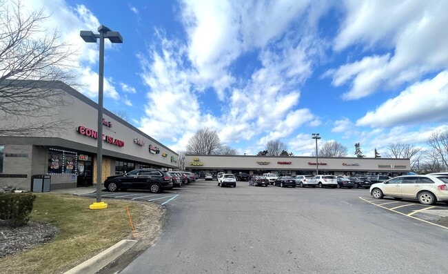
6040 Rawsonville Rd, Ypsilanti, MI 48198


NEARBY LISTINGS FOR SALE OR LEASE
Property Detail
6040 Rawsonville Rd
11-25-100-012
YP#25-3E-1A; BEG AT NE CORNER OF SEC 25; TH S 00-42-00 W ALONG THE EAST LINE OF SEC 25 WHICH IS ALSO THE C/L OF RAWSONVILLE
Commercialnec
Washtenaw
X
Michigan
26161C0435E
2.22 AC
0
Washtenaw E of 23
2025
Detroit
412000
Ann Arbor, MI
12,720 SF
DEMOGRAPHICS near 6040 Rawsonville Rd
1 Mile
3 Mile
5 Mile
2024 Total Population
2,506
34,247
93,069
2029 Population
2,480
33,723
91,506
Pop Growth 2024-2029
(1.04%)
(1.53%)
(1.68%)
Average Age
42
39
39
2024 Total Households
1,046
14,551
39,217
HH Growth 2024-2029
(0.96%)
(1.70%)
(1.79%)
Median Household Inc
$68,928
$64,995
$60,187
Avg Household Size
2.30
2.30
2.30
2024 Avg HH Vehicles
2.00
2.00
2.00
Median Home Value
$183,749
$187,564
$198,132
Median Year Built
1988
1976
1976
Nearby Places
Map Layers
Map Styles
 Street
 Aerial
- Restaurants
- Banks
- Shops
- Fitness
- Groceries
PUBLIC TRANSPORTATION
AIRPORT
Detroit Metro Wayne County
DRIVE
WALK
Distance
Detroit Metro Wayne County
15 min
13.4 mi
Freight Ports
Port of Baltimore
DRIVE
WALK
Distance
Port of Baltimore
1 min
416.4 mi
SALE & LEASE HISTORY
LISTING DATE
SALE/LEASE

Sep 24, 2016
For Lease
Jun 20, 2024
For Lease
Nearby Properties
Address
Land Use
TOTAL SIZE
Lot Size
Zoning
Address
Land Use
TOTAL SIZE
Lot Size
Zoning
277.73 AC
Address
Land Use
TOTAL SIZE
Lot Size
Zoning
38,001 SF
177.04 AC
BA
Address
Land Use
TOTAL SIZE
Lot Size
Zoning
432.42 AC
M2 GEN
Address
Land Use
TOTAL SIZE
Lot Size
Zoning
11,847 SF
91.35 AC
II
Address
Land Use
TOTAL SIZE
Lot Size
Zoning
97.69 AC
Address
Land Use
TOTAL SIZE
Lot Size
Zoning
19,692 SF
21.22 AC
BA
Address
Land Use
TOTAL SIZE
Lot Size
Zoning
206,958 SF
8.33 AC
AP
Address
Land Use
TOTAL SIZE
Lot Size
Zoning
198,549 SF
13.43 AC
RM MULT
Address
Land Use
TOTAL SIZE
Lot Size
Zoning
630,828 SF
62.51 AC
R1B
Address
Land Use
TOTAL SIZE
Lot Size
Zoning
196,044 SF
18.67 AC
RM MULT
Address
Land Use
TOTAL SIZE
Lot Size
Zoning
132,528 SF
5.91 AC
C2 EXT
Address
Land Use
TOTAL SIZE
Lot Size
Zoning
12,747 SF
17.90 AC
BA
Address
Land Use
TOTAL SIZE
Lot Size
Zoning
1,960 SF
59.97 AC
Address
Land Use
TOTAL SIZE
Lot Size
Zoning
889,111 SF
78.78 AC
Address
Land Use
TOTAL SIZE
Lot Size
Zoning
19,008 SF
9.68 AC
Address
Land Use
TOTAL SIZE
Lot Size
Zoning
4,636 SF
18.91 AC
Address
Land Use
TOTAL SIZE
Lot Size
Zoning
161,042 SF
26.29 AC
II
Address
Land Use
TOTAL SIZE
Lot Size
Zoning
140,677 SF
11.19 AC
RM MULT
Address
Land Use
TOTAL SIZE
Lot Size
Zoning
12,747 SF
7.37 AC
BA
Address
Land Use
TOTAL SIZE
Lot Size
Zoning
126,711 SF
12.74 AC
Address
Land Use
TOTAL SIZE
Lot Size
Zoning
12,316 SF
5.51 AC
BA
Address
Land Use
TOTAL SIZE
Lot Size
Zoning
29,610 SF
9.10 AC
BA
Address
Land Use
TOTAL SIZE
Lot Size
Zoning
158,744 SF
10.17 AC
RM MULT
Address
Land Use
TOTAL SIZE
Lot Size
Zoning
12,747 SF
6.25 AC
BA
Address
Land Use
TOTAL SIZE
Lot Size
Zoning
134,499 SF
6.20 AC
BA
Address
Land Use
TOTAL SIZE
Lot Size
Zoning
1,744 SF
41.75 AC
BI
Address
Land Use
TOTAL SIZE
Lot Size
Zoning
72,834 SF
4.97 AC
RM MULT
Address
Land Use
TOTAL SIZE
Lot Size
Zoning
1,680 SF
20 AC
II
Address
Land Use
TOTAL SIZE
Lot Size
Zoning
83,673 SF
8.22 AC
AP
Address
Land Use
TOTAL SIZE
Lot Size
Zoning
73,239 SF
6.18 AC
RM MULT
The World's #1 Commercial Real Estate Marketplace
Connect with us
© 2026 CoStar Group
The information above has been obtained from sources believed reliable. While we do not doubt its accuracy we have not verified it and make no guarantee, warranty or representation about it. It is your responsibility to independently confirm its accuracy and completeness. Any projections, opinions, assumptions, or estimates used are for example only and do not represent the current or future performance of the property. The value of this transaction to you depends on tax and other factors which should be evaluated by your tax, financial, and legal advisors. You and your advisors should conduct a careful, independent investigation of the property to determine to your satisfaction the suitability of the property for your needs.