Property Record
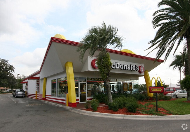
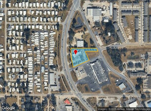
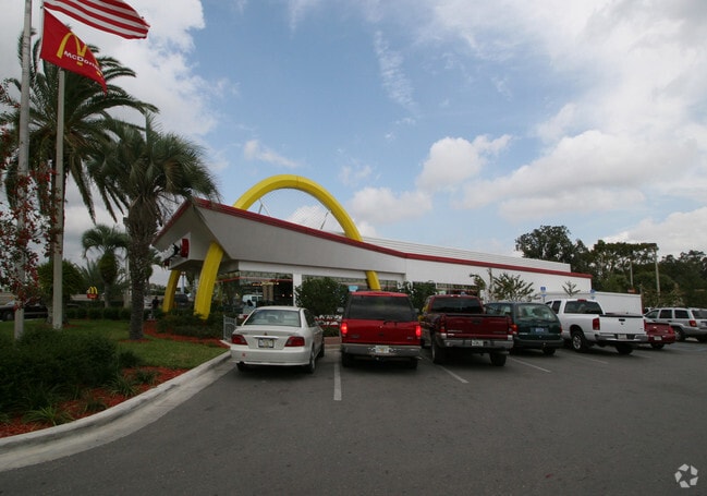
6042 Gall Blvd, Zephyrhills, FL 33542
NEARBY LISTINGS FOR SALE OR LEASE
Property Detail
6042 Gall Blvd
03-26-21-0010-11300-0000
Zephyrhills Colony Company
Restaurantdrivein
ZH COL SUB PB 1 PG 55 POR TR 113 LYING E OF US 301 DESC AS COM SE COR SEC TH N00DG 25MIN 50W 497.30 FT TO PT ON WLY R/W LN FORT KING RD TH N25DG 39MIN 30W 137.85 FT FOR POB TH W 177.53 FT TH S23DG 19MIN 56E 135.82 FT TH S65DG 25MIN 48W 242.20 FT TO P
X
Pasco
12101C0452F
Florida
2024
1.24 AC
2026
Pasco County
033009
Tampa/St Petersburg
3,998 SF
Tampa-St. Petersburg-Clearwater, FL
DEMOGRAPHICS near 6042 Gall Blvd
1 Mile
3 Mile
5 Mile
2024 Total Population
9,853
51,828
78,442
2029 Population
11,953
62,992
95,741
Pop Growth 2024-2029
+ 21.31%
+ 21.54%
+ 22.05%
Average Age
48
49
48
2024 Total Households
4,625
23,908
34,730
HH Growth 2024-2029
+ 21.36%
+ 21.65%
+ 22.01%
Median Household Inc
$42,390
$41,690
$45,819
Avg Household Size
2.10
2.10
2.20
2024 Avg HH Vehicles
1.00
2.00
2.00
Median Home Value
$136,231
$115,612
$132,771
Median Year Built
1980
1985
1988
Nearby Places
Map Layers
Map Styles
 Street
 Aerial
- Restaurants
- Banks
- Shops
- Fitness
- Groceries
PUBLIC TRANSPORTATION
AIRPORT
Tampa International
DRIVE
WALK
Distance
Tampa International
54 min
37.1 mi
Freight Ports
Port of Tampa Bay
DRIVE
WALK
Distance
Port of Tampa Bay
47 min
30.5 mi
Nearby Properties
Address
Land Use
TOTAL SIZE
Lot Size
Zoning
Address
Land Use
TOTAL SIZE
Lot Size
Zoning
245,602 SF
12.57 AC
MPUD
Address
Land Use
TOTAL SIZE
Lot Size
Zoning
273,092 SF
12.29 AC
R4
Address
Land Use
TOTAL SIZE
Lot Size
Zoning
352,321 SF
27.88 AC
OP
Address
Land Use
TOTAL SIZE
Lot Size
Zoning
610,631 SF
45.79 AC
LI
Address
Land Use
TOTAL SIZE
Lot Size
Zoning
199,367 SF
15.46 AC
R2
Address
Land Use
TOTAL SIZE
Lot Size
Zoning
162,278 SF
118.82 AC
AP2
Address
Land Use
TOTAL SIZE
Lot Size
Zoning
107,232 SF
12.79 AC
MPUD
Address
Land Use
TOTAL SIZE
Lot Size
Zoning
292,589 SF
52.57 AC
R3
Address
Land Use
TOTAL SIZE
Lot Size
Zoning
88,782 SF
4.09 AC
M1
Address
Land Use
TOTAL SIZE
Lot Size
Zoning
91,192 SF
3.40 AC
C2
Address
Land Use
TOTAL SIZE
Lot Size
Zoning
41,812 SF
255.72 AC
AP2
Address
Land Use
TOTAL SIZE
Lot Size
Zoning
216,202 SF
23.77 AC
C2
Address
Land Use
TOTAL SIZE
Lot Size
Zoning
21.81 AC
MPUD
Address
Land Use
TOTAL SIZE
Lot Size
Zoning
68,446 SF
3.54 AC
C2
Address
Land Use
TOTAL SIZE
Lot Size
Zoning
79,605 SF
3.13 AC
C2
Address
Land Use
TOTAL SIZE
Lot Size
Zoning
105,449 SF
5.14 AC
OP
Address
Land Use
TOTAL SIZE
Lot Size
Zoning
101.06 AC
MPUD
Address
Land Use
TOTAL SIZE
Lot Size
Zoning
60,759 SF
7.56 AC
C2
Address
Land Use
TOTAL SIZE
Lot Size
Zoning
32,076 SF
3.58 AC
PUD
Address
Land Use
TOTAL SIZE
Lot Size
Zoning
107,022 SF
13.27 AC
C2
Address
Land Use
TOTAL SIZE
Lot Size
Zoning
56,312 SF
8.85 AC
PUD
Address
Land Use
TOTAL SIZE
Lot Size
Zoning
94,412 SF
9.67 AC
C2
Address
Land Use
TOTAL SIZE
Lot Size
Zoning
62,320 SF
8.13 AC
R4
Address
Land Use
TOTAL SIZE
Lot Size
Zoning
76,015 SF
9.18 AC
C2
Address
Land Use
TOTAL SIZE
Lot Size
Zoning
143,626 SF
11.13 AC
R4
Address
Land Use
TOTAL SIZE
Lot Size
Zoning
61,636 SF
6.84 AC
C2
Address
Land Use
TOTAL SIZE
Lot Size
Zoning
131,274 SF
13.07 AC
R4
Address
Land Use
TOTAL SIZE
Lot Size
Zoning
123,959 SF
15.18 AC
C2
Address
Land Use
TOTAL SIZE
Lot Size
Zoning
72,183 SF
42.44 AC
R3
Address
Land Use
TOTAL SIZE
Lot Size
Zoning
67,222 SF
7.96 AC
C2
The World's #1 Commercial Real Estate Marketplace
Connect with us
© 2026 CoStar Group
The information above has been obtained from sources believed reliable. While we do not doubt its accuracy we have not verified it and make no guarantee, warranty or representation about it. It is your responsibility to independently confirm its accuracy and completeness. Any projections, opinions, assumptions, or estimates used are for example only and do not represent the current or future performance of the property. The value of this transaction to you depends on tax and other factors which should be evaluated by your tax, financial, and legal advisors. You and your advisors should conduct a careful, independent investigation of the property to determine to your satisfaction the suitability of the property for your needs.