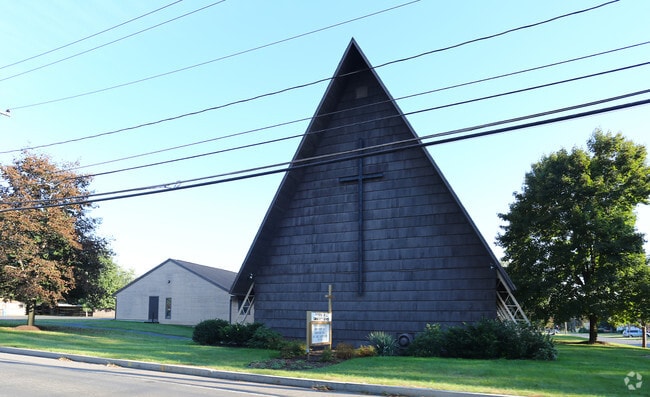
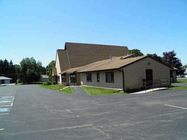
Property Record
605 Bailey Rd, Syracuse, NY 13212
Property Detail
605 Bailey Rd
314889-047-000-0003-009-000-0000
PITCHER HILL COMMUNITY CHURCH 0470309 47000011010060
Religious
Onondaga
02 - SINGL
New York
B and X Area of moderate flood hazard, usually the area between the limits of the 100-year and 500-year floods.
9.000
2025
0.54 AC
2025
NE Outer Onondaga County
013800
Syracuse
3,663 SF
Syracuse, NY
NEARBY LISTINGS FOR SALE OR LEASE
DEMOGRAPHICS near 605 Bailey Rd
1 mile
3 mile
5 mile
2025 Total Population
7,228
62,686
172,643
2030 Population
7,067
61,624
170,327
Pop Growth 2025-2030
(2.23%)
(1.69%)
(1.34%)
Average Age
45
42
40
2025 Total Households
3,168
27,530
75,810
HH Growth 2025-2030
(2.46%)
(1.77%)
(1.30%)
Median Household Inc
$80,832
$69,270
$63,694
Avg Household Size
2.20
2.20
2.20
2025 Avg HH Vehicles
2.00
2.00
1.00
Median Home Value
$183,595
$162,400
$167,683
Median Year Built
1965
1958
1958
Nearby Places
Map Layers
Map Styles
 Street
 Aerial
Layers
 Traffic
 Biking
Places
Listings with unknown addresses are not visible on the map
- Restaurants
- Banks
- Shops
- Fitness
- Groceries
PUBLIC TRANSPORTATION
AIRPORT
Syracuse Hancock International
Drive
Walk
Distance
Syracuse Hancock International
11 min
3.1 mi
SALE & LEASE HISTORY
LISTING DATE
SALE/LEASE

Sep 25, 2016
For Lease
Nearby Properties
Address
Land Use
TOTAL SIZE
Lot Size
Zoning
Address
Land Use
TOTAL SIZE
Lot Size
Zoning
110,105 SF
26.68 AC
06 - INDUS
Address
Land Use
TOTAL SIZE
Lot Size
Zoning
169,752 SF
12.81 AC
04 - FARM
Address
Land Use
TOTAL SIZE
Lot Size
Zoning
432,246 SF
37.21 AC
05 - COMME
Address
Land Use
TOTAL SIZE
Lot Size
Zoning
22.16 AC
06 - INDUS
Address
Land Use
TOTAL SIZE
Lot Size
Zoning
11,484 SF
16.36 AC
03 - MULTI
Address
Land Use
TOTAL SIZE
Lot Size
Zoning
2,025 SF
267.94 AC
06 - INDUS
Address
Land Use
TOTAL SIZE
Lot Size
Zoning
218,439 SF
18.85 AC
Address
Land Use
TOTAL SIZE
Lot Size
Zoning
77,150 SF
159.25 AC
06 - INDUS
Address
Land Use
TOTAL SIZE
Lot Size
Zoning
35,848 SF
1.68 AC
05 - COMME
Address
Land Use
TOTAL SIZE
Lot Size
Zoning
3,968 SF
14.31 AC
03 - MULTI
Address
Land Use
TOTAL SIZE
Lot Size
Zoning
7,229 SF
111.29 AC
05 - COMME
Address
Land Use
TOTAL SIZE
Lot Size
Zoning
11,952 SF
9.14 AC
03 - MULTI
Address
Land Use
TOTAL SIZE
Lot Size
Zoning
38,000 SF
9.90 AC
22
Address
Land Use
TOTAL SIZE
Lot Size
Zoning
3.59 AC
04 - FARM
Address
Land Use
TOTAL SIZE
Lot Size
Zoning
71,074 SF
27.78 AC
02 - SINGL
Address
Land Use
TOTAL SIZE
Lot Size
Zoning
78,656 SF
9.14 AC
06 - INDUS
Address
Land Use
TOTAL SIZE
Lot Size
Zoning
32,586 SF
6.87 AC
06 - INDUS
Address
Land Use
TOTAL SIZE
Lot Size
Zoning
112,608 SF
5.92 AC
02 - SINGL
Address
Land Use
TOTAL SIZE
Lot Size
Zoning
118,651 SF
12.27 AC
02 - SINGL
Address
Land Use
TOTAL SIZE
Lot Size
Zoning
17,240 SF
6.49 AC
03 - MULTI
Address
Land Use
TOTAL SIZE
Lot Size
Zoning
71,194 SF
10.76 AC
02 - SINGL
Address
Land Use
TOTAL SIZE
Lot Size
Zoning
109,642 SF
22.17 AC
06 - INDUS
Address
Land Use
TOTAL SIZE
Lot Size
Zoning
96,084 SF
8.74 AC
06 - INDUS
Address
Land Use
TOTAL SIZE
Lot Size
Zoning
66,476 SF
7.68 AC
03 - MULTI
Address
Land Use
TOTAL SIZE
Lot Size
Zoning
11,059 SF
8.23 AC
06 - INDUS
Address
Land Use
TOTAL SIZE
Lot Size
Zoning
120,000 SF
2.21 AC
22
Address
Land Use
TOTAL SIZE
Lot Size
Zoning
64,833 SF
3.25 AC
05 - COMME
Address
Land Use
TOTAL SIZE
Lot Size
Zoning
57,993 SF
16.80 AC
02 - SINGL
Address
Land Use
TOTAL SIZE
Lot Size
Zoning
1.66 AC
06 - INDUS
The World's #1 Commercial Real Estate Marketplace
Connect with us
© 2026 CoStar Group
The information above has been obtained from sources believed reliable. While we do not doubt its accuracy we have not verified it and make no guarantee, warranty or representation about it. It is your responsibility to independently confirm its accuracy and completeness. Any projections, opinions, assumptions, or estimates used are for example only and do not represent the current or future performance of the property. The value of this transaction to you depends on tax and other factors which should be evaluated by your tax, financial, and legal advisors. You and your advisors should conduct a careful, independent investigation of the property to determine to your satisfaction the suitability of the property for your needs.