Property Record
605 Elm St, Walpole, MA 02081


NEARBY LISTINGS FOR SALE OR LEASE
-
-
View all Walpole listings for sale on LoopNet.com
Property Detail
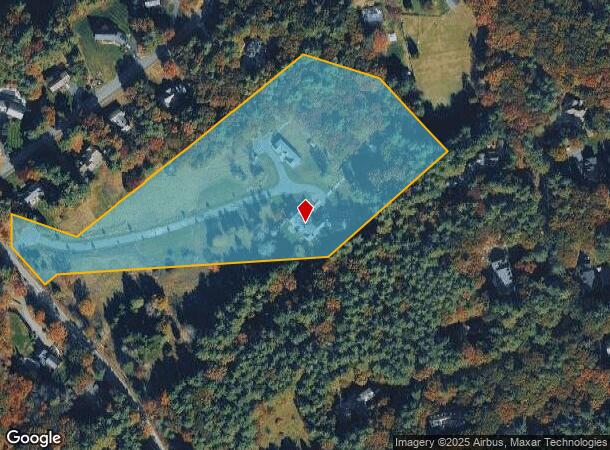
605 Elm St
WALP-000016-000028
Norfolk
Religious
Massachusetts
X
9.60 AC
25021C0167F
I-95 Corridor South
2024
Boston
2025
Boston-Cambridge-Newton, MA-NH
411302
DEMOGRAPHICS near 605 Elm St
1 Mile
3 Mile
5 Mile
2024 Total Population
2,428
36,167
94,330
2029 Population
2,413
36,250
93,907
Pop Growth 2024-2029
(0.62%)
+ 0.23%
(0.45%)
Average Age
40
41
41
2024 Total Households
767
12,989
34,921
HH Growth 2024-2029
(0.65%)
+ 0.34%
(0.51%)
Median Household Inc
$215,625
$144,285
$137,464
Avg Household Size
3.10
2.70
2.60
2024 Avg HH Vehicles
2.00
2.00
2.00
Median Home Value
$774,661
$704,180
$682,415
Median Year Built
1980
1974
1969
Nearby Places
Map Layers
Map Styles
 Street
 Aerial
- Restaurants
- Banks
- Shops
- Fitness
- Groceries
PUBLIC TRANSPORTATION
COMMUTER RAIL
Walpole (Foxboro Line (Special Events Only) - Massachusetts Bay Transportation Authority Commuter Rail (Purple Line), Franklin Line - Massachusetts Bay Transportation Authority Commuter Rail (Purple Line))
DRIVE
WALK
Distance
Walpole (Foxboro Line (Special Events Only) - Massachusetts Bay Transportation Authority Commuter Rail (Purple Line), Franklin Line - Massachusetts Bay Transportation Authority Commuter Rail (Purple Line))
4 min
1.8 mi
Windsor Gardens (Franklin Line - Massachusetts Bay Transportation Authority Commuter Rail (Purple Line))
DRIVE
WALK
Distance
Windsor Gardens (Franklin Line - Massachusetts Bay Transportation Authority Commuter Rail (Purple Line))
9 min
4.4 mi
AIRPORT
General Edward Lawrence Logan International
DRIVE
WALK
Distance
General Edward Lawrence Logan International
46 min
30.5 mi
Freight Ports
Port of Boston
DRIVE
WALK
Distance
Port of Boston
43 min
25.1 mi
SALE & LEASE HISTORY
LISTING DATE
SALE/LEASE

Jul 21, 2017
For Sale
Nearby Properties
Address
Land Use
TOTAL SIZE
Lot Size
Zoning
Address
Land Use
TOTAL SIZE
Lot Size
Zoning
61.50 AC
RS
Address
Land Use
TOTAL SIZE
Lot Size
Zoning
198,498 SF
14 AC
Address
Land Use
TOTAL SIZE
Lot Size
Zoning
97.60 AC
Address
Land Use
TOTAL SIZE
Lot Size
Zoning
245,693 SF
2.57 AC
Address
Land Use
TOTAL SIZE
Lot Size
Zoning
211,362 SF
2.39 AC
Address
Land Use
TOTAL SIZE
Lot Size
Zoning
89,960 SF
52.40 AC
Address
Land Use
TOTAL SIZE
Lot Size
Zoning
79,901 SF
11.46 AC
Address
Land Use
TOTAL SIZE
Lot Size
Zoning
11.98 AC
Address
Land Use
TOTAL SIZE
Lot Size
Zoning
117.30 AC
Address
Land Use
TOTAL SIZE
Lot Size
Zoning
48,693 SF
9.02 AC
Address
Land Use
TOTAL SIZE
Lot Size
Zoning
52,214 SF
20 AC
Address
Land Use
TOTAL SIZE
Lot Size
Zoning
93,218 SF
9.68 AC
LI
Address
Land Use
TOTAL SIZE
Lot Size
Zoning
64,887 SF
21.10 AC
Address
Land Use
TOTAL SIZE
Lot Size
Zoning
54,948 SF
11.43 AC
Address
Land Use
TOTAL SIZE
Lot Size
Zoning
12.65 AC
B
Address
Land Use
TOTAL SIZE
Lot Size
Zoning
147,984 SF
20.57 AC
Address
Land Use
TOTAL SIZE
Lot Size
Zoning
28,080 SF
2.80 AC
RU
Address
Land Use
TOTAL SIZE
Lot Size
Zoning
94,623 SF
8.17 AC
Address
Land Use
TOTAL SIZE
Lot Size
Zoning
91,891 SF
10.03 AC
B
Address
Land Use
TOTAL SIZE
Lot Size
Zoning
73,607 SF
11.70 AC
Address
Land Use
TOTAL SIZE
Lot Size
Zoning
65,190 SF
44.25 AC
RE
Address
Land Use
TOTAL SIZE
Lot Size
Zoning
61,880 SF
6.06 AC
Address
Land Use
TOTAL SIZE
Lot Size
Zoning
46,536 SF
1.64 AC
Address
Land Use
TOTAL SIZE
Lot Size
Zoning
19,654 SF
0.20 AC
Address
Land Use
TOTAL SIZE
Lot Size
Zoning
14.91 AC
RU
Address
Land Use
TOTAL SIZE
Lot Size
Zoning
3.01 AC
Address
Land Use
TOTAL SIZE
Lot Size
Zoning
9.15 AC
Address
Land Use
TOTAL SIZE
Lot Size
Zoning
9.93 AC
Address
Land Use
TOTAL SIZE
Lot Size
Zoning
4,480 SF
21.61 AC
RE
Address
Land Use
TOTAL SIZE
Lot Size
Zoning
21.39 AC
The World's #1 Commercial Real Estate Marketplace
Connect with us
© 2025 CoStar Group
The information above has been obtained from sources believed reliable. While we do not doubt its accuracy we have not verified it and make no guarantee, warranty or representation about it. It is your responsibility to independently confirm its accuracy and completeness. Any projections, opinions, assumptions, or estimates used are for example only and do not represent the current or future performance of the property. The value of this transaction to you depends on tax and other factors which should be evaluated by your tax, financial, and legal advisors. You and your advisors should conduct a careful, independent investigation of the property to determine to your satisfaction the suitability of the property for your needs.