Property Record
605 Pascack Rd, Paramus, NJ 07652
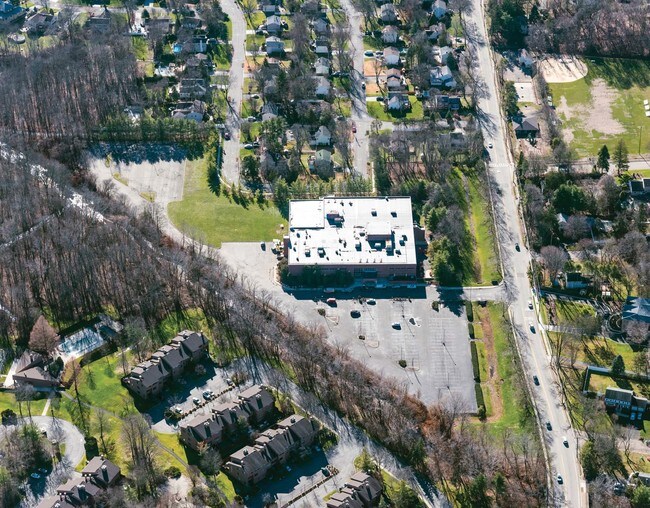

Property Detail
605 Pascack Rd
New York-Jersey City-White Plains, NY-NJ
9.7AC RECREATION CENTER
66-03202-01-00003
BERGEN
Religious
New Jersey
AE The base floodplain where base flood elevations are provided. AE Zones are now used on new format FIRMs instead of A1-A30 Zones.
3
0
9.70 AC
2025
North Central Bergen
042302
Northern New Jersey
NEARBY LISTINGS FOR SALE OR LEASE
-
-
View all Paramus listings for sale on LoopNet.com
DEMOGRAPHICS near 605 Pascack Rd
1 mile
3 mile
5 mile
2025 Total Population
11,897
91,668
261,403
2030 Population
12,321
94,981
270,529
Pop Growth 2025-2030
+ 3.56%
+ 3.61%
+ 3.49%
Average Age
44
43
43
2025 Total Households
4,192
31,352
90,444
HH Growth 2025-2030
+ 3.51%
+ 3.61%
+ 3.51%
Median Household Inc
$164,329
$173,059
$162,558
Avg Household Size
2.80
2.80
2.80
2025 Avg HH Vehicles
2.00
2.00
2.00
Median Home Value
$722,290
$757,896
$751,229
Median Year Built
1960
1958
1957
Nearby Places
Map Layers
Map Styles
 Street
 Aerial
Layers
 Traffic
 Biking
Places
Listings with unknown addresses are not visible on the map
- Restaurants
- Banks
- Shops
- Fitness
- Groceries
PUBLIC TRANSPORTATION
COMMUTER RAIL
Hillsdale (Pascack Valley Line - NJ Transit Commuter Rail (NJ Transit))
Drive
Walk
Distance
Hillsdale (Pascack Valley Line - NJ Transit Commuter Rail (NJ Transit))
5 min
1.7 mi
Westwood (Pascack Valley Line - NJ Transit Commuter Rail (NJ Transit))
Drive
Walk
Distance
Westwood (Pascack Valley Line - NJ Transit Commuter Rail (NJ Transit))
4 min
1.9 mi
AIRPORT
LaGuardia
Drive
Walk
Distance
LaGuardia
40 min
24.2 mi
Newark Liberty International
Drive
Walk
Distance
Newark Liberty International
34 min
26.3 mi
Westchester County
Drive
Walk
Distance
Westchester County
48 min
31.0 mi
Freight Ports
Maher Terminal
Drive
Walk
Distance
Maher Terminal
42 min
28.8 mi
SALE & LEASE HISTORY
LISTING DATE
SALE/LEASE

Sep 24, 2016
For Sale
Nearby Properties
Address
Land Use
TOTAL SIZE
Lot Size
Zoning
Address
Land Use
TOTAL SIZE
Lot Size
Zoning
45,191 SF
3.11 AC
BL
Address
Land Use
TOTAL SIZE
Lot Size
Zoning
15.57 AC
H
Address
Land Use
TOTAL SIZE
Lot Size
Zoning
62.88 AC
R100
Address
Land Use
TOTAL SIZE
Lot Size
Zoning
19.96 AC
HSO
Address
Land Use
TOTAL SIZE
Lot Size
Zoning
131,384 SF
65 AC
EO
Address
Land Use
TOTAL SIZE
Lot Size
Zoning
394,039 SF
24.31 AC
BG
Address
Land Use
TOTAL SIZE
Lot Size
Zoning
164,588 SF
14.60 AC
BG
Address
Land Use
TOTAL SIZE
Lot Size
Zoning
205,580 SF
21.18 AC
EO
Address
Land Use
TOTAL SIZE
Lot Size
Zoning
8.78 AC
HSO
Address
Land Use
TOTAL SIZE
Lot Size
Zoning
59 AC
AA
Address
Land Use
TOTAL SIZE
Lot Size
Zoning
23,572 SF
98.75 AC
CR
Address
Land Use
TOTAL SIZE
Lot Size
Zoning
205,856 SF
12.49 AC
BIL
Address
Land Use
TOTAL SIZE
Lot Size
Zoning
205,856 SF
12.12 AC
BIL
Address
Land Use
TOTAL SIZE
Lot Size
Zoning
306,046 SF
21.48 AC
Address
Land Use
TOTAL SIZE
Lot Size
Zoning
156,877 SF
12.60 AC
BG
Address
Land Use
TOTAL SIZE
Lot Size
Zoning
29,018 SF
4.40 AC
BG
Address
Land Use
TOTAL SIZE
Lot Size
Zoning
45,269 SF
5.66 AC
BG
Address
Land Use
TOTAL SIZE
Lot Size
Zoning
127,333 SF
8.30 AC
R100
Address
Land Use
TOTAL SIZE
Lot Size
Zoning
161,352 SF
14.02 AC
BG
Address
Land Use
TOTAL SIZE
Lot Size
Zoning
192,486 SF
11.82 AC
BL
Address
Land Use
TOTAL SIZE
Lot Size
Zoning
82.73 AC
Address
Land Use
TOTAL SIZE
Lot Size
Zoning
92,778 SF
8.86 AC
BIL
Address
Land Use
TOTAL SIZE
Lot Size
Zoning
21.74 AC
SC
Address
Land Use
TOTAL SIZE
Lot Size
Zoning
144,868 SF
11.14 AC
BG
Address
Land Use
TOTAL SIZE
Lot Size
Zoning
157,100 SF
11.84 AC
BG
Address
Land Use
TOTAL SIZE
Lot Size
Zoning
57,890 SF
26.61 AC
R100
Address
Land Use
TOTAL SIZE
Lot Size
Zoning
94,076 SF
7.57 AC
BIL
Address
Land Use
TOTAL SIZE
Lot Size
Zoning
9.58 AC
R125
Address
Land Use
TOTAL SIZE
Lot Size
Zoning
117,101 SF
25.06 AC
R100
Address
Land Use
TOTAL SIZE
Lot Size
Zoning
110,814 SF
10 AC
BG
The World's #1 Commercial Real Estate Marketplace
Connect with us
© 2026 CoStar Group
The information above has been obtained from sources believed reliable. While we do not doubt its accuracy we have not verified it and make no guarantee, warranty or representation about it. It is your responsibility to independently confirm its accuracy and completeness. Any projections, opinions, assumptions, or estimates used are for example only and do not represent the current or future performance of the property. The value of this transaction to you depends on tax and other factors which should be evaluated by your tax, financial, and legal advisors. You and your advisors should conduct a careful, independent investigation of the property to determine to your satisfaction the suitability of the property for your needs.