Property Record
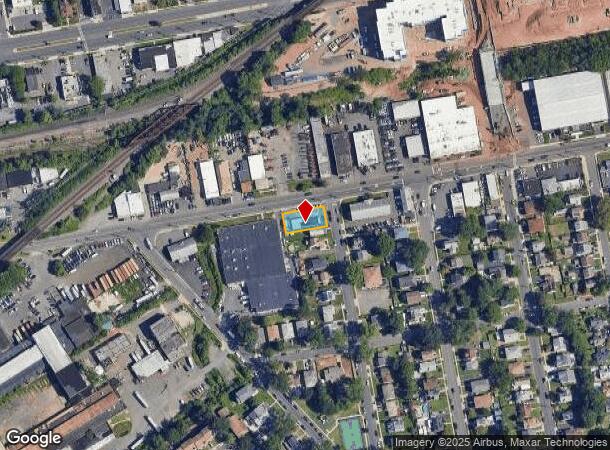
605 W 1St Ave, Roselle, NJ 07203


NEARBY LISTINGS FOR SALE OR LEASE
Property Detail
605 W 1St Ave
14-06502-0000-00003
ADDITIONAL LOTS: DEED 325006.
Transportationcommunicationsgeneral
Union
X
New Jersey
34013C0150F
3
2024
0.18 AC
2025
Parkway Cranford Corridor
034000
Northern New Jersey
1,907 SF
Newark, NJ-PA
DEMOGRAPHICS near 605 W 1St Ave
1 Mile
3 Mile
5 Mile
2024 Total Population
23,545
195,146
508,160
2029 Population
23,213
192,389
498,532
Pop Growth 2024-2029
(1.41%)
(1.41%)
(1.89%)
Average Age
41
41
40
2024 Total Households
8,871
70,441
179,811
HH Growth 2024-2029
(1.54%)
(1.46%)
(1.94%)
Median Household Inc
$85,209
$92,338
$85,103
Avg Household Size
2.60
2.70
2.70
2024 Avg HH Vehicles
2.00
2.00
2.00
Median Home Value
$379,290
$422,449
$429,136
Median Year Built
1955
1954
1956
Nearby Places
Map Layers
Map Styles
 Street
 Aerial
- Restaurants
- Banks
- Shops
- Fitness
- Groceries
PUBLIC TRANSPORTATION
COMMUTER RAIL
Roselle Park (Raritan Valley Line - NJ Transit Commuter Rail (NJ Transit))
DRIVE
WALK
Distance
Roselle Park (Raritan Valley Line - NJ Transit Commuter Rail (NJ Transit))
4 min
1.3 mi
Cranford (Raritan Valley Line - NJ Transit Commuter Rail (NJ Transit))
DRIVE
WALK
Distance
Cranford (Raritan Valley Line - NJ Transit Commuter Rail (NJ Transit))
3 min
1.5 mi
AIRPORT
Newark Liberty International
DRIVE
WALK
Distance
Newark Liberty International
14 min
11.3 mi
LaGuardia
DRIVE
WALK
Distance
LaGuardia
46 min
32.1 mi
John F Kennedy International
DRIVE
WALK
Distance
John F Kennedy International
54 min
35.0 mi
Freight Ports
New York Container Terminal
DRIVE
WALK
Distance
New York Container Terminal
1 min
5.3 mi
SALE & LEASE HISTORY
LISTING DATE
SALE/LEASE

May 17, 2019
For Sale
Mar 13, 2023
For Sale
Nearby Properties
Address
Land Use
TOTAL SIZE
Lot Size
Zoning
Address
Land Use
TOTAL SIZE
Lot Size
Zoning
107.41 AC
Address
Land Use
TOTAL SIZE
Lot Size
Zoning
Address
Land Use
TOTAL SIZE
Lot Size
Zoning
78.47 AC
Address
Land Use
TOTAL SIZE
Lot Size
Zoning
Address
Land Use
TOTAL SIZE
Lot Size
Zoning
8.43 AC
Address
Land Use
TOTAL SIZE
Lot Size
Zoning
29.03 AC
IL
Address
Land Use
TOTAL SIZE
Lot Size
Zoning
1 SF
117.50 AC
Address
Land Use
TOTAL SIZE
Lot Size
Zoning
151.20 AC
O
Address
Land Use
TOTAL SIZE
Lot Size
Zoning
0.82 AC
Address
Land Use
TOTAL SIZE
Lot Size
Zoning
3,538 SF
112 AC
Address
Land Use
TOTAL SIZE
Lot Size
Zoning
5.73 AC
Address
Land Use
TOTAL SIZE
Lot Size
Zoning
159,434 SF
11.93 AC
IL
Address
Land Use
TOTAL SIZE
Lot Size
Zoning
19.90 AC
P
Address
Land Use
TOTAL SIZE
Lot Size
Zoning
197 AC
RA
Address
Land Use
TOTAL SIZE
Lot Size
Zoning
182 SF
13.80 AC
Address
Land Use
TOTAL SIZE
Lot Size
Zoning
1.62 AC
Address
Land Use
TOTAL SIZE
Lot Size
Zoning
1.59 AC
Address
Land Use
TOTAL SIZE
Lot Size
Zoning
17,416 SF
19.42 AC
Address
Land Use
TOTAL SIZE
Lot Size
Zoning
253,287 SF
6.03 AC
Address
Land Use
TOTAL SIZE
Lot Size
Zoning
Address
Land Use
TOTAL SIZE
Lot Size
Zoning
4,700,000 SF
5.53 AC
Address
Land Use
TOTAL SIZE
Lot Size
Zoning
10.15 AC
RA
Address
Land Use
TOTAL SIZE
Lot Size
Zoning
238,948 SF
1.89 AC
Address
Land Use
TOTAL SIZE
Lot Size
Zoning
4.13 AC
Address
Land Use
TOTAL SIZE
Lot Size
Zoning
3.87 AC
CG
Address
Land Use
TOTAL SIZE
Lot Size
Zoning
1.45 AC
Address
Land Use
TOTAL SIZE
Lot Size
Zoning
Address
Land Use
TOTAL SIZE
Lot Size
Zoning
224.81 AC
Address
Land Use
TOTAL SIZE
Lot Size
Zoning
8.77 AC
Address
Land Use
TOTAL SIZE
Lot Size
Zoning
23.96 AC
The World's #1 Commercial Real Estate Marketplace
Connect with us
© 2025 CoStar Group
The information above has been obtained from sources believed reliable. While we do not doubt its accuracy we have not verified it and make no guarantee, warranty or representation about it. It is your responsibility to independently confirm its accuracy and completeness. Any projections, opinions, assumptions, or estimates used are for example only and do not represent the current or future performance of the property. The value of this transaction to you depends on tax and other factors which should be evaluated by your tax, financial, and legal advisors. You and your advisors should conduct a careful, independent investigation of the property to determine to your satisfaction the suitability of the property for your needs.