Property Record
6050 36Th St S, Fargo, ND 58104

NEARBY LISTINGS FOR SALE OR LEASE
Property Detail
6050 36Th St S
Other Market Areas
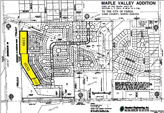
Maple Valley
Fargo, ND-MN
MAPLE VALLEY ADDN LT 21 BLK 6
01-8394-01830-000
Cass
Apartment
North Dakota
2021
21
2021
4.69 AC
0405002483
South Fargo
39,762 SF
DEMOGRAPHICS near 6050 36Th St S
1 Mile
3 Mile
5 Mile
2024 Total Population
4,575
43,645
119,352
2029 Population
4,964
47,018
127,887
Pop Growth 2024-2029
+ 8.50%
+ 7.73%
+ 7.15%
Average Age
35
35
35
2024 Total Households
1,804
17,537
50,231
HH Growth 2024-2029
+ 8.98%
+ 8.23%
+ 7.56%
Median Household Inc
$108,998
$81,730
$72,484
Avg Household Size
2.50
2.40
2.30
2024 Avg HH Vehicles
2.00
2.00
2.00
Median Home Value
$322,923
$306,725
$290,943
Median Year Built
2010
2006
2002
Nearby Places
Map Layers
Map Styles
 Street
 Aerial
- Restaurants
- Banks
- Shops
- Fitness
- Groceries
PUBLIC TRANSPORTATION
COMMUTER RAIL
Fargo Amtrak Station (Empire Builder - Amtrak)
DRIVE
WALK
Distance
Fargo Amtrak Station (Empire Builder - Amtrak)
18 min
8.3 mi
AIRPORT
Hector International
DRIVE
WALK
Distance
Hector International
22 min
12.1 mi
Freight Ports
Port Milwaukee
DRIVE
WALK
Distance
Port Milwaukee
636 min
576.6 mi
Nearby Properties
Address
Land Use
TOTAL SIZE
Lot Size
Zoning
Address
Land Use
TOTAL SIZE
Lot Size
Zoning
161,184 SF
10.51 AC
GC
Address
Land Use
TOTAL SIZE
Lot Size
Zoning
55.68 AC
Address
Land Use
TOTAL SIZE
Lot Size
Zoning
Address
Land Use
TOTAL SIZE
Lot Size
Zoning
7.66 AC
Address
Land Use
TOTAL SIZE
Lot Size
Zoning
64,653 SF
2.20 AC
MR3
Address
Land Use
TOTAL SIZE
Lot Size
Zoning
30,240 SF
1.54 AC
MR2
Address
Land Use
TOTAL SIZE
Lot Size
Zoning
217,776 SF
31.82 AC
GC
Address
Land Use
TOTAL SIZE
Lot Size
Zoning
122,201 SF
8.92 AC
GO
Address
Land Use
TOTAL SIZE
Lot Size
Zoning
191,151 SF
22.98 AC
LC
Address
Land Use
TOTAL SIZE
Lot Size
Zoning
387,326 SF
16.51 AC
GC
Address
Land Use
TOTAL SIZE
Lot Size
Zoning
88,956 SF
10.56 AC
GO
Address
Land Use
TOTAL SIZE
Lot Size
Zoning
160,913 SF
11.46 AC
GC
Address
Land Use
TOTAL SIZE
Lot Size
Zoning
Address
Land Use
TOTAL SIZE
Lot Size
Zoning
42,476 SF
2.07 AC
MR1
Address
Land Use
TOTAL SIZE
Lot Size
Zoning
3.72 AC
Address
Land Use
TOTAL SIZE
Lot Size
Zoning
44,851 SF
19 AC
LI
Address
Land Use
TOTAL SIZE
Lot Size
Zoning
38,325 SF
465,408 AC
MR3
Address
Land Use
TOTAL SIZE
Lot Size
Zoning
54,870 SF
5.43 AC
MR3
Address
Land Use
TOTAL SIZE
Lot Size
Zoning
165,824 SF
5.38 AC
MR1
Address
Land Use
TOTAL SIZE
Lot Size
Zoning
Address
Land Use
TOTAL SIZE
Lot Size
Zoning
75,600 SF
3.82 AC
LC
Address
Land Use
TOTAL SIZE
Lot Size
Zoning
Address
Land Use
TOTAL SIZE
Lot Size
Zoning
5.92 AC
Address
Land Use
TOTAL SIZE
Lot Size
Zoning
26,046 SF
1.38 AC
MR3
Address
Land Use
TOTAL SIZE
Lot Size
Zoning
166,453 SF
6.65 AC
MR3
Address
Land Use
TOTAL SIZE
Lot Size
Zoning
Address
Land Use
TOTAL SIZE
Lot Size
Zoning
41,698 SF
465,408 AC
MR3
Address
Land Use
TOTAL SIZE
Lot Size
Zoning
Address
Land Use
TOTAL SIZE
Lot Size
Zoning
68,590 SF
3.11 AC
MR3
Address
Land Use
TOTAL SIZE
Lot Size
Zoning
63,672 SF
7.91 AC
LC
The World's #1 Commercial Real Estate Marketplace
Connect with us
© 2025 CoStar Group
The information above has been obtained from sources believed reliable. While we do not doubt its accuracy we have not verified it and make no guarantee, warranty or representation about it. It is your responsibility to independently confirm its accuracy and completeness. Any projections, opinions, assumptions, or estimates used are for example only and do not represent the current or future performance of the property. The value of this transaction to you depends on tax and other factors which should be evaluated by your tax, financial, and legal advisors. You and your advisors should conduct a careful, independent investigation of the property to determine to your satisfaction the suitability of the property for your needs.