Property Record
6050 Perimeter Pkwy, Montgomery, AL 36116

NEARBY LISTINGS FOR SALE OR LEASE
-
-
View all Montgomery listings for lease on LoopNet.com
Property Detail
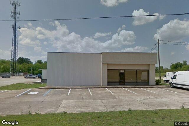
6050 Perimeter Pkwy
Montgomery, AL
Perimeter Park 1
15-01-01-4-000-004.005
1501014000004005
Publicstorage
Montgomery
X
Alabama
01101C0237H
3
2025
1.95 AC
2025
South Montgomery
005613
Montgomery
7,827 SF
DEMOGRAPHICS near 6050 Perimeter Pkwy
1 Mile
3 Mile
5 Mile
2024 Total Population
4,108
32,843
82,088
2029 Population
4,042
31,812
79,349
Pop Growth 2024-2029
(1.61%)
(3.14%)
(3.34%)
Average Age
33
36
38
2024 Total Households
1,539
13,699
34,366
HH Growth 2024-2029
(1.62%)
(3.24%)
(3.47%)
Median Household Inc
$62,980
$43,679
$55,905
Avg Household Size
2.60
2.30
2.30
2024 Avg HH Vehicles
2.00
2.00
2.00
Median Home Value
$149,833
$147,479
$176,532
Median Year Built
1995
1987
1986
Nearby Places
Map Layers
Map Styles
 Street
 Aerial
- Restaurants
- Banks
- Shops
- Fitness
- Groceries
PUBLIC TRANSPORTATION
AIRPORT
Montgomery Regional (Dannelly Field)
DRIVE
WALK
Distance
Montgomery Regional (Dannelly Field)
17 min
13.0 mi
Freight Ports
Port of Panama City
DRIVE
WALK
Distance
Port of Panama City
226 min
179.6 mi
SALE & LEASE HISTORY
LISTING DATE
SALE/LEASE

Aug 25, 2023
For Lease
Nearby Properties
Address
Land Use
TOTAL SIZE
Lot Size
Zoning
Address
Land Use
TOTAL SIZE
Lot Size
Zoning
4,998 SF
27.50 AC
R-65-M
Address
Land Use
TOTAL SIZE
Lot Size
Zoning
1,343 SF
31.75 AC
R-65-M
Address
Land Use
TOTAL SIZE
Lot Size
Zoning
47,292 SF
63.99 AC
Address
Land Use
TOTAL SIZE
Lot Size
Zoning
23,642 SF
13.70 AC
PUD
Address
Land Use
TOTAL SIZE
Lot Size
Zoning
1,554 SF
18.26 AC
R-75-M
Address
Land Use
TOTAL SIZE
Lot Size
Zoning
10,317 SF
16.70 AC
AGR-1
Address
Land Use
TOTAL SIZE
Lot Size
Zoning
164,528 SF
5.28 AC
B-3
Address
Land Use
TOTAL SIZE
Lot Size
Zoning
30,536 SF
18.06 AC
AGR-1
Address
Land Use
TOTAL SIZE
Lot Size
Zoning
56,446 SF
18.67 AC
PUD
Address
Land Use
TOTAL SIZE
Lot Size
Zoning
208,584 SF
21.10 AC
B-3
Address
Land Use
TOTAL SIZE
Lot Size
Zoning
21,634 SF
6.64 AC
Address
Land Use
TOTAL SIZE
Lot Size
Zoning
154,711 SF
31 AC
Address
Land Use
TOTAL SIZE
Lot Size
Zoning
3,312 SF
15.73 AC
R-65-M
Address
Land Use
TOTAL SIZE
Lot Size
Zoning
7,683 SF
8.11 AC
PUD
Address
Land Use
TOTAL SIZE
Lot Size
Zoning
14,409 SF
16.01 AC
B-3
Address
Land Use
TOTAL SIZE
Lot Size
Zoning
2,164 SF
7.50 AC
R-60-A
Address
Land Use
TOTAL SIZE
Lot Size
Zoning
113,108 SF
3.70 AC
B-3
Address
Land Use
TOTAL SIZE
Lot Size
Zoning
44,082 SF
5.95 AC
Address
Land Use
TOTAL SIZE
Lot Size
Zoning
1,747 SF
7 AC
R-65-M
Address
Land Use
TOTAL SIZE
Lot Size
Zoning
2,115 SF
11.90 AC
R-65-M
Address
Land Use
TOTAL SIZE
Lot Size
Zoning
918 SF
8.86 AC
R-65-M
Address
Land Use
TOTAL SIZE
Lot Size
Zoning
10,314 SF
6.92 AC
PUD
Address
Land Use
TOTAL SIZE
Lot Size
Zoning
13,369 SF
14 AC
B-3
Address
Land Use
TOTAL SIZE
Lot Size
Zoning
5,400 SF
12.61 AC
M-1
Address
Land Use
TOTAL SIZE
Lot Size
Zoning
8,580 SF
6.80 AC
R-65-M
Address
Land Use
TOTAL SIZE
Lot Size
Zoning
8,028 SF
12.50 AC
R-65-M
Address
Land Use
TOTAL SIZE
Lot Size
Zoning
6,866 SF
5.39 AC
PUD
Address
Land Use
TOTAL SIZE
Lot Size
Zoning
3,358 SF
123.85 AC
AGR-1
Address
Land Use
TOTAL SIZE
Lot Size
Zoning
12,226 SF
7 AC
B-3
Address
Land Use
TOTAL SIZE
Lot Size
Zoning
24,697 SF
20 AC
INST
The World's #1 Commercial Real Estate Marketplace
Connect with us
© 2026 CoStar Group
The information above has been obtained from sources believed reliable. While we do not doubt its accuracy we have not verified it and make no guarantee, warranty or representation about it. It is your responsibility to independently confirm its accuracy and completeness. Any projections, opinions, assumptions, or estimates used are for example only and do not represent the current or future performance of the property. The value of this transaction to you depends on tax and other factors which should be evaluated by your tax, financial, and legal advisors. You and your advisors should conduct a careful, independent investigation of the property to determine to your satisfaction the suitability of the property for your needs.