Property Record
6053 N Mcdonald St, Melissa, TX 75454
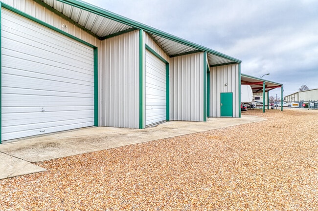


Current Lease Availabilities
Property Detail
6053 N Mcdonald St
Dallas-Fort Worth-Arlington, TX
ABS A0706 S M PULLIAM SURVEY, TRACT 59, 3.297 ACRES
R-6706-000-0590-1
COLLIN
Commercialnec
Texas
B and X Area of moderate flood hazard, usually the area between the limits of the 100-year and 500-year floods.
59
2025
3.30 AC
2025
Outlying Collin Cnty
030201
Dallas/Ft Worth
61,195 SF
NEARBY LISTINGS FOR SALE OR LEASE
DEMOGRAPHICS near 6053 N Mcdonald St
1 mile
3 mile
5 mile
2025 Total Population
2,372
29,988
86,590
2030 Population
2,792
35,633
101,700
Pop Growth 2025-2030
+ 17.71%
+ 18.82%
+ 17.45%
Average Age
39
37
37
2025 Total Households
813
9,320
28,281
HH Growth 2025-2030
+ 17.96%
+ 19.96%
+ 17.86%
Median Household Inc
$160,043
$148,829
$115,221
Avg Household Size
2.90
3.10
3.00
2025 Avg HH Vehicles
3.00
2.00
2.00
Median Home Value
$596,292
$580,975
$513,172
Median Year Built
2010
2011
2010
Nearby Places
Map Layers
Map Styles
 Street
 Aerial
Transit
 Traffic
 Biking
Places
Listings with unknown addresses are not visible on the map
- Restaurants
- Banks
- Shops
- Fitness
- Groceries
Nearby Properties
Address
Land Use
TOTAL SIZE
Lot Size
Zoning
Address
Land Use
TOTAL SIZE
Lot Size
Zoning
1,532,548 SF
270.56 AC
Address
Land Use
TOTAL SIZE
Lot Size
Zoning
657,692 SF
67.73 AC
Address
Land Use
TOTAL SIZE
Lot Size
Zoning
574,477 SF
62.52 AC
Address
Land Use
TOTAL SIZE
Lot Size
Zoning
420,738 SF
39.53 AC
Address
Land Use
TOTAL SIZE
Lot Size
Zoning
412,593 SF
17.24 AC
Address
Land Use
TOTAL SIZE
Lot Size
Zoning
428,778 SF
15.87 AC
Address
Land Use
TOTAL SIZE
Lot Size
Zoning
428,537 SF
19.95 AC
PD
Address
Land Use
TOTAL SIZE
Lot Size
Zoning
372,239 SF
18.42 AC
Address
Land Use
TOTAL SIZE
Lot Size
Zoning
360,057 SF
12.65 AC
C
Address
Land Use
TOTAL SIZE
Lot Size
Zoning
697,149 SF
45.08 AC
Address
Land Use
TOTAL SIZE
Lot Size
Zoning
204,764 SF
19.65 AC
PD
Address
Land Use
TOTAL SIZE
Lot Size
Zoning
298,992 SF
16.82 AC
LI
Address
Land Use
TOTAL SIZE
Lot Size
Zoning
279,356 SF
16.24 AC
COMM
Address
Land Use
TOTAL SIZE
Lot Size
Zoning
163,398 SF
39.25 AC
Address
Land Use
TOTAL SIZE
Lot Size
Zoning
104,858 SF
12 AC
Address
Land Use
TOTAL SIZE
Lot Size
Zoning
140,803 SF
25 AC
Address
Land Use
TOTAL SIZE
Lot Size
Zoning
189,490 SF
81.82 AC
ML LIGHT M
Address
Land Use
TOTAL SIZE
Lot Size
Zoning
209,016 SF
13.60 AC
LT INDUSTR
Address
Land Use
TOTAL SIZE
Lot Size
Zoning
192,676 SF
11.93 AC
Address
Land Use
TOTAL SIZE
Lot Size
Zoning
184,367 SF
39.04 AC
Address
Land Use
TOTAL SIZE
Lot Size
Zoning
16,860 SF
4 AC
Address
Land Use
TOTAL SIZE
Lot Size
Zoning
168,840 SF
17.57 AC
Address
Land Use
TOTAL SIZE
Lot Size
Zoning
117,600 SF
3.88 AC
Address
Land Use
TOTAL SIZE
Lot Size
Zoning
77,039 SF
9.98 AC
EX
Address
Land Use
TOTAL SIZE
Lot Size
Zoning
169,777 SF
36.25 AC
Address
Land Use
TOTAL SIZE
Lot Size
Zoning
326,709 SF
38.94 AC
Address
Land Use
TOTAL SIZE
Lot Size
Zoning
202,660 SF
13.31 AC
INDUSTRIAL
Address
Land Use
TOTAL SIZE
Lot Size
Zoning
90,964 SF
45.08 AC
Address
Land Use
TOTAL SIZE
Lot Size
Zoning
147,420 SF
13.41 AC
COMM
Address
Land Use
TOTAL SIZE
Lot Size
Zoning
172,218 SF
13.44 AC
COMM
The World's #1 Commercial Real Estate Marketplace
Connect with us
© 2026 CoStar Group
The information above has been obtained from sources believed reliable. While we do not doubt its accuracy we have not verified it and make no guarantee, warranty or representation about it. It is your responsibility to independently confirm its accuracy and completeness. Any projections, opinions, assumptions, or estimates used are for example only and do not represent the current or future performance of the property. The value of this transaction to you depends on tax and other factors which should be evaluated by your tax, financial, and legal advisors. You and your advisors should conduct a careful, independent investigation of the property to determine to your satisfaction the suitability of the property for your needs.