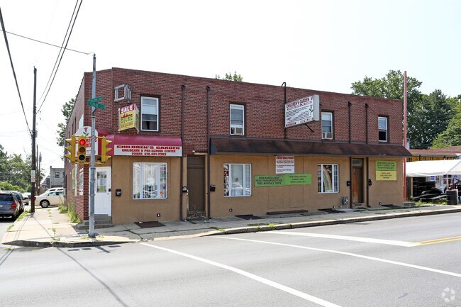
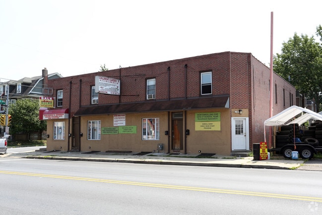
Property Record
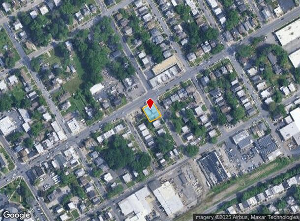
606 Macdade Blvd, Darby, PA 19023
NEARBY LISTINGS FOR SALE OR LEASE
Property Detail
606 Macdade Blvd
11-00-01730-00
Andrew Dorosz
Officebuilding
2 STY STORE/APT 24.67 X 100
X
Delaware
42045C0117F
Pennsylvania
2024
0.06 AC
2025
Delaware County
403104
Philadelphia
12,953 SF
Philadelphia-Camden-Wilmington, PA-NJ-DE-MD
DEMOGRAPHICS near 606 Macdade Blvd
1 Mile
3 Mile
5 Mile
2024 Total Population
26,176
212,405
518,352
2029 Population
25,886
208,693
508,216
Pop Growth 2024-2029
(1.11%)
(1.75%)
(1.96%)
Average Age
38
39
38
2024 Total Households
9,427
80,805
200,098
HH Growth 2024-2029
(1.24%)
(1.79%)
(2.11%)
Median Household Inc
$56,039
$57,284
$55,673
Avg Household Size
2.70
2.60
2.50
2024 Avg HH Vehicles
1.00
1.00
1.00
Median Home Value
$141,019
$168,617
$187,647
Median Year Built
1951
1951
1949
Nearby Places
Map Layers
Map Styles
 Street
 Aerial
- Restaurants
- Banks
- Shops
- Fitness
- Groceries
PUBLIC TRANSPORTATION
TRANSIT/SUBWAY
MacDade Boulevard (Route 102 - Southeastern Pennsylvania Transportation Authority Rapid Transit (SEPTA Subway & Trolley))
DRIVE
WALK
Distance
MacDade Boulevard (Route 102 - Southeastern Pennsylvania Transportation Authority Rapid Transit (SEPTA Subway & Trolley))
1 min
8 min
0.4 mi
Andrews Avenue (Route 102 - Southeastern Pennsylvania Transportation Authority Rapid Transit (SEPTA Subway & Trolley))
DRIVE
WALK
Distance
Andrews Avenue (Route 102 - Southeastern Pennsylvania Transportation Authority Rapid Transit (SEPTA Subway & Trolley))
2 min
10 min
0.5 mi
Sharon Hill (Route 102 - Southeastern Pennsylvania Transportation Authority Rapid Transit (SEPTA Subway & Trolley))
DRIVE
WALK
Distance
Sharon Hill (Route 102 - Southeastern Pennsylvania Transportation Authority Rapid Transit (SEPTA Subway & Trolley))
3 min
14 min
0.7 mi
Bartram Avenue (Route 102 - Southeastern Pennsylvania Transportation Authority Rapid Transit (SEPTA Subway & Trolley))
DRIVE
WALK
Distance
Bartram Avenue (Route 102 - Southeastern Pennsylvania Transportation Authority Rapid Transit (SEPTA Subway & Trolley))
3 min
14 min
0.7 mi
Sharon Hill (R2 - Southeastern Pennsylvania Transportation Authority Regional Rail (SEPTA Regional Rail))
DRIVE
WALK
Distance
Sharon Hill (R2 - Southeastern Pennsylvania Transportation Authority Regional Rail (SEPTA Regional Rail))
3 min
18 min
0.9 mi
COMMUTER RAIL
Sharon Hill (R2 - Southeastern Pennsylvania Transportation Authority Regional Rail (SEPTA Regional Rail))
DRIVE
WALK
Distance
Sharon Hill (R2 - Southeastern Pennsylvania Transportation Authority Regional Rail (SEPTA Regional Rail))
3 min
17 min
0.9 mi
Folcroft (R2 - Southeastern Pennsylvania Transportation Authority Regional Rail (SEPTA Regional Rail))
DRIVE
WALK
Distance
Folcroft (R2 - Southeastern Pennsylvania Transportation Authority Regional Rail (SEPTA Regional Rail))
5 min
1.5 mi
AIRPORT
Philadelphia International
DRIVE
WALK
Distance
Philadelphia International
15 min
5.8 mi
Trenton Mercer
DRIVE
WALK
Distance
Trenton Mercer
68 min
41.7 mi
Freight Ports
Broadway Terminal - Pier 5
DRIVE
WALK
Distance
Broadway Terminal - Pier 5
26 min
12.0 mi
SALE & LEASE HISTORY
LISTING DATE
SALE/LEASE

Oct 24, 2016
For Sale
Nearby Properties
Address
Land Use
TOTAL SIZE
Lot Size
Zoning
Address
Land Use
TOTAL SIZE
Lot Size
Zoning
762,100 SF
Address
Land Use
TOTAL SIZE
Lot Size
Zoning
685,000 SF
47.69 AC
CMX3
Address
Land Use
TOTAL SIZE
Lot Size
Zoning
158,496 SF
Address
Land Use
TOTAL SIZE
Lot Size
Zoning
910,000 SF
70 AC
I2
Address
Land Use
TOTAL SIZE
Lot Size
Zoning
488,254 SF
31.56 AC
I2
Address
Land Use
TOTAL SIZE
Lot Size
Zoning
89,456 SF
27.06 AC
Address
Land Use
TOTAL SIZE
Lot Size
Zoning
97,810 SF
40 AC
I3
Address
Land Use
TOTAL SIZE
Lot Size
Zoning
164,182 SF
Address
Land Use
TOTAL SIZE
Lot Size
Zoning
323,248 SF
2.90 AC
SPAIR
Address
Land Use
TOTAL SIZE
Lot Size
Zoning
975.62 AC
Address
Land Use
TOTAL SIZE
Lot Size
Zoning
226,764 SF
5.72 AC
CMX3
Address
Land Use
TOTAL SIZE
Lot Size
Zoning
140,010 SF
28.50 AC
ICMX
Address
Land Use
TOTAL SIZE
Lot Size
Zoning
63.81 AC
I2
Address
Land Use
TOTAL SIZE
Lot Size
Zoning
6,040 SF
16.45 AC
Address
Land Use
TOTAL SIZE
Lot Size
Zoning
63.53 AC
CMX3
Address
Land Use
TOTAL SIZE
Lot Size
Zoning
156,079 SF
13.44 AC
Address
Land Use
TOTAL SIZE
Lot Size
Zoning
25,680 SF
31.64 AC
Address
Land Use
TOTAL SIZE
Lot Size
Zoning
136,972 SF
27 AC
Address
Land Use
TOTAL SIZE
Lot Size
Zoning
3,600 SF
6.61 AC
SPPOA
Address
Land Use
TOTAL SIZE
Lot Size
Zoning
454,536 SF
26.63 AC
Address
Land Use
TOTAL SIZE
Lot Size
Zoning
164,184 SF
14.62 AC
I2
Address
Land Use
TOTAL SIZE
Lot Size
Zoning
96,500 SF
6.11 AC
CMX3
Address
Land Use
TOTAL SIZE
Lot Size
Zoning
363,215 SF
7.27 AC
RM1
Address
Land Use
TOTAL SIZE
Lot Size
Zoning
131,980 SF
9.17 AC
Address
Land Use
TOTAL SIZE
Lot Size
Zoning
16,990 SF
221.09 AC
SPPOA
Address
Land Use
TOTAL SIZE
Lot Size
Zoning
40,572 SF
6.52 AC
Address
Land Use
TOTAL SIZE
Lot Size
Zoning
192,000 SF
6.40 AC
CMX3
Address
Land Use
TOTAL SIZE
Lot Size
Zoning
246,296 SF
10.78 AC
RM2
Address
Land Use
TOTAL SIZE
Lot Size
Zoning
246,303 SF
11 AC
RM2
Address
Land Use
TOTAL SIZE
Lot Size
Zoning
68,096 SF
7.78 AC
The World's #1 Commercial Real Estate Marketplace
Connect with us
© 2025 CoStar Group
The information above has been obtained from sources believed reliable. While we do not doubt its accuracy we have not verified it and make no guarantee, warranty or representation about it. It is your responsibility to independently confirm its accuracy and completeness. Any projections, opinions, assumptions, or estimates used are for example only and do not represent the current or future performance of the property. The value of this transaction to you depends on tax and other factors which should be evaluated by your tax, financial, and legal advisors. You and your advisors should conduct a careful, independent investigation of the property to determine to your satisfaction the suitability of the property for your needs.