Property Record
606 Rayford Rd, Spring, TX 77386
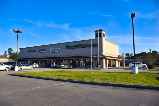


Property Detail
606 Rayford Rd
Houston-Pasadena-The Woodlands, TX
S822800 - RAYFORD PROPERTIES, BLOCK 2, RES A-1, RES A2-A, ACRES 1.264
8228-00-00201
Montgomery
Commercialnec
Texas
AE The base floodplain where base flood elevations are provided. AE Zones are now used on new format FIRMs instead of A1-A30 Zones.
a-1
2024
1.26 AC
2025
Montgomery County
691900
Houston
11,600 SF
NEARBY LISTINGS FOR SALE OR LEASE
DEMOGRAPHICS near 606 Rayford Rd
1 mile
3 mile
5 mile
2025 Total Population
9,599
83,947
191,895
2030 Population
11,130
96,563
218,115
Pop Growth 2025-2030
+ 15.95%
+ 15.03%
+ 13.66%
Average Age
34
37
37
2025 Total Households
3,723
31,320
70,257
HH Growth 2025-2030
+ 16.49%
+ 15.65%
+ 14.25%
Median Household Inc
$58,198
$95,133
$101,586
Avg Household Size
2.50
2.70
2.70
2025 Avg HH Vehicles
2.00
2.00
2.00
Median Home Value
$289,999
$330,239
$342,309
Median Year Built
2000
2003
2005
Nearby Places
Map Layers
Map Styles
 Street
 Aerial
Layers
 Traffic
 Biking
Places
Listings with unknown addresses are not visible on the map
- Restaurants
- Banks
- Shops
- Fitness
- Groceries
PUBLIC TRANSPORTATION
AIRPORT
George Bush Intcntl/Houston
Drive
Walk
Distance
George Bush Intcntl/Houston
24 min
19.0 mi
Freight Ports
Port of Houston
Drive
Walk
Distance
Port of Houston
47 min
34.8 mi
SALE & LEASE HISTORY
LISTING DATE
SALE/LEASE

Sep 23, 2016
For Sale
May 15, 2020
For Sale
Nearby Properties
Address
Land Use
TOTAL SIZE
Lot Size
Zoning
Address
Land Use
TOTAL SIZE
Lot Size
Zoning
6,576,138 SF
186.74 AC
Address
Land Use
TOTAL SIZE
Lot Size
Zoning
1,673,574 SF
5.10 AC
Address
Land Use
TOTAL SIZE
Lot Size
Zoning
855,268 SF
31.65 AC
6
Address
Land Use
TOTAL SIZE
Lot Size
Zoning
1,186,001 SF
13.27 AC
Address
Land Use
TOTAL SIZE
Lot Size
Zoning
1,004,830 SF
7.83 AC
Address
Land Use
TOTAL SIZE
Lot Size
Zoning
1,053,284 SF
2.25 AC
Address
Land Use
TOTAL SIZE
Lot Size
Zoning
974,064 SF
11.79 AC
Address
Land Use
TOTAL SIZE
Lot Size
Zoning
802,274 SF
2.68 AC
Address
Land Use
TOTAL SIZE
Lot Size
Zoning
469,813 SF
3.16 AC
Address
Land Use
TOTAL SIZE
Lot Size
Zoning
225,149 SF
1.07 AC
Address
Land Use
TOTAL SIZE
Lot Size
Zoning
670,665 SF
6.70 AC
Address
Land Use
TOTAL SIZE
Lot Size
Zoning
571,041 SF
4.82 AC
Address
Land Use
TOTAL SIZE
Lot Size
Zoning
178,645 SF
8.74 AC
Address
Land Use
TOTAL SIZE
Lot Size
Zoning
457,883 SF
3.74 AC
Address
Land Use
TOTAL SIZE
Lot Size
Zoning
327,377 SF
24.02 AC
6
Address
Land Use
TOTAL SIZE
Lot Size
Zoning
473,060 SF
10.07 AC
Address
Land Use
TOTAL SIZE
Lot Size
Zoning
327,018 SF
21.91 AC
6
Address
Land Use
TOTAL SIZE
Lot Size
Zoning
368,000 SF
8.65 AC
Address
Land Use
TOTAL SIZE
Lot Size
Zoning
467,928 SF
6 AC
Address
Land Use
TOTAL SIZE
Lot Size
Zoning
296,094 SF
10.19 AC
Address
Land Use
TOTAL SIZE
Lot Size
Zoning
514,121 SF
2.01 AC
Address
Land Use
TOTAL SIZE
Lot Size
Zoning
279,413 SF
12.45 AC
6
Address
Land Use
TOTAL SIZE
Lot Size
Zoning
532,751 SF
6.43 AC
Address
Land Use
TOTAL SIZE
Lot Size
Zoning
314,169 SF
3.09 AC
Address
Land Use
TOTAL SIZE
Lot Size
Zoning
246,719 SF
1.25 AC
Address
Land Use
TOTAL SIZE
Lot Size
Zoning
377,266 SF
17.44 AC
Address
Land Use
TOTAL SIZE
Lot Size
Zoning
325,294 SF
21.81 AC
6
Address
Land Use
TOTAL SIZE
Lot Size
Zoning
388,855 SF
19.86 AC
6
Address
Land Use
TOTAL SIZE
Lot Size
Zoning
246,043 SF
1.88 AC
Address
Land Use
TOTAL SIZE
Lot Size
Zoning
454,330 SF
9.77 AC
The World's #1 Commercial Real Estate Marketplace
Connect with us
© 2026 CoStar Group
The information above has been obtained from sources believed reliable. While we do not doubt its accuracy we have not verified it and make no guarantee, warranty or representation about it. It is your responsibility to independently confirm its accuracy and completeness. Any projections, opinions, assumptions, or estimates used are for example only and do not represent the current or future performance of the property. The value of this transaction to you depends on tax and other factors which should be evaluated by your tax, financial, and legal advisors. You and your advisors should conduct a careful, independent investigation of the property to determine to your satisfaction the suitability of the property for your needs.