Property Record
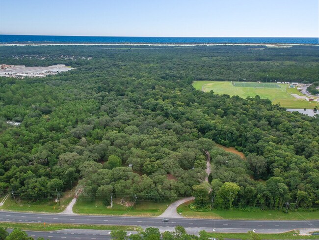
6060 Us Highway 1 S, Saint Augustine, FL 32086


Property Detail
6060 Us Highway 1 S
184450-0000
4 PART OF ANDREAS PAPY GRANT LYING N OF MOSES CREEK & E OF US 1 (EX 2AC IN DB155/424 2AC IN OR26/408 0.512AC TO R/W US 1 IN DB238/27 & 5.488AC IN DB260/255) OR249/774 & 5541/1740
Multifamilydwelling
ST. JOHNS
OR
Florida
AE The base floodplain where base flood elevations are provided. AE Zones are now used on new format FIRMs instead of A1-A30 Zones.
1
2025
16.60 AC
2026
St Johns County
021208
Jacksonville (Florida)
7,008 SF
Jacksonville, FL
NEARBY LISTINGS FOR SALE OR LEASE
DEMOGRAPHICS near 6060 Us Highway 1 S
1 mile
3 mile
5 mile
2025 Total Population
3,459
16,329
45,413
2030 Population
3,957
18,881
53,147
Pop Growth 2025-2030
+ 14.40%
+ 15.63%
+ 17.03%
Average Age
46
50
51
2025 Total Households
1,423
7,359
20,722
HH Growth 2025-2030
+ 14.83%
+ 16.09%
+ 17.66%
Median Household Inc
$76,058
$72,624
$80,681
Avg Household Size
2.30
2.10
2.10
2025 Avg HH Vehicles
2.00
2.00
2.00
Median Home Value
$400,739
$393,614
$467,246
Median Year Built
2006
2002
1995
Nearby Places
Map Layers
Map Styles
 Street
 Aerial
Layers
 Traffic
 Biking
Places
Listings with unknown addresses are not visible on the map
- Restaurants
- Banks
- Shops
- Fitness
- Groceries
SALE & LEASE HISTORY
LISTING DATE
SALE/LEASE

Aug 30, 2021
For Sale
Aug 23, 2018
For Sale
Nearby Properties
Address
Land Use
TOTAL SIZE
Lot Size
Zoning
Address
Land Use
TOTAL SIZE
Lot Size
Zoning
208,579 SF
110.53 AC
OR
Address
Land Use
TOTAL SIZE
Lot Size
Zoning
220,105 SF
26.42 AC
PUD
Address
Land Use
TOTAL SIZE
Lot Size
Zoning
76,233 SF
10.94 AC
CG
Address
Land Use
TOTAL SIZE
Lot Size
Zoning
107,404 SF
3.17 AC
CI
Address
Land Use
TOTAL SIZE
Lot Size
Zoning
132,616 SF
87 AC
OR
Address
Land Use
TOTAL SIZE
Lot Size
Zoning
12,697 SF
26.99 AC
PUD
Address
Land Use
TOTAL SIZE
Lot Size
Zoning
26,259 SF
11.43 AC
Address
Land Use
TOTAL SIZE
Lot Size
Zoning
17,534 SF
21.84 AC
CHT
Address
Land Use
TOTAL SIZE
Lot Size
Zoning
85,726 SF
13.01 AC
PUD
Address
Land Use
TOTAL SIZE
Lot Size
Zoning
2,100 SF
7.48 AC
CG
Address
Land Use
TOTAL SIZE
Lot Size
Zoning
55,497 SF
4.13 AC
CG
Address
Land Use
TOTAL SIZE
Lot Size
Zoning
26,624 SF
2.24 AC
PUD
Address
Land Use
TOTAL SIZE
Lot Size
Zoning
1,179.40 AC
OR
Address
Land Use
TOTAL SIZE
Lot Size
Zoning
67,154 SF
4.22 AC
PUD
Address
Land Use
TOTAL SIZE
Lot Size
Zoning
30,000 SF
4.82 AC
PSD
Address
Land Use
TOTAL SIZE
Lot Size
Zoning
30,125 SF
9.89 AC
OR
Address
Land Use
TOTAL SIZE
Lot Size
Zoning
38.17 AC
OR
Address
Land Use
TOTAL SIZE
Lot Size
Zoning
38,250 SF
3.20 AC
CG
Address
Land Use
TOTAL SIZE
Lot Size
Zoning
22,638 SF
9.99 AC
OR
Address
Land Use
TOTAL SIZE
Lot Size
Zoning
56,003 SF
5.24 AC
PUD
Address
Land Use
TOTAL SIZE
Lot Size
Zoning
41,205 SF
6.80 AC
OR
Address
Land Use
TOTAL SIZE
Lot Size
Zoning
24,779 SF
29.89 AC
OR
Address
Land Use
TOTAL SIZE
Lot Size
Zoning
11,640 SF
2.29 AC
PUD
Address
Land Use
TOTAL SIZE
Lot Size
Zoning
23,316 SF
11.87 AC
OR
Address
Land Use
TOTAL SIZE
Lot Size
Zoning
3,748 SF
53.96 AC
OR
Address
Land Use
TOTAL SIZE
Lot Size
Zoning
36,540 SF
0.44 AC
Address
Land Use
TOTAL SIZE
Lot Size
Zoning
36,540 SF
0.44 AC
Address
Land Use
TOTAL SIZE
Lot Size
Zoning
28,056 SF
12.13 AC
OR
Address
Land Use
TOTAL SIZE
Lot Size
Zoning
14,993 SF
1.63 AC
PUD
Address
Land Use
TOTAL SIZE
Lot Size
Zoning
15.34 AC
PUD
The World's #1 Commercial Real Estate Marketplace
Connect with us
© 2026 CoStar Group
The information above has been obtained from sources believed reliable. While we do not doubt its accuracy we have not verified it and make no guarantee, warranty or representation about it. It is your responsibility to independently confirm its accuracy and completeness. Any projections, opinions, assumptions, or estimates used are for example only and do not represent the current or future performance of the property. The value of this transaction to you depends on tax and other factors which should be evaluated by your tax, financial, and legal advisors. You and your advisors should conduct a careful, independent investigation of the property to determine to your satisfaction the suitability of the property for your needs.