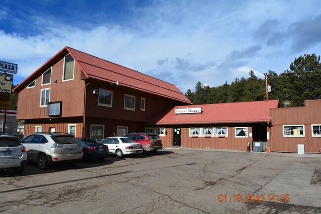
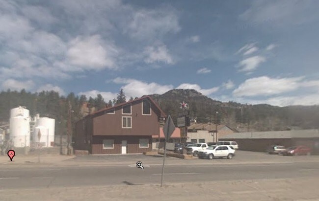
Property Record
60615 Us Highway 285, Bailey, CO 80421

Property Detail
60615 Us Highway 285
Denver-Aurora-Centennial, CO
T07 R72 S29 SW4 BAILEY LOT 73
18832
Park
Officebuilding
Colorado
A Areas with a 1% annual chance of flooding and a 26% chance of flooding over the life of a 30-year mortgage.
73
2025
0.20 AC
2025
Southwest Outlying
000101
Denver
5,805 SF
NEARBY LISTINGS FOR SALE OR LEASE
DEMOGRAPHICS near 60615 Us Highway 285
1 mile
3 mile
5 mile
2025 Total Population
225
2,997
5,817
2030 Population
226
3,097
6,034
Pop Growth 2025-2030
+ 0.44%
+ 3.34%
+ 3.73%
Average Age
45
44
45
2025 Total Households
102
1,269
2,452
HH Growth 2025-2030
+ 0.98%
+ 3.47%
+ 3.83%
Median Household Inc
$129,839
$110,160
$110,855
Avg Household Size
2.20
2.40
2.40
2025 Avg HH Vehicles
3.00
3.00
3.00
Median Home Value
$650,000
$608,711
$621,942
Median Year Built
1989
1989
1989
Nearby Places
Map Layers
Map Styles
 Street
 Aerial
Transit
 Traffic
 Biking
Places
Listings with unknown addresses are not visible on the map
- Restaurants
- Banks
- Shops
- Fitness
- Groceries
SALE & LEASE HISTORY
LISTING DATE
SALE/LEASE

Sep 23, 2016
For Sale
Nearby Properties
Address
Land Use
TOTAL SIZE
Lot Size
Zoning
Address
Land Use
TOTAL SIZE
Lot Size
Zoning
18,430 SF
3 AC
Address
Land Use
TOTAL SIZE
Lot Size
Zoning
17,496 SF
15.61 AC
Address
Land Use
TOTAL SIZE
Lot Size
Zoning
8,599 SF
44.28 AC
Address
Land Use
TOTAL SIZE
Lot Size
Zoning
3,473 SF
2.99 AC
Address
Land Use
TOTAL SIZE
Lot Size
Zoning
9,403 SF
1.46 AC
Address
Land Use
TOTAL SIZE
Lot Size
Zoning
18,480 SF
1.71 AC
Address
Land Use
TOTAL SIZE
Lot Size
Zoning
4,800 SF
3 AC
Address
Land Use
TOTAL SIZE
Lot Size
Zoning
4,200 SF
2.11 AC
Address
Land Use
TOTAL SIZE
Lot Size
Zoning
3,936 SF
1.40 AC
Address
Land Use
TOTAL SIZE
Lot Size
Zoning
4,400 SF
3.73 AC
Address
Land Use
TOTAL SIZE
Lot Size
Zoning
Address
Land Use
TOTAL SIZE
Lot Size
Zoning
11,356 SF
296.91 AC
Address
Land Use
TOTAL SIZE
Lot Size
Zoning
9,570 SF
7.46 AC
Address
Land Use
TOTAL SIZE
Lot Size
Zoning
3,205 SF
1.45 AC
Address
Land Use
TOTAL SIZE
Lot Size
Zoning
5,040 SF
1.19 AC
Address
Land Use
TOTAL SIZE
Lot Size
Zoning
11,439 SF
0.26 AC
Address
Land Use
TOTAL SIZE
Lot Size
Zoning
5,250 SF
5.50 AC
Address
Land Use
TOTAL SIZE
Lot Size
Zoning
2,400 SF
0.86 AC
Address
Land Use
TOTAL SIZE
Lot Size
Zoning
4,200 SF
2.12 AC
Address
Land Use
TOTAL SIZE
Lot Size
Zoning
3,450 SF
5 AC
Address
Land Use
TOTAL SIZE
Lot Size
Zoning
1,074 SF
1.08 AC
Address
Land Use
TOTAL SIZE
Lot Size
Zoning
4,142 SF
1.30 AC
Address
Land Use
TOTAL SIZE
Lot Size
Zoning
4,910 SF
3.18 AC
Address
Land Use
TOTAL SIZE
Lot Size
Zoning
52.70 AC
Address
Land Use
TOTAL SIZE
Lot Size
Zoning
962 SF
12.70 AC
Address
Land Use
TOTAL SIZE
Lot Size
Zoning
3,656 SF
0.11 AC
Address
Land Use
TOTAL SIZE
Lot Size
Zoning
15,416 SF
1 AC
Address
Land Use
TOTAL SIZE
Lot Size
Zoning
2,880 SF
3.88 AC
Address
Land Use
TOTAL SIZE
Lot Size
Zoning
3,170 SF
0.26 AC
Address
Land Use
TOTAL SIZE
Lot Size
Zoning
3,200 SF
2.07 AC
The World's #1 Commercial Real Estate Marketplace
Connect with us
© 2026 CoStar Group
The information above has been obtained from sources believed reliable. While we do not doubt its accuracy we have not verified it and make no guarantee, warranty or representation about it. It is your responsibility to independently confirm its accuracy and completeness. Any projections, opinions, assumptions, or estimates used are for example only and do not represent the current or future performance of the property. The value of this transaction to you depends on tax and other factors which should be evaluated by your tax, financial, and legal advisors. You and your advisors should conduct a careful, independent investigation of the property to determine to your satisfaction the suitability of the property for your needs.