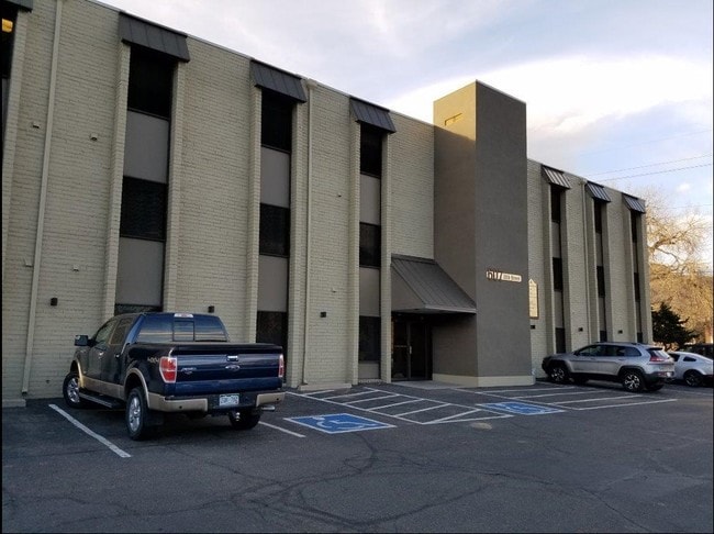
Property Record
607 10Th St, Golden, CO 80401

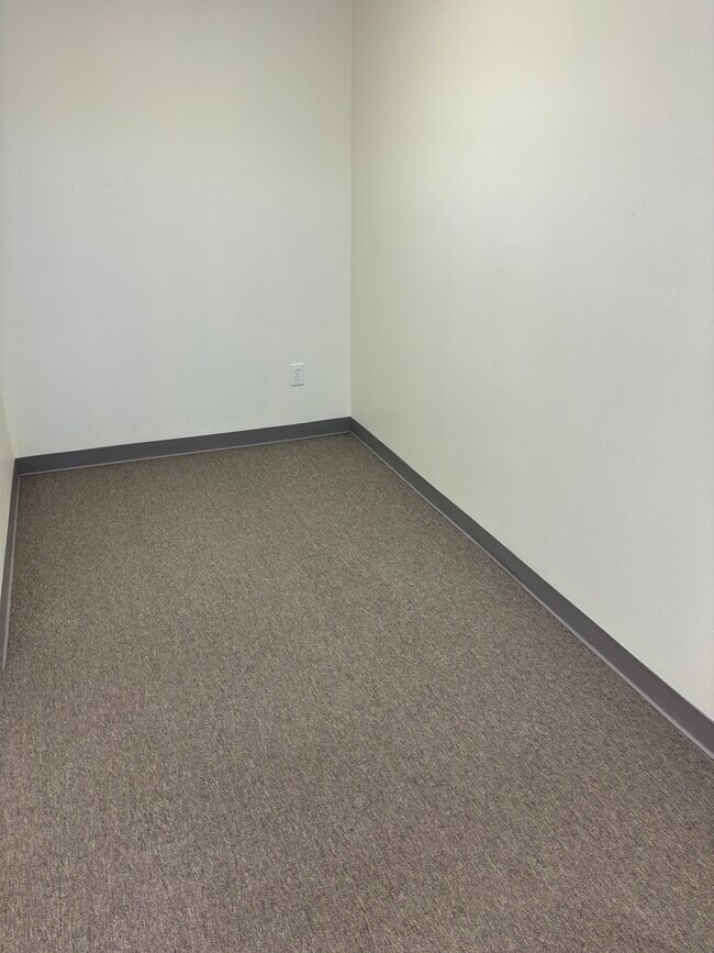

Current Lease Availabilities
Property Detail
607 10Th St
Denver-Aurora-Centennial, CO
SECTION 27 TOWNSHIP 03 RANGE 70 QTR SW SUBDIVISIONCD 555000 SUBDIVISIONNAME NORTH GOLDEN BLOCK 034 LOT 0003 SIZE: 1400 TRACT 00B VALUE: .032 SECTION 27 TOWNSHIP 03 RANGE 70 QTR SW SUBDIVISIONCD 555000 SUBDIVISIONNAME NORTH GOLDEN BLOCK 034 LOT 0004 S
30-273-07-002
JEFFERSON
Commercialnec
Colorado
C and X Area of minimal flood hazard, usually depicted on FIRMs as above the 500-year flood level.
3-6
2025
0.52 AC
2025
West Denver
009854
Denver
20,709 SF
NEARBY LISTINGS FOR SALE OR LEASE
DEMOGRAPHICS near 607 10Th St
1 mile
3 mile
5 mile
2025 Total Population
9,635
26,591
70,007
2030 Population
9,743
26,701
69,946
Pop Growth 2025-2030
+ 1.12%
+ 0.41%
(0.09%)
Average Age
38
40
42
2025 Total Households
3,751
10,434
27,867
HH Growth 2025-2030
+ 1.36%
+ 0.48%
(0.10%)
Median Household Inc
$91,702
$96,334
$121,789
Avg Household Size
2.20
2.30
2.40
2025 Avg HH Vehicles
2.00
2.00
2.00
Median Home Value
$916,765
$829,234
$811,319
Median Year Built
1982
1985
1984
Nearby Places
Map Layers
Map Styles
 Street
 Aerial
Transit
 Traffic
 Biking
Places
Listings with unknown addresses are not visible on the map
- Restaurants
- Banks
- Shops
- Fitness
- Groceries
PUBLIC TRANSPORTATION
COMMUTER RAIL
Wheat Ridge - Ward Station Track 1 (Union Station to Wheat Ridge Ward Station - Regional Transportation District)
Drive
Walk
Distance
Wheat Ridge - Ward Station Track 1 (Union Station to Wheat Ridge Ward Station - Regional Transportation District)
11 min
7.1 mi
Arvada Ridge Station Track 1 (Union Station to Wheat Ridge Ward Station - Regional Transportation District)
Drive
Walk
Distance
Arvada Ridge Station Track 1 (Union Station to Wheat Ridge Ward Station - Regional Transportation District)
12 min
8.1 mi
Freight Ports
Tulsa Port Of Catoosa
Drive
Walk
Distance
Tulsa Port Of Catoosa
742 min
721.2 mi
Nearby Properties
Address
Land Use
TOTAL SIZE
Lot Size
Zoning
Address
Land Use
TOTAL SIZE
Lot Size
Zoning
Address
Land Use
TOTAL SIZE
Lot Size
Zoning
367,452 SF
38.94 AC
Address
Land Use
TOTAL SIZE
Lot Size
Zoning
2,710,724 SF
32.87 AC
Address
Land Use
TOTAL SIZE
Lot Size
Zoning
420,482 SF
66.03 AC
Address
Land Use
TOTAL SIZE
Lot Size
Zoning
69,819 SF
1,402.21 AC
R1
Address
Land Use
TOTAL SIZE
Lot Size
Zoning
25,925 SF
7.12 AC
Address
Land Use
TOTAL SIZE
Lot Size
Zoning
103,076 SF
1.28 AC
Address
Land Use
TOTAL SIZE
Lot Size
Zoning
966,836 SF
84.74 AC
I2
Address
Land Use
TOTAL SIZE
Lot Size
Zoning
352,259 SF
17.94 AC
Address
Land Use
TOTAL SIZE
Lot Size
Zoning
117,036 SF
1.38 AC
Address
Land Use
TOTAL SIZE
Lot Size
Zoning
52,103 SF
2.44 AC
Address
Land Use
TOTAL SIZE
Lot Size
Zoning
Address
Land Use
TOTAL SIZE
Lot Size
Zoning
135,113 SF
2.58 AC
Address
Land Use
TOTAL SIZE
Lot Size
Zoning
42,684 SF
2.53 AC
Address
Land Use
TOTAL SIZE
Lot Size
Zoning
615,195 SF
23.48 AC
Address
Land Use
TOTAL SIZE
Lot Size
Zoning
322,105 SF
136.23 AC
Address
Land Use
TOTAL SIZE
Lot Size
Zoning
104,088 SF
1.31 AC
Address
Land Use
TOTAL SIZE
Lot Size
Zoning
162,271 SF
8.20 AC
Address
Land Use
TOTAL SIZE
Lot Size
Zoning
353,286 SF
14.49 AC
Address
Land Use
TOTAL SIZE
Lot Size
Zoning
188,554 SF
33.28 AC
Address
Land Use
TOTAL SIZE
Lot Size
Zoning
484,918 SF
58.36 AC
Address
Land Use
TOTAL SIZE
Lot Size
Zoning
282,265 SF
80.48 AC
I2
Address
Land Use
TOTAL SIZE
Lot Size
Zoning
39,374 SF
1.20 AC
Address
Land Use
TOTAL SIZE
Lot Size
Zoning
198,147 SF
2.55 AC
Address
Land Use
TOTAL SIZE
Lot Size
Zoning
55,030 SF
4.94 AC
Address
Land Use
TOTAL SIZE
Lot Size
Zoning
227,132 SF
11.95 AC
Address
Land Use
TOTAL SIZE
Lot Size
Zoning
22,232 SF
2.18 AC
Address
Land Use
TOTAL SIZE
Lot Size
Zoning
192,500 SF
10.97 AC
Address
Land Use
TOTAL SIZE
Lot Size
Zoning
260,325 SF
13.70 AC
Address
Land Use
TOTAL SIZE
Lot Size
Zoning
220,462 SF
73.85 AC
R1
The World's #1 Commercial Real Estate Marketplace
Connect with us
© 2026 CoStar Group
The information above has been obtained from sources believed reliable. While we do not doubt its accuracy we have not verified it and make no guarantee, warranty or representation about it. It is your responsibility to independently confirm its accuracy and completeness. Any projections, opinions, assumptions, or estimates used are for example only and do not represent the current or future performance of the property. The value of this transaction to you depends on tax and other factors which should be evaluated by your tax, financial, and legal advisors. You and your advisors should conduct a careful, independent investigation of the property to determine to your satisfaction the suitability of the property for your needs.